Passages in Howe Sound

Heights of Howe Sound revealed

1-10 June 2012

We do some repairs, laundry and communications, meet up with Vancouver friends, and wait for Elisabeth to arrive from Nova Scotia. It is all very exciting although much of this activity involves using the boat like a car, which is really harder than most people imagine.  It can be very exhausting in fact, for we must raise anchor, motor for an hour or two to a new place, sort out how to dock there, put out fenders and dock lines, dock, and race around on shore or meet people for brief periods. Then we ready ourselves to leave the dock, depart, stow the lines and fenders, and find a place to stay for the night. Anchor again. Repeat.

Sign seen near the ferry dock on Bowen Island

All at a maximum speed of 6 knots an hour.  Sometimes in the pouring rain.  But who’s complaining?

We can’t believe that, anchored in the Marine Park in Halkett Bay on Gambier Island, we’re just 5 miles away from Horseshoe Bay, one of Vancouver’s major ferry terminals, or Snug Cove on Bowen Island.  Or, in the other direction, Gibson’s Landing on the Sechelt Peninsula.

Waterfall in Halkett Cove Park

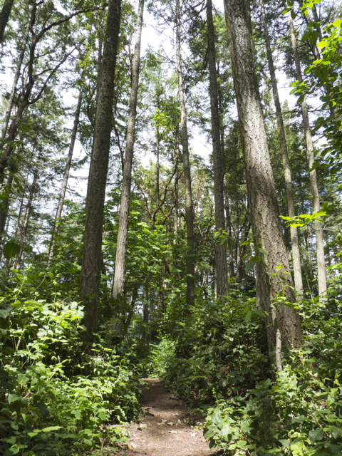
When the clouds move off, we see long cataracts tumbling down the sides of steep snow-covered mountains on the mainland.  We watch eagles and otters and great blue herons and Canada geese and longtailed ducks feeding and fishing. Harbour seals sneak up and watch us shyly, then dive noisily.  Ferries come and go and we rock in their wakes.  A sailboat race around Bowen Island fills the Sound with hundreds of boats of every size and make.  We row ashore and go hiking on short steep trails through the cedars.  The ferns are taller than we are and vibrant green moss grows on everything. It is dark in the forest, and the light seems to glow greenly; your sense of size is altered by these enormous trees, but so is your eyesight, your sense of colour.

When it rains, the scent of damp cedar fills the air and sometimes wood smoke.  We get cold so we light a fire, make a minestrone soup and sit in our dry cockpit enclosure, admiring the world or watching the light fall.

Howe Sound under cloud cover

British Columbia is crazily beautiful and we’ve fallen in love.  We admit it; we’re seduced.  If real estate weren’t so terrifyingly expensive here, we’d be tempted to make the jump from our coast to this one. But as we go from place to place, using our boat like a car—or parking it for a couple of days at a dock in Snug Cove on Bowen Island, and taking the ferry across to Vancouver to visit with friends—we cannot imagine where we could possibly settle.  Each place we see has its glories.  Each is but a tiny fraction of the whole.  And we’ve only begun to explore.

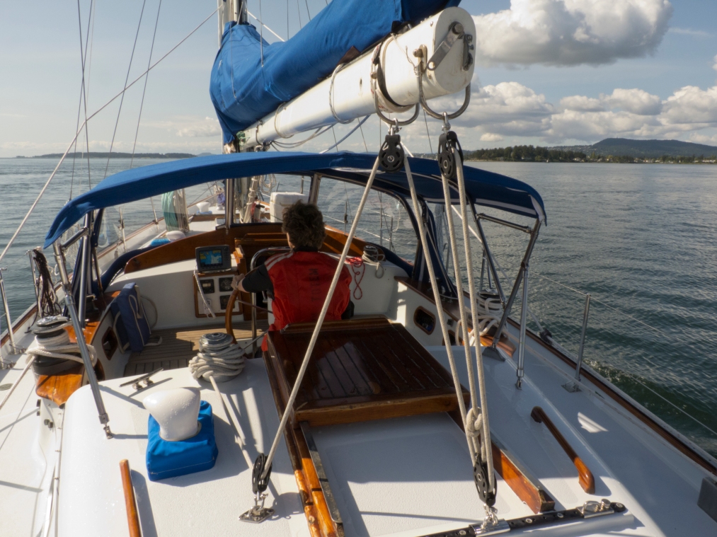
Friend Janice at the helm

Each place is hard to leave, but each new inlet beckons, luring us onward.  Northward, northward now!

Posted in 2012 | Tagged , , | Leave a comment

Strait Crossing (in which we learn the origins of several colonial place names)

Setting out for Howe Sound from Nanaimo

Thursday 31 May 2012

We set out from Nanaimo for Howe Sound in the morning after listening to the weather report.  It’s about 26 miles across the Georgia Strait, anchorage to anchorage, on this calm grey morning. We hope for a bit of wind—last year we had a speedy sail—but this time we motor the entire way.  Our friend Carolyn had said, “Sometimes the Strait is like a mill pond.” It was today. The crossing takes just five hours.

To pass the time, we read from our favourite cruising guide, Wolferstan’s Sunshine Coast, which is from 1982, and often radically out of date, but full of marvellously interesting historical detail.  We learn, for example, that virtually every island and passage in Howe Sound has been named for a prominent naval figure or vessel—British of course—from the battle of “the Glorious First of June” 1794, in which “Lord Howe was victorious.”  Thus, the Barfleur Passage, which we enter at the edge of Howe Sound is named for the HMS Barfleur, a 98 gun vessel engaged in the battle, at the cost of nine lives and 24 injuries.  And Bowen Island is named after Rear Admiral James Bowen, master of HMS Queen Charlotte (which also gave it’s name to Queen Charlotte Channel), who, for his “valuable and exceptional service” during the battle of “the Glorious First of June,” was promoted to lieutenant, then commander, then post captain.  Gambier Island was named for Admiral of the Fleet, James, Lord Gambier, captain of HM. Defence—“first to break through the line and hotly engage three French ships.”

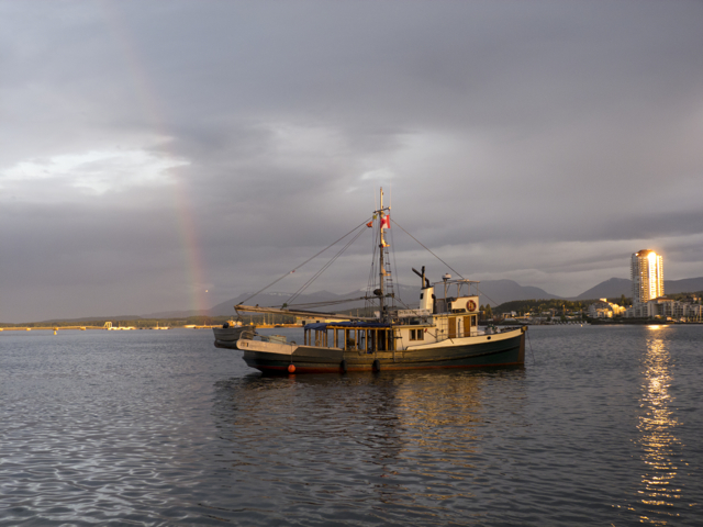
Contemporary agents of trade at anchor in Nanaimo

It took us a while to figure out what this “Glorious First of June” battle was about—the 218th anniversary of which we inadvertently celebrated whether we liked it or not, on waking our first morning in Howe Sound. For who remembers that day, aside from this geography?

“The Glorious First of June” was a battle between the English, who were anxiously keeping “revolutionary fever” at bay, and the French, who were protecting a convoy of American ships bringing grain to French ports.  The battle took place at sea, in the North Atlantic, some 350 miles northwest of Cape Finisterre. The British captured seven French battleships, including, Wolferstan notes, L’America, a US-built naval ship presented to France once France beheaded its king and became, as well, a “republican” patrician nation.

Arrival in Howe Sound

And then that story, from that coast, was written large upon the landscape here in 1860, 66 years after it was over, by British geographers and surveyors who were themselves quite worried about another battle taking place just to the south on San Juan Island between American settlers of the “Oregon Country” and British (Canadian) settlers, chiefly functionaries of the Hudson’s Bay Company (itself, we could say, a forward arm of British imperialism).  That battle, known as the “pig war,” because it began with the shooting of a British owned pig owned by an American settler in 1857–a proxy if there ever were one!–continued with a fifteen year stand-off and joint US-British occupation.

The dispute over which nation should have right to the jointly settled territories between the 42nd parallel and latitude 54° 40’ was finally settled when both nations agreed to abide by a ruling by Kaiser Wilhelm I of Germany.  (Why him?  We still don’t know the answer to that question, but encourage responses from anyone who does.) The Kaiser made his ruling on 21 October 1872, drawing a boundary between the two expansionist empires through Haro Strait, on the 49th parallel.  Thus the Americans got the San Juan Islands, and the British (Canada) the entirety of Vancouver Island and what we now know as the Gulf Islands.  But as place names up and down the British Columbia coast were conferred by the surveyors aboard the HMS Plumper in 1860, the standoff on San Juan Island was still raging, and so too, we imagine, were (British) nationalist sentiments.

Time rolls on, but imperial histories still ravage and scar the landscape, and confuse us all–more perhaps than they should.  We should not consider ourselves, after all, innocents.

Three generations of tree, Plumper Marine Park, Howe Sound

 Notes from our ship’s log

Flat or nearly flat water on the crossing, silver in the dull glaring light. Clouds cover the higher peaks on Bowen and Gambier Island, and the snow-capped peaks that surround them are invisible, merely a matter of reputation.

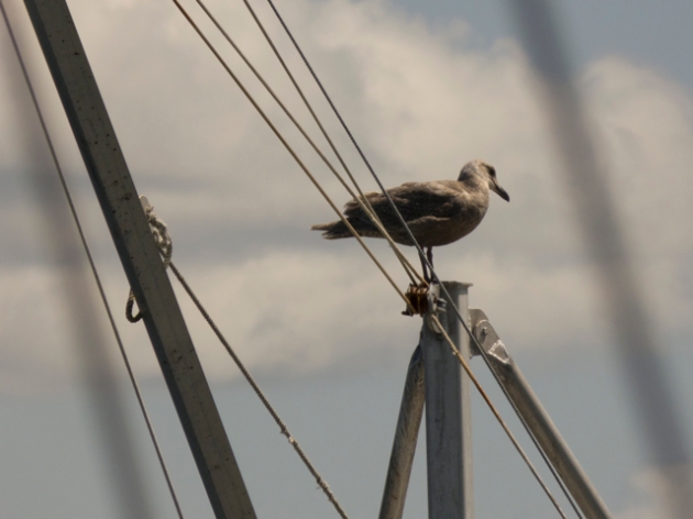
Milky green water from the Squamish River clouds even the deepest water at the mouth of Howe Sound, and quantites of debris flow by in the current—huge logs and then smaller deadheads.  Seagulls hitch a ride on the moving logs and face into what little wind flows up out of the southeast.  Shreds of blue sky and sunlight as we arrive. Blue heights at a distance.

Plumes of smoke rise from the mill in Thornbrough Channel—and when the clouds lift, huge patches of clearcut are visible, enormous rectangles hacked from the mountainsides.

That reviled (foreign, invasive) species, Cytisus scoparius, Scotch Broom

Birds sing and yellow broom bends down towards the water, as if, like narcissus, peering at its own reflection.

It is always a moment of note when you put away the old charts and get out the new ones, as we must do here.  It takes hours of poring over the charts to learn their new lines and contours and hazards and names.

Vancouver had apparently named the sound in 1792 after his superior officer, Admiral the Right Honorable Richard Scrope, Earl Howe.  (We imagine how astonished Earl Howe would be today to find his own fame utterly eclipsed by that upstart Vancouver’s.)  Captain Vancouver had hoped to find the Northwest Passage up this inlet (and each of many others ranging north up the coast), but was sorely disappointed, finding, as he proceeded up the inlet to the Squamish River, “a dreary aspect” to the steep surroundings and a “chalky aspect” to the water.  The sound was a “gloomy spectacle,” wrote Vancouver in his log. “Not a bird, nor living creature was to be seen, and the roaring of the falling cataracts in every direction precluded their being heard, had any been in our neighbourhood.” (Vancouver quoted by Upton, Journeys Through the Inside Passage, 32.).

Walbran, in British Columbia Place Names, says:

“Captain Richards, R.N., who made the survey of Howe sound, 1859-1860, followed up Vancouver’s name by giving to all the principal islands, points, passages and mountains in and around the sound, the names of the ships and officers engaged in Lord Howe’s celebrated victory of 1 June 1794.  Thus this sound is a record of the battle.”

The Sound sounds out a battle in dozens of forgotten names, overwriting one landscape with the wars of another. Does anywhere else remember them?

Nootka Rose, Plumper Marine Park

Walbran continues:

“In the same manner, Jervis Inlet, also named by Vancouver and surveyed by Richards, is a record of the battle of St. Vincent, 14 February 1797; and also Nelson’s Victory of the Nile, 1 August, 1798” (p. 256, “Howe Sound”).

Walbran goes on to note that Lieutenant Eliza, one of the Spaniards surveying the area in 1791, before Vancouver arrived, named the inlet we call Howe Sound Boca de Carmelo.  We find this name justly descriptive, for the water is like green caramel, the luscious colour of saltwater taffy—Vancouver’s “chalky aspect”: fine glacial silt.

 We gather other bouquets of names here too, sweeter ones:

Nootka rose

Salmonberry

Each name bound up with a story.  These are the stories we prefer.

Salmonberry bloom, Plumper Marine Park

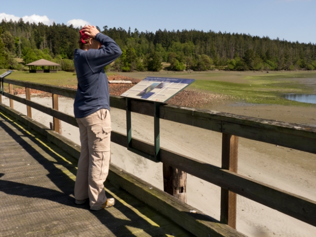
We wonder what were the names of these peaks and points and islands and bays and inlets before English notables’ names gave sign of imperial claims upon the land and its stories? Will those Coast Salish names ever return? Where might we look for them? How might we learn them, and learn to read their take on the shapes and histories of the land? Our books and cruising guides are silent on this matter.

Posted in 2012 | Tagged , , , , | Leave a comment

How much stuff can you stuff on a boat?

Image

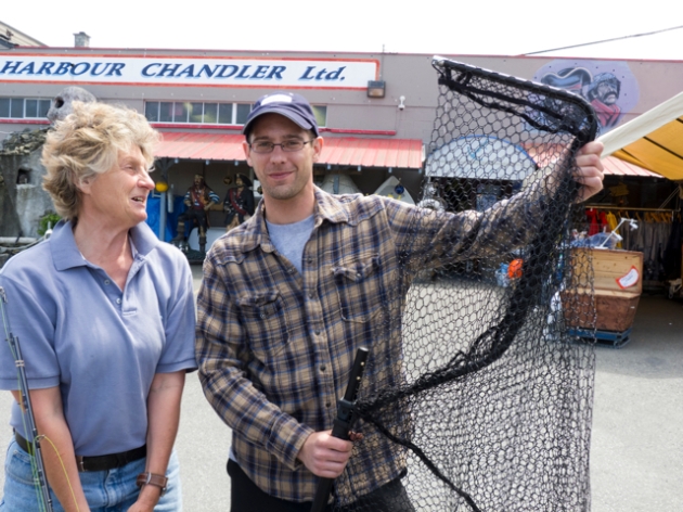
Marike considers our new fishing gear–and our advisor at the Harbour Chandlery

Dog days of May

How much stuff can you stuff on a boat? That’s always the question when you’re preparing for a big voyage.  There are all sorts of places to hide things on a boat—we find the extra box of band-aids or the candles or the strobing flashlights or the haircutting scissors or the mosquito coils by tearing everything apart and searching in every compartment. Then we “systematize”—a place for everything, and each thing in its place–but with both of us going at it, and at least 35 or 40 places to stow what we’ve brought aboard, things sometimes still do get lost.

By the time we arrived in Nanaimo, we knew we were not going to be going into Vancouver to provision.  There was, literally, no room at the inn, no place to put the boat in the metro area.  One of the yacht clubs was putting in new pilings, and so its boats were taking dock space elsewhere; besides, one voice at the other end of the phone explained when we called around looking for a space, the weather had been so bad that no one was out sailing yet. Really?  We’d been out for a month in that “bad weather” and found it glorious…

So the plan changed, as plans on the water do. We’d provision in Nanaimo and then head across the Georgia Strait into Howe Sound to meet up with Vancouver-based friends.  And so we did.

Image

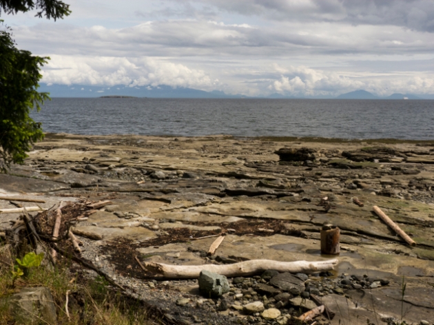
Beach on Newcastle Island, Nanaimo Harbour. Mountains behind Vancouver in the distance, across Georgia Strait

What a scramble.  Lists, more lists, consultations, and then we loaded everything we imagined we might need over the course of the next three months in the north from fuel and water to a fishing rod to kilo sacks of powdered milk, tubs of powdered Gatorade, boxes of wine, beer, a fishing license, the charts for our voyage north up the central coast and across to Haida Gwaii, and then down the outside of Vancouver Island (huge rolls of charts, more than 50 charts in all), flour, rolls of aluminum foil, dish soap, laundry detergent, sponges, trash bags, masses of batteries in D and AA sizes, peanut butter, almond butter, tahini, yeast, pasta, olives, canned tomatoes, coconut milk, beans, rice, quinoa, couscous, canned beans, boxes of soy milk, juices, salsa, mustard, energy bars, body lotion, toothpaste, mouthwash, B vitamins, chips, crackers, granolas, pancake and brownie mixes, olive oil, vinegar, soy sauce, dried tomatoes, mushrooms and hot peppers, bags of onions & garlic & oranges, apples, many kinds of cheeses and sausages that don’t need to be refrligerated so long as you keep them cool, potatoes, carrots, eggs, teas, cookies, artichoke hearts, capers, Realemon and Realime (for when we’re really out of range of fresh produce), ground flax, maple syrup, ginger, dried fruits and nuts of every description, lots of chocolate and several kilo bags of coffee…and then some fresh things.  Some chicken and turkey sausages, bacon, frozen black Alaska cod, and frozen edamame filled our microscopic freezer; we added a few tubs of yoghurt to the fridge and we were ready.  A big shout out to our friends Jay and Anita, who live in Nanaimo. We’d met on a beach in Mexico two years ago, and when we showed up in their back yard they were kind enough to drive us to Costco. No way we could have done this without them!

Are we ready? Well, as ready as we can be. The pocket book is aching, but we won’t go hungry.  We’ve added another ton to our ballast, and every cupboard and drawer and pocket of space behind the cushions is filled up. We’ve strapped extra jugs of diesel and water to the stern and we are beginning to dream of the voyage–or voyages–to come…

Image

View of the Georgia Strait from Newcastle Island, Nanaimo Harbour

29 May 2012, Nanaimo, notes from Karin’s journal:

Awake at 4:30 am: blue sky, light streaming through the hatch and port lights.  I’m jittery with anticipation and convoluted dreams of passages through the long winding canyons for which we bought charts yesterday—of the “Central Mainland” above the Broughtons, towards Bella Bella and Prince Rupert—islands and steep river canyons, fjords fingering far inland.  In my dreams I track the light—golden on hilltops, deep green spruce and cedar, steep snowy peaks, the sounds of birds echoing across the water, a spirit bear on the shore, fur flickering, as if it, too, were light.

But as soon as I am awake I begin to fret: can we trust the engine? Who needs to know where we are? Will our SSB work in those steep fjords?  Who are the people we need to keep in touch with while we are in the north? Where will we pick up water?

Then I think with some pleasure and relish of planning a voyage—the charts stacking up in the shop, 33 for the trip north, 15 for the outside of Vancouver Island, and 4 more that map dealer has to order in for the morning.  Rolls and rolls of places to visit hidden away, each revealing itself, like the vista before you, as you approach and then pass through it.  So many charts I could not carry them back to the dinghy all at once. 

Posted in 2012 | Tagged | Leave a comment

Threading the Narrows

Racing over the water through Dodd Narrows

27 May 2012

The west coast offers some novel challenges to sailors like us who have arrived from elsewhere.  In particular, the mix of tides, currents and wind in the numerous narrow straits and passages of the waters between Vancouver Island and the mainland makes for thrilling, potentially risky and historically, often deadly encounters.  Better instruments, weather prediction, and helpful guides and aids have reduced the risks, but, as one of our guidebooks says, “A working knowledge of tides and currents, and their interplay with the wind, is especially important in this region” (A Dreamspeaker Cruising Guide to Desolation Sound and the Discovery Islands, 5).

The first professional skipper we met here told us to go out right away and buy the current edition of Ports and Passes, a hefty 590-page ringbound yearly that details tides, currents and services available from Olympia, Washington to Prince Rupert BC.  We did, and now we wouldn’t dream of navigating these waters without a copy.

Sometimes the book is quite bossy, but in a helpful way: “When traveling through Gillard Passage and the nearby areas of swift current, including Yaculta (pronounced: yew-cah-taw) and Dent Rapids, one must respect the currents. Timing is very important, even for a fast boat…Strong tidal streams with overfalls, and sometimes violent eddies and whirlpools will develop in the period between 2 hours after the turn to flood and 1 hour before the turn to ebb…When northbound, plan to overnight between Dent Rapids and Green Point…” We try to follow its instructions scrupulously.

The first narrows we transited when we arrived in BC was the Dodd Narrows.  It is a very narrow little passage–perhaps 60 meters wide at its slimmest point—and contains a slight dogleg.  It is, however, the straightest way to get from Nanaimo to the Gulf Islands and southern Vancouver Island, or vice versa in a small or moderate sized craft.

Man spray painting logs on a moving log boom

Depending on the lunar cycle, currents can ebb or flow in the Dodd Narrows at up to nine knots, or nearly 150% of our usual motoring speed.  (Further north, the Nakwatkto Rapids can run at up to 20 knots, which is nearly three times our typical motoring speed.)  Timing is, obviously, everything.  Even a current of three knots will throw the boat around and can make it considerably harder to steer. A current of 5 knots against us will virtually stall us; more than that and we may move backwards.  Add the complications of transiting these narrows with tugs pulling logbooms or inconsiderate powerboats that zip through at high speed and hit slower boats with noxious wakes, and you get a sense of the drama that a passage can involve.  “Whitewater sailing” some of our friends call it. Those in lighter boats with a great deal of experience even cultivate the challenge of racing through rapids at high speeds, sometimes under sail.  Now and then, however, the instructions will be explicit: “Do not attempt to transit this passage under sail.”

We’re now old hands at transiting the Dodd Narrows—we even let ourselves put up a sail, and wait until we’re past slack and can pick up a little push.  The rushing sound of the water, and the little eddies and whirlpools that knock us about are rather exciting, not part of the usual repertoire of a big heavy old fashioned cruising boat like Quoddy’s Run.

We hear others announce their arrival at the Narrows on the radio: “Securité, securité, securité. 32-foot motor vessel, Can Do, heading north through Dodd Narrows. Any concerned vessels, please respond on channel 16.”

And then it is our turn.

Safe passage to Nanaimo Harbour–tree faller at anchor in the rain

Posted in 2012 | Tagged , , , , | Leave a comment

“What is the Nature of Your Distress?” In Praise of Coast Guard Stations

Where there’s smoke…the fireplace works

19 May 2012  Montague Harbour, Galiano Island

“What is the nature of your distress?” Question routinely asked by Coast Guard Station dispatchers.

Slowly, over the Victoria Day weekend, in measured questions and responses, a drama unfolded over the radio.

A man called in on Channel 16, said a diver was down. Lost.

In Saanich Inlet, on the point across from Brentwood Bay.

There were two boats; the caller was on one and the diver was from another boat called “Corona.”

In fact there were three divers.

Yes, all were on the surface.

In the water.

One was bleeding, now non-responsive.

Yes, they were trying to get them into the dive boat.

The one who was non-responsive and bleeding, no, it was not certain he was breathing.

His lips were blue and pink foam was coming from his mouth.

Where should they go?

A nearby doctor who overheard this conversation—we all heard it; you are required to monitor channel 16 while underway in a boat—offered his services:  Just where is the diver? Where are the dive boats? What do they look like?

They are aluminum craft.

Oddly, no one answered more clearly. The doctor raced about (we heard the roar of the engine in the background when he called in), desperately searching for the dive boats.  He did not seem to find them.

The first caller returned to the channel. He confirmed that all three divers were on board. The Corona was proceeding to Brentwood inlet. He was preternaturally calm.  Who could be that calm? What were people doing out there diving in this cold water anyway?

Seconds later, someone from the Corona called. He sounded terrified, young, military in his precision.  He wanted to know where exactly he should proceed.  This was a navy dive team, he reported. The injured diver was one of theirs. The navy had been notified; they were sending a helicopter; to which dock in Brentwood was he to proceed?  We heard the motor behind him, his panic, the waves slapping the boat.  He turned to the side, gave someone an order, returned to the radio to speak to the Coast Guard.

Then silence. Nothing.

Within half an hour, two orange Search-and-Rescue inflatables returned up the Satellite Channel along the foot of Salt Spring Island to Ganges Harbour.

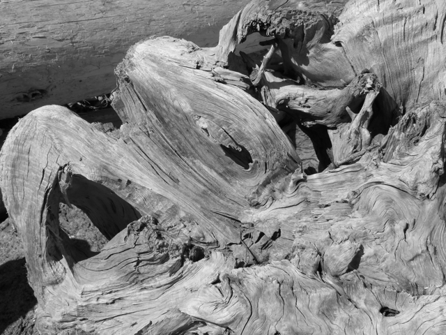
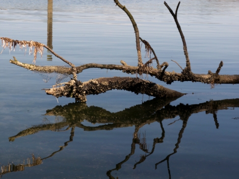
driftwood

Later, as we were sailing by Ganges, we heard the same Coast Guard dispatcher, a woman, take a call from a boater in Ganges who had plucked a man who appeared to have hypothermia from an island in the harbour.

Was that the person who had been doing tai chi in the water earlier in the day? The dispatcher asked.

Affirmative.

He had been checked out earlier and released.

But now?

He is known, the dispatcher stressed.

This made the boater who picked up this known and possibly hypothermic psychotic anxious that the Coast Guard wasn’t going to do anything, but that wasn’t true.  They were simply tired, or perhaps simply tired of this particular character and his watery antics.

Bring him in, the dispatcher said wearily.  Emergency Medical Technicians have been deployed. They will be in the harbour when he arrives.

Before we anchored at the end of the day, we heard the dispatchers handle three losses of power, a grounding or two, a sailboat adrift, a boat on fire—a holiday weekend, the first of the summer season, in the Gulf Islands.

Just a few weeks ago, as part of their budget cutting exercises, the ever helpful Harper government announced reductions in the numbers of Coast Guard Stations. Apparently, according to federal government wisdom, new technology means we don’t need quite so much aid on the water; we can cut down the number of Coast Guard stations.   We’re for setting Mr. Harper and his cabinet adrift on a cold day at sea, without offering any reply when they call. We think they could use a “corrective emotional experience.”

Driftwood and seaweed slime

We had our turn with the Victoria Coast Guard Station.  Last year, when our raw water pump failed, and we were in the ferry channel in Nanaimo, and there was not enough wind to sail, we called in to say we’d broken down.

No, no ferry was coming yet, but it would arrive, and then there would be trouble.  The Coast Guard dispatchers asked us a few questions, put out a call, and within five minutes, a nearby vessel, a sailboat, appeared to offer us a tow.  They brought us safely into a dock, where we were able to repair the pump.  A nightmare averted, without any real danger to us, to our vessel or to anyone else and their vessel, thanks to the voices on the other end of the radio. (For more on this incident, see Letters Hither and Home, July 31, 2011).

No matter how many precautions you take, things do happen on the water.  That’s why the Coast Guard Stations are there, and why we need them. Let’s go on staffing them! We desperately need people who will answer when we call, “And what is the nature of your distress?”

fossil

Posted in 2012 | Tagged , , | 2 Comments

The Spirit of Maria Mahoi

Clam shell beach at Russell Island

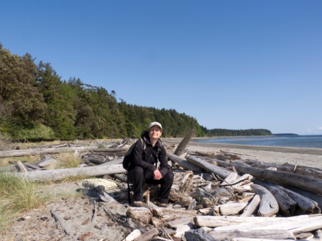
Russell Island is a crooked finger of land tucked into the eastern edge of Fulford Harbour, Salt Spring Island.  You can only get there by boat—though a kayak or rowboat would do if you were near enough to begin with. It is one of several small plots and spits of land in the Gulf Islands comprising the Gulf Islands National Park Reserve. A narrow trail runs around the perimeter of the park, and at low tide you can walk the beaches on the western and northern sides of the park.  They are covered with driftwood and sloping craggy volcanic rock or deeply piled thick white shell beaches, the remains of years of clam and oyster cultivation and harvesting by Coast Salish people.

Perimeter path through the trees, Russell Island

You can anchor behind the island and watch the sun set beside Baynes Peak.  The light shoots down Fulford Harbour and glows on the metal roof of the little house that still stands on Russell Island; indeed, the whole island turns golden and green, a glory of colour.  The birds seem to sing particularly loudly here.  At first we thought that was just a peculiar impression, but then we met an inflatable full of bird researchers from the University of Victoria.  They were tracking these birds and recording their songs.  They circumnavigated the island in their inflatable, wearing their Mustang suits and wielding a directional antenna and recording devices.  There are no predators here, they told us—no raccoons or rats or cats.  And indeed, we heard many birds rustling about in the underbrush when we walked around the island.

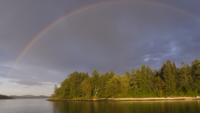
Double rainbow over Russell Island

There is something magical about Russell Island.  It’s not just the birds, or the fact that we’ve seen a rainbow arc over it, or that it’s a convenient stopping place when we have to be in Canoe Cove for a repair or a meeting early in the morning; it’s not because it’s fairly near a bakery in Fulford Harbour or quieter than Ganges Harbour (also on Salt Spring, and always overflowing with boats), or because usually you have cell phone reception there (not so in other island retreats); it’s not because it is surprisingly sheltered when westerly and southerly winds blow—though of course it is, also, all of these things.  Still, after stopping many times behind Russell Island, and walking the perimeter trail, exploring the grounds around the little house and the marine railway one cove over, or the generating station back in the woods, we’ve decided that the reason we like Russell Island so much is because it is still inhabited by the spirit of Maria Mahoi.

The house that still stands there was her house.  It is sheltered from the harshest winds and perfectly situated to catch light from both the rising and setting sun.  Strawberry plants trail up the path to the house, and the place is still surrounded by flowering bushes and fruit trees, although the gypsy moths are making harsh work of many of the apple trees this year.  A path runs from the back of the house up into the woods, where there is a little defunct generating station—and now, a bio-recovery operation superintended by Parks Canada.  Another path runs down to the beach—and to, the next cove over, the rusting remains of a marine railway, with a car and winch and cable still intact, though probably stuck fast and not of much use.

Maria Mahoi’s house in evening light

Surprisingly for us–as East Coast residents, we were unprepared for this fact– since the 1880s Russell Island has been a Hawaiian homestead and outpost. (Hawaii?!  But that’s so far away!  Actually, it’s not—it was, once upon a time, a regular sailing route from this shore and one of the nearest places in the Pacific, once you’re out away from the continental coast.) William Humea, thought perhaps to be Maria Mahoi’s father, first cleared some of the land for planting and building.  He was among 200 Hawaiians who had been brought by the Hudson Bay Company to Salt Spring and its environs to work. When the US annexed Hawaii, the Hawaiian immigrants didn’t want to return home—or so the Parks’ story goes—thus they stayed and built many of the primary institutions (their church, for example, still stands in Fulford Harbour) that governed southern island life early in the last century.

Local resident patrols in the rain

Because the island was homesteaded, wild descendents of strawberries carpet the lowlands, and English ivy strangles several small arbutus trees.  But the clearings are also filled with blooms—apple and pear and lilac (purple and white and a white and purple variety), roses, morning glories, yellow broom.  Bees buzz overhead, and the air is sweet and perfumed.  Sedums crawl over the rocks, and one grassy clearing is filled with purple lilies, common camas, nodding in the breeze.

Another vessel anchored off of Russell Island at sunset

Coast Salish people also farmed the island—they built retaining walls in the water that became the architecture for very productive clam beds.  The shallows all around the island, but especially on its sheltered northern side, are filled with crushed clam and oyster shells, glittering white sand shallows, testifying to generations of expert cultivation.

Evening light at Maria Mahoi’s

But the house and gardens and spirit of the place are clearly Maria Mahoi’s—part Hawaiian and part Coast Salish, fully familiar with a varied and generous island life. We were visited by a raven while on the island, and conversed with it for a long time. An avatar of Maria Mahoi? Perhaps.  In any case, we’ve felt her warm welcome more than once, and remain grateful for the shelter and insight the traces of her life have offered us.  In fact, secretly, we hope she’s shipped onboard with us.  We’ll return her safely to Russell Island, we promise, once the season is over. In the meantime, we like the golden light, and lightness of spirit, she shares with us.

Posted in 2012 | Tagged | 5 Comments

Quoddy gets refit

Karin on the deck of a damaged Quoddy’s Run on the Dockwise ship in Nanaimo

A blue water cruising vessel is like a house that you shake up and down and immerse in salt water.  Things break and wear out under such stresses.  A sailing vessel built in 1976, and sailed hard part of the time in the tropics, Quoddy’s Run had aged to the point where she required not simply a facelift, but some joint replacements. When we purchased her in 2003, we knew that she was going to require some work, but we decided to go sailing rather than spending–at that moment–the years and money necessary to repair her fully.

A damaged Quoddy’s Run aboard the Dockwise ship

When we began to think about bringing Quoddy’s Run to British Columbia, we knew that we were going to have to address a number of issues apart from paying customs duty and taxes.  We even considered selling her to avoid such extravagances, but when we showed her to a prospective customer in Mexico, we balked.  We love our boat and our hearts would not let us part with her, although it may have been the economically rational thing to do.  “Oh you’d just go out and get another boat,” said Karin (this is probably true), “and we already know what we’re in for with this one.”  So we booked passage for Quoddy’s Run aboard the yacht transporter, Dockwise, and awaited her arrival in Nanaimo last May, 2011.  We had decided not to sail her further north precisely because her rig needed going over and possibly repair.
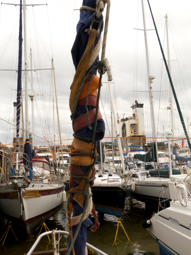
Forestay and ripped sail all tied up

As you may have heard, while aboard the Dockwise ship, during a night storm that came at the vessel on the forward starboard quarter, a stay gave way on Quoddy’s Run.  The thrashing of the staysail furler about the deck, before it was discovered and lashed down by the crew, destroyed much of QR’s rigging and sails forward of the mast.  Crestfallen, we motored Quoddy’s Run off the ship and around to Blackline Marine Repair at Canoe Cove on Vancouver Island, the outfit suggested by the shipping company’s insurer’s surveyor.  Thus began stage one of QR’s refit, some of it covered by insurance.   We like to think of the damage on the ship as a big red finger pointing down at the boat saying, “Fix this now, and this too, and better check that while you’re at it.”  And so we did.

Damaged furler and staysail

Stout replacement for the bit that broke (for want of a nail…)

THE RIG

Will fixing things at the top of the mast at Canoe Cove

Blackline is first and foremost a rigging and stainless steel fabrication company.  Before we set off for our summer sail last year (2011), they replaced all of the stays (those wires that hold the mast up), and the chain-plates—stainless steel straps bolted to the knees of the hull that hold the stays down to the deck.  Jeff, Brent and Will, all expert riggers, clambered up the mast, inspected all the fastenings, reattached the new wires and chain plates, sometimes making them even more skookum than before, because that is what they knew was called for.  It was a pleasure, not to mention of great reassurance, to watch such consummate professionals at their work.

New stainless steel pulpit gleams in the sun

Their stainless steel technicians, who really should be called artists, fabricated a new pulpit (the bit that goes around the bow or front of the boat), stem chain-plate, stanchions and boarding ladder for the boat.  They even polished the nuts, making their work sparkle like those brilliant hubcaps on long haul transports.
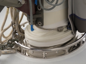
Mast collar at the deck

Mast collar belowdecks

This winter the mast was un-stepped in order to replace the fastenings and sheaves at the mast head, to repair the base of the mast where it was slightly corroded, to rebuild the mast step at the base of the hull, and to fashion a new mast collar where the mast goes through the deck.  This collar is a piece of jewelry, a necklace so to speak, of incredible workmanship.  We had the design modified somewhat to accommodate blocks on deck should we ever get old and rickety enough (right now of course we don’t really believe that will ever happen) to require all halyards and reefing lines to be lead aft to the cockpit.  Currently, Marike finds it an easy step and a half to the mast from the center cockpit to raise, lower, and shorten sail in all conditions.

Will again, working on the rigging

Much of the running rigging was also upgraded: several new halyards, the non-stretch new hi-tech kind.  A new Harken furler, and new furling lines.  Even the boom vang—a gold star to whoever knows what that is–was rebuilt.

Vern, Seamus and Jeff hold the base of the mast as the crane lifts

Sometimes, in the past, our mast pumped; indeed, we’d nearly lost the rig when the forward chain plate bolt gave way in Panama a few years ago.  But since Blackline has had a go at it, the rig is as solid as a BC red cedar, not to mention tuned to perfection by Jeff, a retired Olympic sailboat racer.  Yes, it’s true: not only are musical instruments tuned, but sailing rigs as well, and with similar results—the harmonies of their parts are pleasing to the senses.

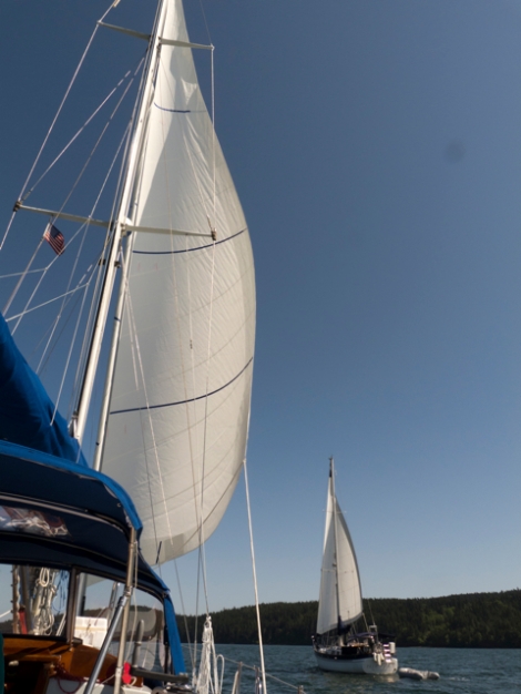
Quoddy’s Run–and new sails–wing on wing

THE SAILS

When we purchased Quoddy’s Run in 2003 her sails, apart form a relatively new staysail, were already a disaster.  Her large foresail, a Genoa, was blown out like an old bag, her Yankee was stiff but tired, and worst of all, her mainsail was more like a heeling over mechanism than a forward driving force.  But the boat continued to sail fairly well in moderate to heavy winds provided we reefed the main early and deep – a testimony to the Kelly Peterson’s balance and design if anything.  In light winds, however, our 38,000 lbs would lumber along so slowly we usually ended up using the old iron sail, our engine.

Shortly before loading the boat on Dockwise, we had procured a secondhand set of sails for Quoddy’s Run that we thought would fit her.  That’s the problem with having a boat off-shore, you cannot get the sailmaker to her for measurements.  The thrashing she took on Dockwise destroyed both her staysail and her Yankee, and destroyed her mainsail cover as well.  Stuart Dahlgren, owner of UK Halsey Sails in Sidney, paid us a visit to measure for and persuade us that UK’s hi-tech computerized international design team was worth choosing over more locally based sail-makers.  He gave us good deal on a new main if we gave him the contract for the foresails.  And there was this thing called a lazy cradle mainsail cover which combined lazy jacks (vertical strings that keep your lowered sail from falling all over the place) with a cover that remained on the boom at all times.  Anything lazy to do with the mainsail Marike was up for–so we ordered that as well.  Do not believe all promotional adjectives always. (That lazy cradle is not so lazy if you let the sail down to quickly. If you let it down slowly however, and train it carefully in what Stuart calls “Dacron obedience school” it’s pretty grand.)  In three weeks, we would have a completely new set of top-drawer, blue water finish, off-shore sails for Quoddy’s Run.  What a luxury!  All the more so because the used main we had procured was five feet too short at the luff.  Ooops!

Quoddy’s Run, sun and spinnaker

Still, the two spinnakers and large Genoa did fit and proved almost new.  Quoddy’s Run now has a downwind sailing capacity dignified of a vessel plying the light winds of BC’s coastal waters not to mention a potential Pacific passage maker running the Tradewinds.  What is more, the spi’s are brightly coloured!
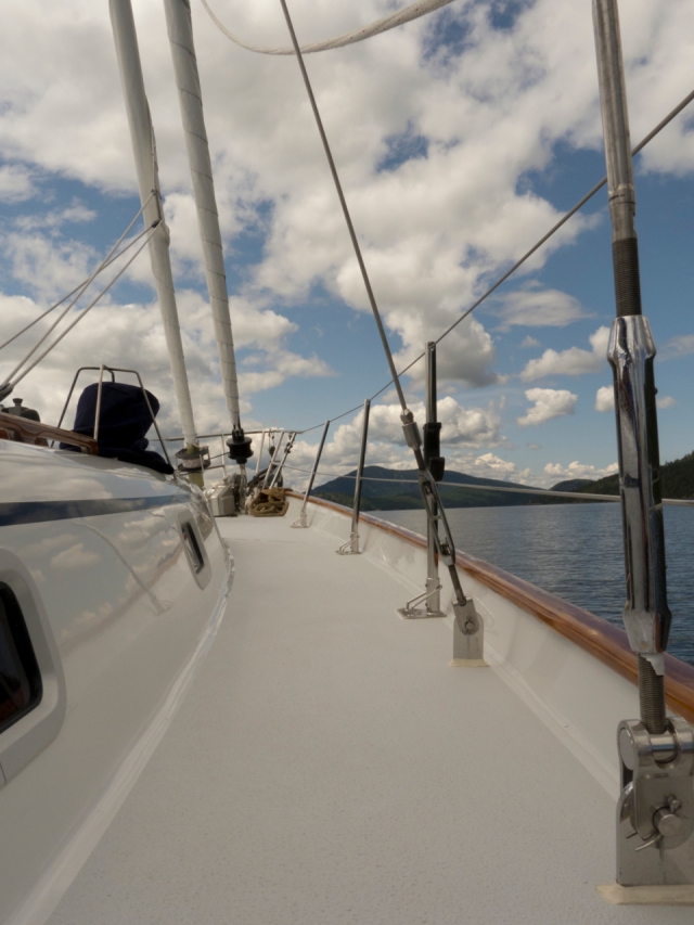
A new deck so gleaming it reflects the clouds

THE DECK!

Now, what about those soft spots on the deck, and what about all of the leaks through deck fittings, port-lights, and hatches?    We knew they were there, even when we bought Quoddy’s Run but since for a number of years we kept her in the Sea of Cortez, laying her up over the summer in the Sonora dessert with full deck covers, we delayed addressing them.  Every year Marike would stomp around on the deck feeling for cavities with her feet; they were spreading.  Keith, the composites man at Blackline, examined QR’s topsides and declared the situation grave; the cure draconian.

Quoddy’s Run would have to have her mast unstopped, to be rolled into a shed, have her decks cut open, the top layer of fiberglass peeled, her portlights and hatches removed, the rotten mahogany laminate core removed, new foam core inserted and the surface reglassed and repainted.  We hesitated.  We tried to imagine alternative solutions: “let’s just drill holes and squirt epoxy into the old core.”  But there was nothing left for the epoxy to adhere to, and we’d still have to repaint in any case.  The estimate made us gulp.  Finally Keith came up with the line that made us decide to do these favours for our vessel: “Somebody has to love this boat enough to fix her properly.”  Quoddy’s Run had carried us for thousands of miles safely, swiftly, and comfortably.  Clearly, that somebody who loved her enough was us.

Quoddy’s Run was in the shed from September 2011 to the end of April 2012.  As Med–short for Diomedes, Blackline’s brilliant fiberglass artist–stripped her down, Blackline sent photos of more and more vast spreads of rot.  Around the port-lights, up the bulwarks, even around the old teak hatches.   Med carved, and carved, then replaced the foam, and re-glassed.  We chose to install new Lewmar port-lights and hatches.  (We would have liked to keep the classic old ones but that would have involved far more work and cost.) The new ones are far easier to open and close and let in much more light.  On the inside, where the old water stains once were, we now have clean marine white surfaces.   The deck and foc’s’l are repainted white with light grey non-skid.  Any extraneous teak has been removed.  All deck fittings have been rebedded.   New stanchion bases, stanchions, and lifelines were fitted–now people can actually lean on them without fear they will give way to rust at any moment.  No more points of entry for water–we hope, anyway.  We’ve been through some rain storms and gusty winds now, and so far, so good.

Quoddy’s Run glistens like a new boat; her structure is solid; her below-decks comfortable, light and dry.

Looking up through a new hatch–and the rain–at the mast

THE ELECTRONICS

When Marike learned to sail, navigation was done by dead reckoning, something we still like to do in case of electronic failures.  Previously we relied on a GPS system from the early 1990s; one day that unit just packed it in, leaving the spare below decks to rely on.  Our electronic chart plotting system was run through our computer, also below decks, as was our vintage radar screen.  That meant that in a tight spot, Karin was always having to pop down below decks to check the screens then pop up to relay the information to a short-handed skipper.   That works in waters of little fog and fewer reefs.  BC is not one of those places.

So we splurged and installed in the cockpit a spanking new Lowrance GPS, chart plotter, depth sounder, and broadband radar system.  All the information we need is in the cockpit and interfaced.  This allows us both to be in the cockpit handling sails and helming as we wind our way through channels and currents.  What a relief!  We can also take photos of the screen, witness to wild moments of white water keel-boat surfacing at over 9 knots through waters like the Dodd’s Narrows.
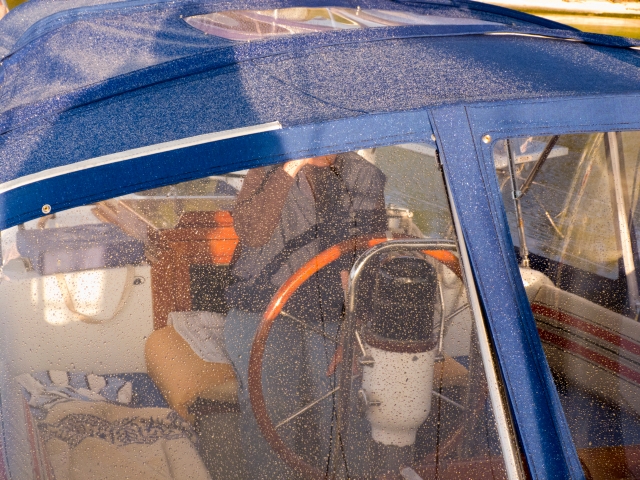
Dry inside, wet outside–as it should be

THE CANVAS

For the past several years, our main concern for shelter in QR’s cockpit has been for shade from the blistering tropical sun, although our dodger did keep us warm during night sails and in blistering northerlies.  Last spring when we arrived in Nanaimo it was raining–through all of our canvas coverings.  We were soaked.  The UV rays had totally eaten away at our dodger and bimini.  We’d had them re-stitched umpteen times.  The canvas man we had scheduled in BC to redo the canvas took our deposit and never showed up.  Finally we met Alan at Watershed Canvas at Canoe Cove whose work looked very professional.  We placed our order a year ahead of time for a completely enclosed cockpit–a sort of pilot house made of canvas and Lexan.    Originally we thought that Alan would have it all completed when we arrived.  We’ve since discovered his process of patterning.  The dodger and bimini were made. but then once the rig was re-stepped he had to measure for the connector pieces.  We had to be there to tell him how we wanted them.  How large a window overhead; where to put the openings for sheets and lines to run through; how far aft the base of aft curtains, etc.

Looking out through the raindrops, through the Lexan

Witnessing Alan make the patterns was a thrill in itself.  Karin likened him to the pattern-makers at NSCAD, though where they use paper or fabric, Alan uses clear plastic, which he pins up and then draws on with sharpies.

Alan is a spatial genius and an artist.  Three weeks later, and we are enclosed in a Sunbrella and Lexan house, resistant to wind, waves, and rain.  This system will keep us warm and dry in the shoulder season or north to Alaska.  And it gives us another all-weather room–the cockpit.  We have not slept out there to gaze at the stars since arriving here, but will soon, because now it will be warm enough.

Standing in the rain and smoke from our wood stove

THE HULL

QR’s bottom was in almost tip top shape when she arrived in BC.  We’d had her undersides re-epoxied and anti-fouled in Puerto Vallarta, after the boat had been a bit scarred up by efforts to remove dinner plate barnacles in El Salvador, and we’d kept up with the anti-fouling every year.  Still she had received a few skidmarks on Dockwise during the course of her thrashing, and we had four unnecessary through-hulls to eliminate.  Keith knew exactly which ones, and the re-glassing is imperceptible.  Blackline completed a light sanding and recoating of anti-fouling paint.  Then we gave a spritz of zinc paint to the propeller just before splashing–thanks to friend Rick Burkmar’s advice and purchasing savvy, we hope we won’t be seeing weeds there this year.  All that we could possibly do to Quoddy’s Run is repaint the hull, and–DO NOT EVEN THINK ABOUT GOING THERE.   A wash and wax from the dinghy in warmer weather is the limit.

And that is all for the refit of Quoddy’s Run.  All, huh?  We are not even going to tell you what the estimates were, let alone the final painful price.  Doing this refit for Quoddy’s Run made absolutely no sense economically.  We could never recover it in a resale.  But we intend to be sailing Quoddy’s Run for many years to come, safely, quickly, comfortably, and–oh yes–aesthetically.  We do love Quoddy’s Run enough to fix her right.

Happy sailing skipper Marike

Karin, ready for adventure on the northwest coast

Posted in 2012 | Tagged , | Leave a comment

Into the San Juan Islands

View of northern San Juan and southern Gulf Islands

International borders are strange and artificial things—they drive distances between spaces that are not at all far apart.  Charts and maps tend to reinforce such prejudices because often they omit lands or waters belonging to other nations—as on ancient maps, “over there” might well be unknown territory, an unmarked blank zone, or simply, cut off: where the chart ends; us, not them.  Thus, when our friends Paul and Dee first suggested we cross the border and meet them in the San Juans, we thought we’d be going quite a distance. Then we studied the single chart we have that encompasses both US San Juans and the Canadian Gulf Islands, and we realized, with a bit of shock, actually, we’re just a few miles from the San Juans.  Indeed, it really makes no sense to think of these Canadian and American islands separately; their histories and flora and fauna and lifeways are closely linked. It is just–just!?!–the politics and hassle of the border that divides our consciousness thus.  And the simple fact that here, we’d not yet crossed it.

And then we did.

Image

Quoddy’s Run and Blue Pteron anchored in Indian Cove

12 May 2012

Saturday

A clear blue morning and we are anchored in Indian Cove on Shaw Island, in the San Juans, alongside Blue Pteron, Paul and Dee’s boat.  The day hints of summer—golden sunshine and the mountains in clear view—Mount Baker and the snow covered Cascades.  They hover like mirages above the low spines of the islands and at sunset those snowy caps turn to rainbow-tinged spectacles of colour.

The boat rocks gently as the ferries go by, but the night was calm, the water glassy and tossing back stars when we went to bed.  The air is sweet; it smells like apple blossoms and woodsmoke.  Something on one of the islands is bursting into bloom and it mingles with the freshening sea air blowing up from the Juan de Fuca Straits.

Image

Quoddy’s Run anchored in the San Juan Islands

Yesterday already seems long ago—we hauled up anchor late, then raised sail and set off around the top of Sidney Spit and towards the border.  The Anacortes-Sidney ferry passed us; we slipped by a tug towing two enormous barges piled high with flattened cars, and motor-sailed towards Spieden Island.  Spieden Channel was anything but speedin’—we were slowin’ and slowin’ and almost stoppin’ in the rush of the current, which bubbled and burbled like a stream, tossing the trailing dinghy sideways, tossing us sideways, spinning us in one direction and then another like a funhouse ride.  We slowed as we approached the San Juan Channel: 1.8 knots; 1.4; then hit by a powerboat wake and another tidal eddy, .8, all sails up and working at the engine pushing at 2000rpm.  “We’ve gone backwards in there!” Dee says when we arrive and tell them the story.

As we’d hoped when we read the current tables, the water was with us in the San Juan Channel, and we raced to Friday Harbour at 7 and 8 knots, and up to the US Customs dock.  Lots of standing around waiting—three other boats were there, and crew has to stay on the boats, so while Skipper Marike paced the docks, Karin tidied the cockpit and galley and read.

Finally, the officers arrived, approved us, and gave us a little slip of paper containing a seal and some numbers that we were to paste in our logbook—which we did—and we were off.

A sweet afternoon sail around the bottom of Shaw Island, and then there, a little speck in the distance—Mount Baker rising impossibly high on the right—was Blue Pteron. Anchored. The cove was warm and still when we arrived, and Paul and Dee were floating about in their dinghy, rowing slowly, having been out clamming.  They’d found huge clams, each a handspan wide.  They came aboard and inspected the work done on Quoddy with much admiration.  Then dinner, wonderful wide-ranging conversation, and sleep.

Image

Marike tries to rescue a drying starfish

Later

After rowing ashore and walking along the beach at Shaw Island, and then up through the 10 campsite County Park there along Indian Cove, we dragged the dinghy back out over the tidal flats and returned to the boat. Paul called Dee, who was painting in a rocky grove, and we set off for Eastsound, a town at the head of East Sound, Orcas Island, which was rumoured to have a mead and cider festival.  No wind, some wind, and then, as we turned up into East Sound, 20 knots of wind on the nose.  Either a beat up into it or one very short tack after another.  Let’s not bash into that, Paul said, and so we turned around and decided, the weather being settled enough, to head for Aleck Bay, along the southern edge of Lopez Island.

Image

Quoddy’s Run and Blue Pteron sailing

We sailed through the Thatcher Pass and into Rosario Strait, south, past the State Park on James Island, along Decatur Island and around the southeast tip of Lopez.

Sudden rugged wildness, snowcapped mountains visible everywhere, steep rocky ledges, rookeries, arbutus and cedar clinging to thin soils.  A clear clean cool smell of the open sea—a whisper of coldness—piping in from the Juan de Fuca Strait—absolutely splendidly beautiful.  We anchor in a corner of the cove that permits us to look over the water at the Cascades.

Image

Quoddy’s Run anchored in Aleck Bay, Lopez Island

13 May 2012

Sunday

Aleck Bay, Lopez Island

Anchored in a rugged rocky cove—echoing just now with the alarms of sentinel Canada geese.  It’s nesting season, and the young, little balls of grey fluff, are just beginning to waddle about in short lines between two watchful adults. Sentinel geese are everywhere, watching; diversionary flights, cries of warning, attempts to mislead potential threats are all part of their repertoire.  It makes for noisy mornings and noisy walks—goose heads suddenly pop up, dozens of them, wherever you go.  Human no trespassing signs don’t strike pangs of guilt in us, but these alarms do.

Cool fresh sea air.  We are just beside the junction of the Rosario and Juan de Fuca Straits, and the air smells of the cold and open sea. Mist lies above the water and the mountains, which we could see last night, are just a bit of shadow—white on white—in the distance.

The water sparkles; the sky is blue, trees and meadows are in bloom.  Somewhere, at one of the immodestly large houses that line the shore, children play and exclaim, oh boy! Let me see!  Perhaps they’ve discovered a large clam.

Image

Paul hoists his horse clams

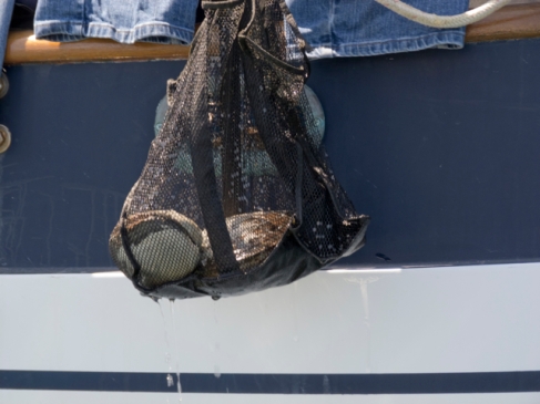
Paul and Dee have been carrying their enormous clams in a mesh bag hanging from the stern of Blue Pteron.  Paul has taken to calling them ‘horse clams’—we find that that’s one name for Fat Gapers in our Seashore of British Columbia field guide.  Last night after dinner, as we were debarking from Blue Pteron for our own boat, Paul said, “I’m not sure I can eat my horse clams. I’m growing attached to them.  I’ve even named them.  Mr. Ed” (we see the chompers chomping).  –And the other one? “Seabiscuit.”  Hard work not to fall into the cold water we were laughing so much.

Image

Paul contemplates the state of the world

14 May 2012

Aleck Bay, Lopez Island

Another stunning day.  The sky is blue, the sun golden, the eastern horizon rosy.  We rock gently in the swell from a shifting tide and wake slowly, though we’ll be leaving this morning (timing our departure carefully so as not to buck against the currents this time), headed to Bedwell Harbour, a re-entry point to Canada.

Paul and Dee left with the ebb yesterday afternoon for Port Townsend.  No wind really, but the way was clear and the day warm, the currents in their favour.

Before that, we’d taken them on a bit of a wild goose chase around the point to a landing where we’d thought we’d be able to walk.  That’s one of the difficulties here in the San Juans—there’s no landing on some of the beaches, not even below the tide line: “no trespassing on private property or tide lands,” say the signs. Finding places where we can walk is not a simple matter; we’d need a map of public and parklands and not just our marine charts.

Image

Dee paints from the bow of the boat

We’d gone in their dinghy—the engine is a bit larger, and so is the dinghy—more room for the four of us. But then the engine died along the way as we stopped to look at what seemed to be either a large mooring buoy or the remains of a sea lion carcass, peeling in the sun.  It was the latter of course—we caught the awful smell as we drifted downwind, Paul pulling on the cord, turning the throttle up and down and pushing the choke in and out.

Finally the engine caught, and we continued on, and on, through tidal eddies and whirlpools, past endless “no trespassing zone” signed beaches and rocky outcrops to a protected little bay—finally!—and wide beach full of people.  A trawler drew close to shore and disgorged two kayakers in the shadow of a rocky steep mountain covered with trees.  And there, winding up the mountainside was the trail we’d been looking for!

The water was still and green, Mount Baker ubiquitous and majestic above us.  But it was also late; Paul and Dee wanted to leave and all of us were reluctant to turn off the engine in case we couldn’t get it to start again.  So we headed back, through eddies and whirlpools, past the perfect reflections of steep red rocks covered in orange lichens (memories of Mexico), weaving between little rocky islets and up into…a cover where our boats were not.

“Where are our boats?” asked Paul.  I’d been searching too, through the binoculars, thinking aids to my vision might make the boats appear.  But they didn’t.

Dee started laughing.  Wrong cove! she said. Oh, oops.

We went out and around the point and up into the next cove, and of course, there they were, those two boats, Quoddy’s Run and Blue Pteron.

We said goodbye and got in our own dinghy and rowed ashore to a place where there didn’t seem to be any no trespassing signs. We stood on the beach and watched as they hauled up their anchor, then we walked up and down the rocky shore, melancholy with goodbye.  We’ll see them again soon, we know, but still, we miss them.

Image

Driftwood deadhead

Posted in 2012 | Tagged , , | Leave a comment

Getting off the Dock

Image

Quoddy’s Run gets off the dock!


10 May 2012

It’s both an enormous relief and a struggle always to leave the dock.  Once we pull away, we sever certain ties with the land and its shops and roadways–as well as, in North America, simple assumptions about unlimited water and power supplies, ready access to garbage and recycling facilities, and easy telephone or internet-based communications.  Once we’re off the dock, we must carry or generate most of what we need, from food and water and fuel and electric power to trash and other wastes.  A blue water cruising boat—that’s to say, an ocean going vessel like Quoddy’s Run—must be a self-contained unit: a safe vessel for travel and then anchorage, a secure and comfortable home, and a power, water and waste managing factory.

Troubleshooting and getting all of these systems up and running after they’ve been shut down for months is quite a job.  We aim for a “best of most, safety-first” strategy in order to be able to move at all.  (This is because we’ve noticed over the years that those who aim for perfection almost never leave the dock.)  This means that we fill with water, charge up our batteries, ensure the windmill and solar panel are working, bend on the sails, go over the engine and alternator carefully, calculate how much fuel we’re carrying, fill if it’s too low, take a jerry jug of gas for the dinghy, and stow plenty of fresh food, dry goods & cleaning supplies, coffee beans, tea, wine, beer, bottled water, dry and canned milk and boxed juices. If there’s not too much dirty laundry, and nothing major (bilge pumps, radio, chart plotter, SSB, radar, gps, windlass, propane system and stove, refrigerator) broken, we’re ready to go. At least one of the two marine heads (toilets) must work, though it’s always easier to service them at the dock.  Charge up the computers and camera and sound recorder batteries. Listen (again) to the weather report. If all is well, a last top-up on the water; disconnect the power cord, fire up the engine, don the life vests, call for an extra hand in roping off the dock, and we’re gone!

We threaded through narrow channels and headed south.  The day was spectacularly clear—every mountain range was visible—the Olympics, the Cascades, the Rockies behind Vancouver, the snow covered peaks running up the spine of Vancouver Island.  What pleasure to be moving on the water again.  To be out, away from the land.

As we approached Sidney Spit, we decided to stop and anchor.  We could dinghy to shore and go for a good walk along the beach and through the woods.  No one else was there, save for two crab fishing boats working their traps.  We hadn’t gone far; we hadn’t gone where we’d intended to go, but no matter.  We were finally off the dock, free! We could go wherever the water and wind would take us, and stop whenever we wanted!

Image

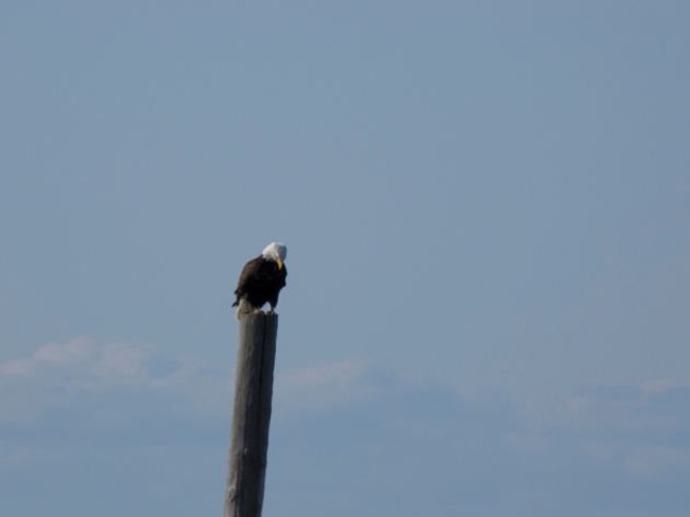
Bald eagle at Sidney Spit


We had a rendezvous for the next day in Indian Cove, on Shaw Island, in the San Juans, with our friends Paul and Dee, but we didn’t need to rush there.  Besides, we needed to eat the rest of the fruit we had on board before we crossed the border into the US, or they’d just take it away, even though we’d carefully chosen, against our usual pattern, US-grown fruit in the supermarket.  “Nope, once it’s been to Canada, it’s contaminated!” joked the customs agent we’d called and talked to about what we’d need to do to cross the border for a long weekend. “What’s the matter?” we wondered. “Do California oranges begin to speak French once they cross the border?”  “No, they become socialists!” our friend Paul asserted. “And we know that’s not allowed in America.”  “Socialist fruits? Really? Even in Stephen Harper’s Canada?” But there the conversation stopped, because, despite his careful study of Republican party politics and his fondest wishes, Canadian Prime Minister Stephen Harper just isn’t a household name south of the border—although, apparently, socialist fruits still are.

Crabs

View from Sidney Spit

Once we arrived at Sidney Spit, we had to anchor twice because the first time where we’d dropped the hook left the boat floating above a crab fishing couples’ traplines.  We hadn’t understood that, unlike lobster traps on the Eastern Shore, each of which is set on its own, the crab traps here are set on lines, which the boats follow, quietly and rhythmically.

The couple–Leanne and Antonio–were sweet about our mistake, and sold us three large Dungeness crabs for supper. “Cook them for five minutes after they start to boil,” Leanne counseled us, “with onion and hot peppers and a bay leaf or two.”

Look at those BLUE nails!

They held up some of their crabs so we could take their picture, when we noticed that Leanne was fishing with LONG BLUE star-spangled nails! Wow! Girl, you have some magnificent nails, we told her.

Image

Tossing by-catch and undersized crabs


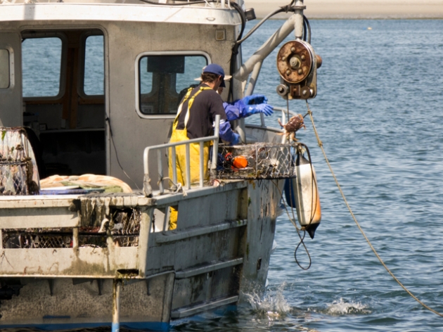
Once we re-anchored, we watched two crab boats work in the curve of the Spit.  They each drive to the head of their line and then snap the line to some sort of pulley that moves them along, trap to trap. At each stop, one person opens the trap and tosses out seaweed and other bycatch, measures smaller crabs, flings undersized ones back, and settles the crabs they will keep in a bin.  The other then picks up the trap and moves it to the back of the boat and stacks it.  When the line has been fished, they rebait and reset each trap, then move to another line, fish that, and come back.

Image

Gull hitching a ride on the crab boat


Gulls trail the crab boats and eagerly gobble by-catch and old bait.  The air on the Spit is cool and fresh and smells of saltwater and seaweed—and a trace of picked fish as the boats pass and dump their bait.

A long walk

Image

Karin temporarily anchors herself to some driftwood


In the afternoon, we kitted out the dinghy—a big wrestle to get the engine to start, but finally it kicked in—and set off.  The floating docks weren’t in yet at the Spit, one of several sites in the Gulf Islands National Park, so we ran the dinghy up a steep bit of beach and pulled it above the high tide line, tying it off to a massive piece of cedar driftwood.

Image

Marike looks out over the lagoon at low tide


We had a lovely long walk along the beach to the lagoon, through fields where geese were nesting—sentries crying out an alarm when they saw us—then through old growth and new greening forest to the furthest point of the park. A lone camper who had arrived by boat was sunning himself near the beach.  We caught glimpses of deer, bits of goose down, whiffs of apple blossom.  Birds were everywhere, fluttering, hovering, diving, coursing, singing.


Goose down

We had to get our feet wet to shove off the dinghy again, but no matter.  The water was bone-achingly cold, but the air was sweet, green, floral, cool: a perfect spring day, our first day at anchor, and fresh crabs for supper.  Nothing could be better.

Apple blossoms

Posted in 2012 | Tagged | 1 Comment

A new voyage, a(n almost) new boat

This gallery contains 16 photos.

Quoddy’s Run has been in the shed in Canoe Cove all winter, undergoing extensive repairs to her decks, which now look brand new.  New port lights, new hatches, new stanchions, new mast collar and various subtle bits of new rigging … Continue reading

More Galleries | 7 Comments