The Sound of Running Water–Butedale Cannery

Butedale dock

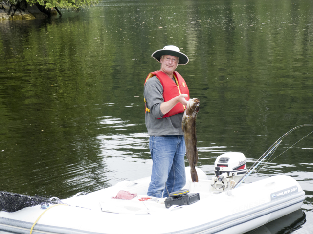
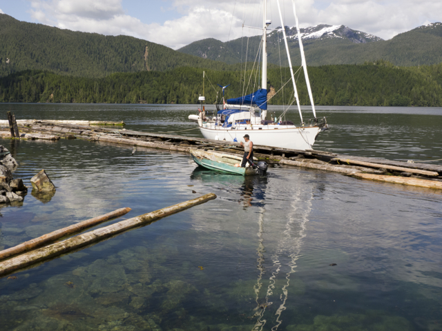
Quoddy’s Run and Butedale Louis in his launch

22 July 2012

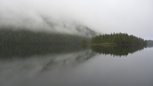
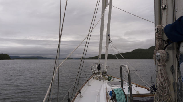
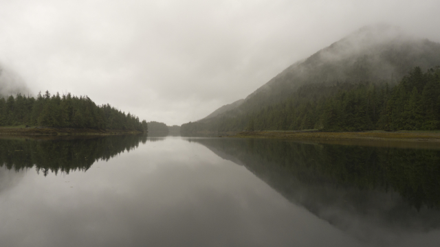
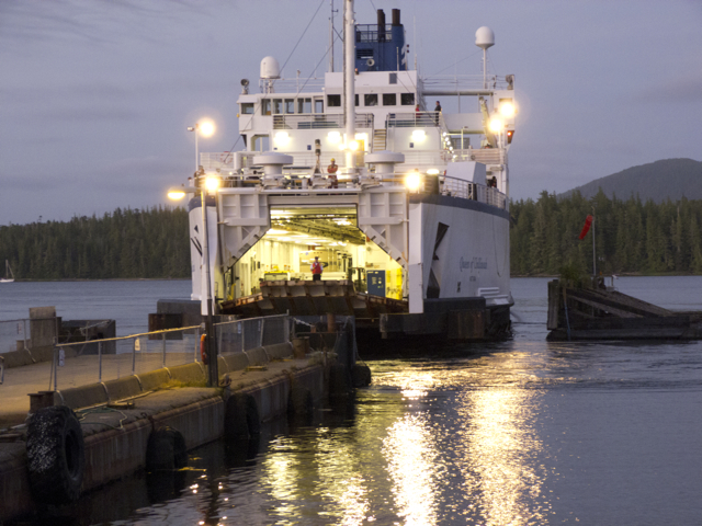
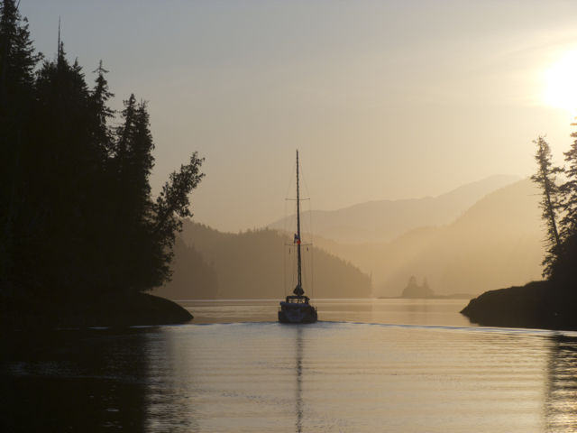
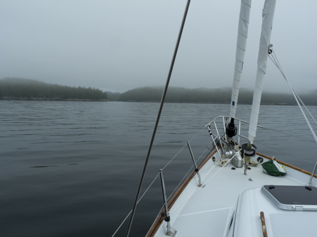
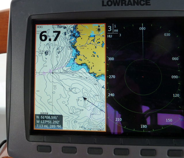
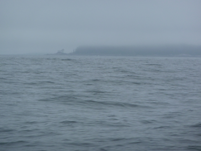
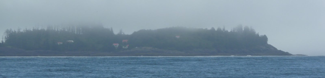
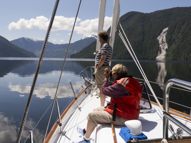
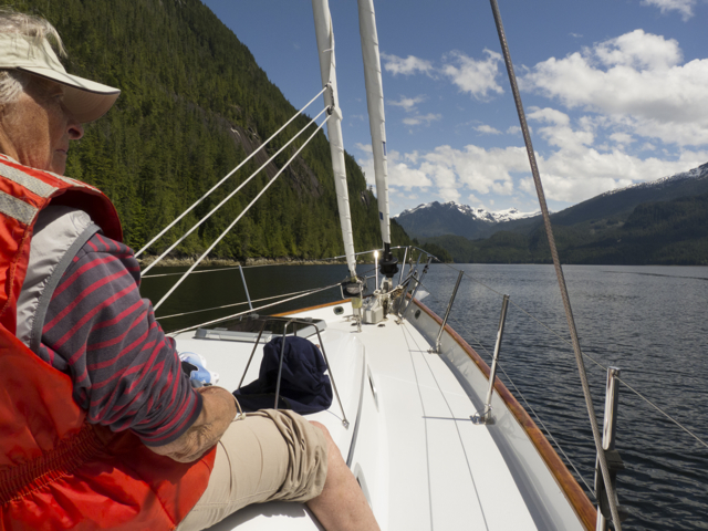
We had planned to sail by Butedale, and rush onward to the hot springs at Bishop Bay.  But as we rounded the corner into Fraser Reach, BC Ferry’s Northern Expedition headed towards us, forcing us in closer to Princess Royal Island, towards the cove where Butedale is located.  At the same moment, a man crossed our path in a ramshackle launch, dragging a few logs behind him.  We thought he came a bit close to the ferry, but he waved to the bridge, as if he and captain and crew were old friends—which, we later thought, they probably were.

Butedale sign

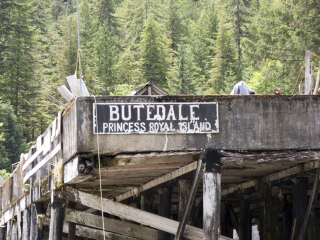
Butedale, Princess Royal Island

ramshackle Butedale dock

Butedale dock

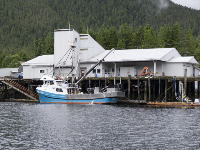
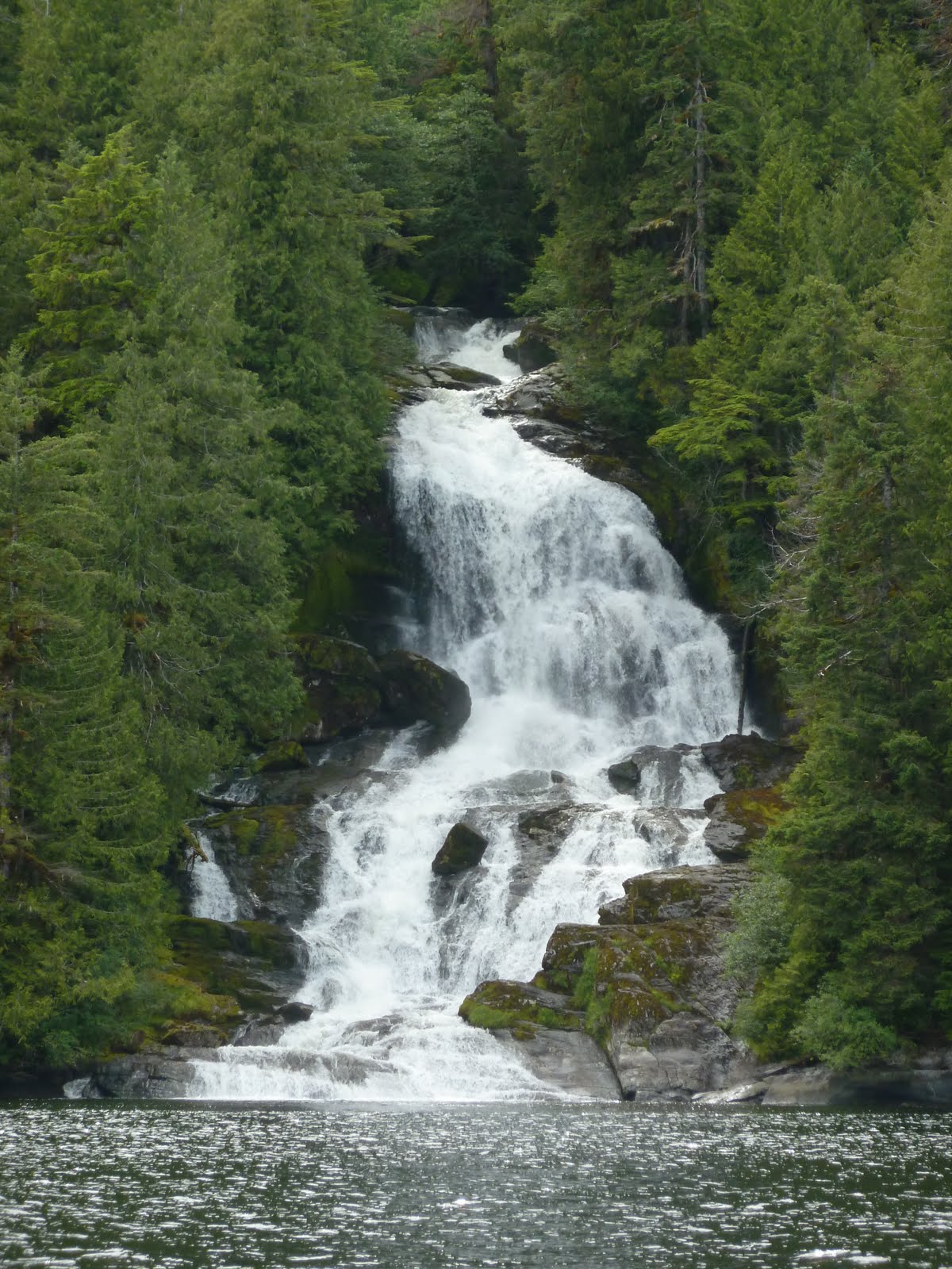
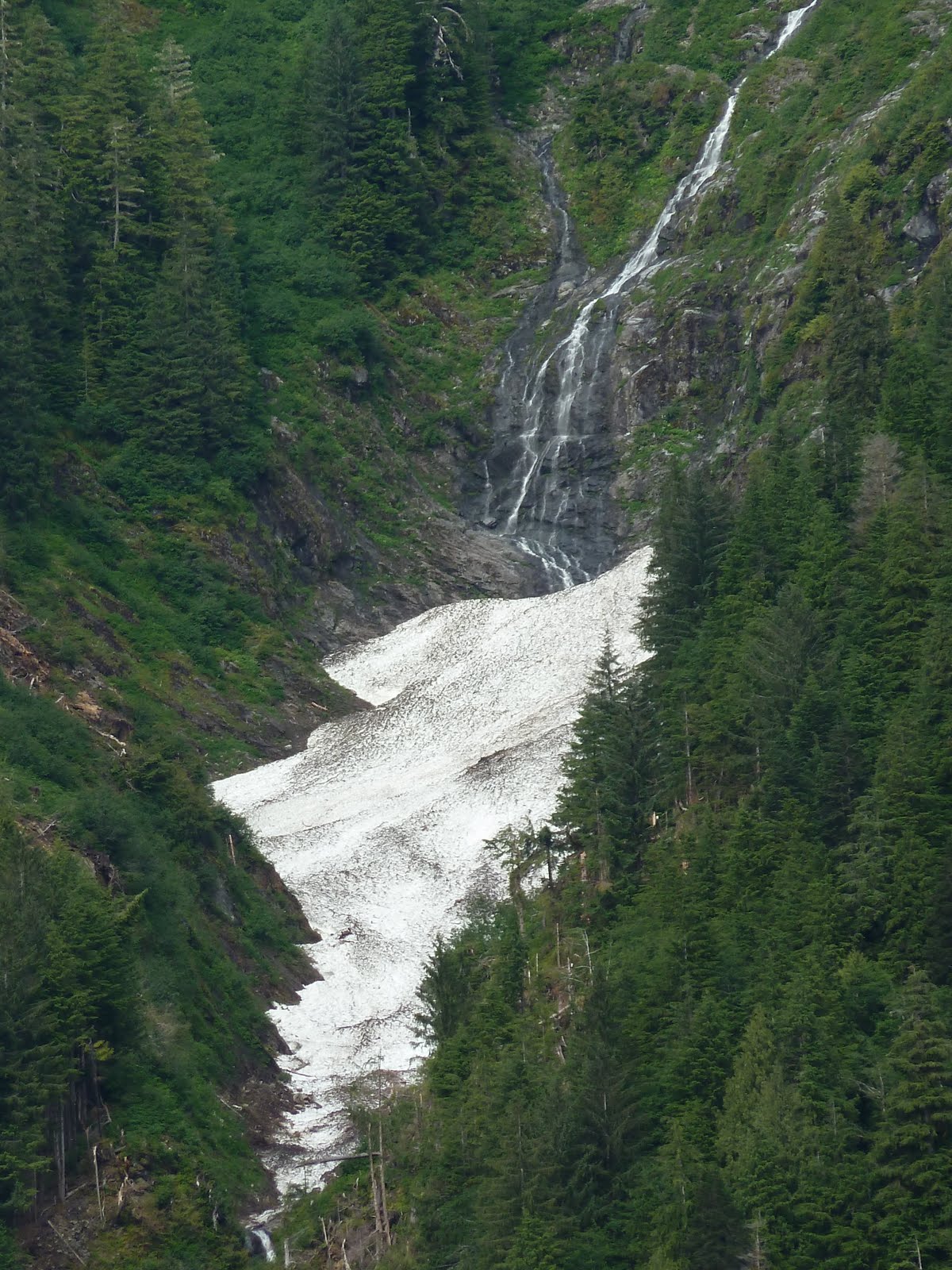
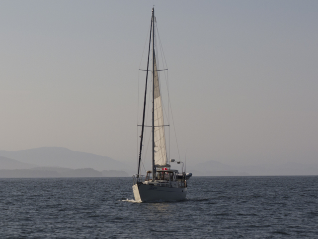
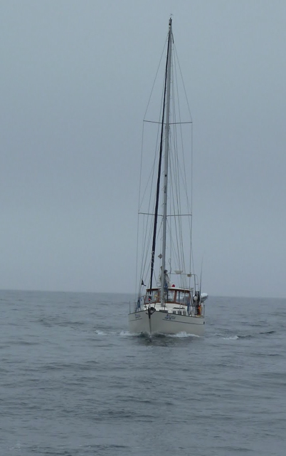
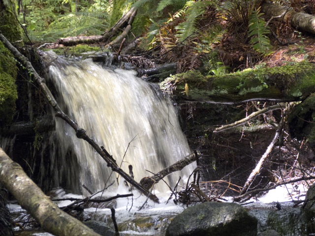
By then we could read the faded sign: “Butedale Marina–hot showers, ice cream.”  Right, we thought, that will be the day.  We edged into the bay behind a yellow sailboat that tied off at the long rough form of a dock built from rows of logs and boards tied and chained haphazardly together.  We still were not sure we wanted to stop.  We called out to the other boaters, “Is there good water?” They pointed to a wooden trough over which a stream of water gushed, then dropped into an old black hose.  Nearby, a raging falls boomed and sprayed into the sea.  “Looks like lots of fresh water,” we said to ourselves. It’s good not to miss an opportunity to fill your tanks.  So we pulled up to the ramshackle dock and tied up, just as the little launch arrived with its cargo in tow.  And that’s how we met Butedale Louis.

water!

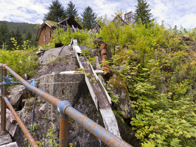
water gushes through a wooden trough

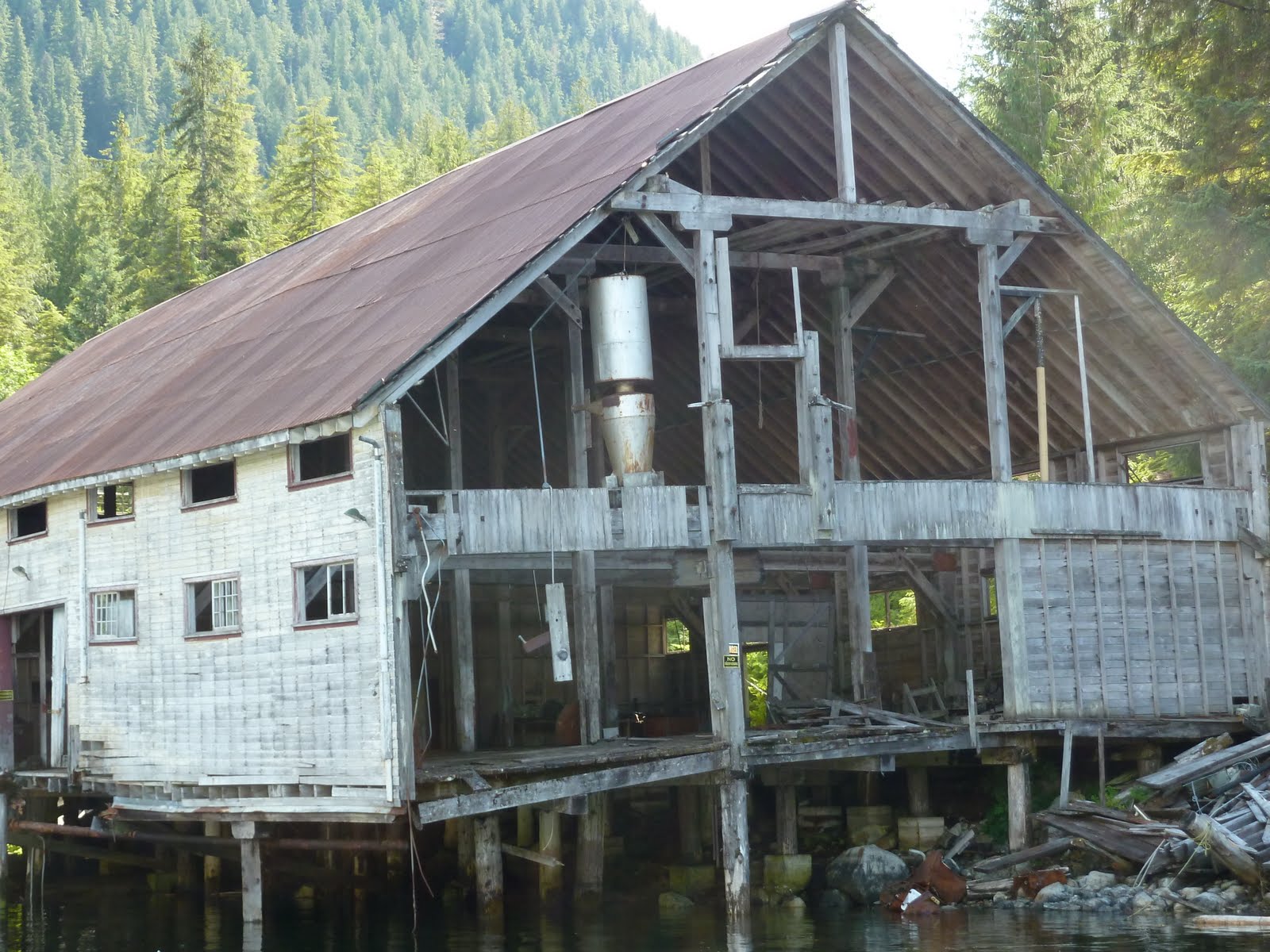
Butedale was once the site of extensive lumber and mining operations, as well as a booming salmon cannery, where hundreds of workers at a time had been employed between 1911 and the 1950s.  Then, as with so many canneries up and down that coast and on our own Atlantic shores, as refrigeration became commonplace, and the larger vessels began to process their own fish, the big canning plants became redundant. They reduced their operations and then closed.

Butedale bunkhouse tumbles

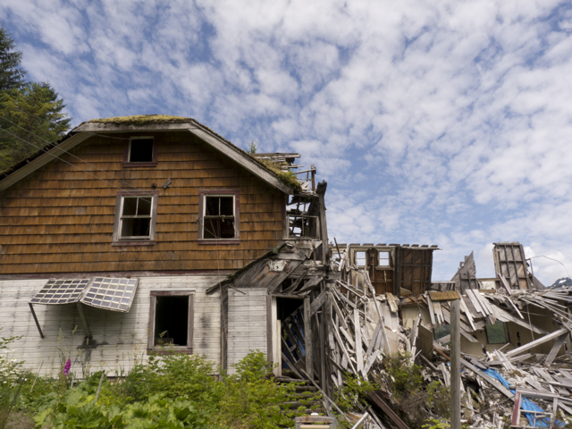
Bunkhouse tumbles down

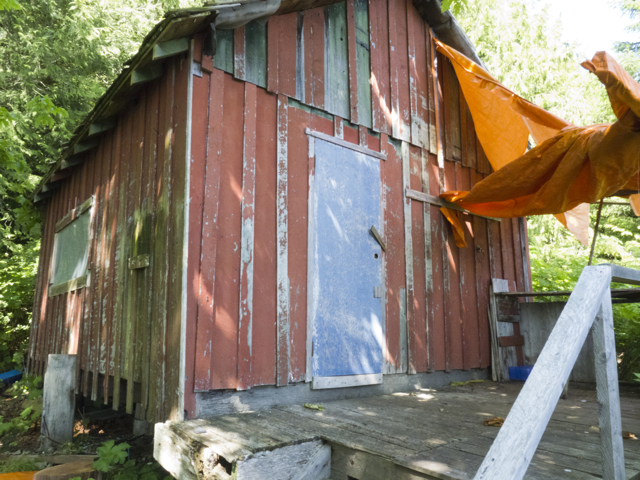
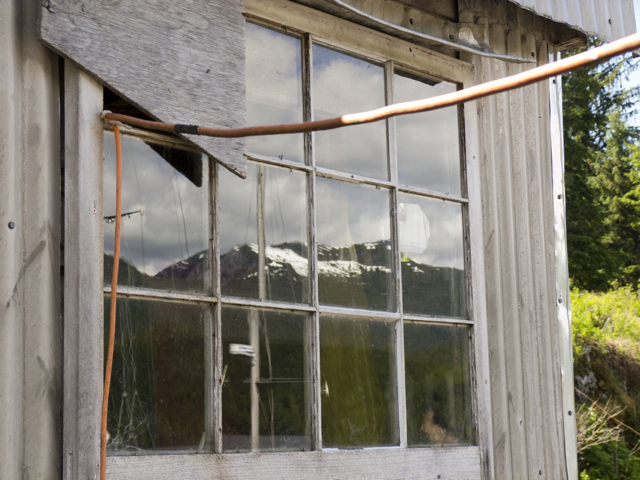
In Butedale, many of the buildings still stood, although in a state of flagrant disrepair.  A boiler shone out from one building, which was missing an entire wall.  The roof caved in on a huge rooming house, and another wall was shattered.  Large wharves were crumbling into the sea.  Yet a few houses and outbuildings still stood.

Butedale cannery

Remains of a boiler

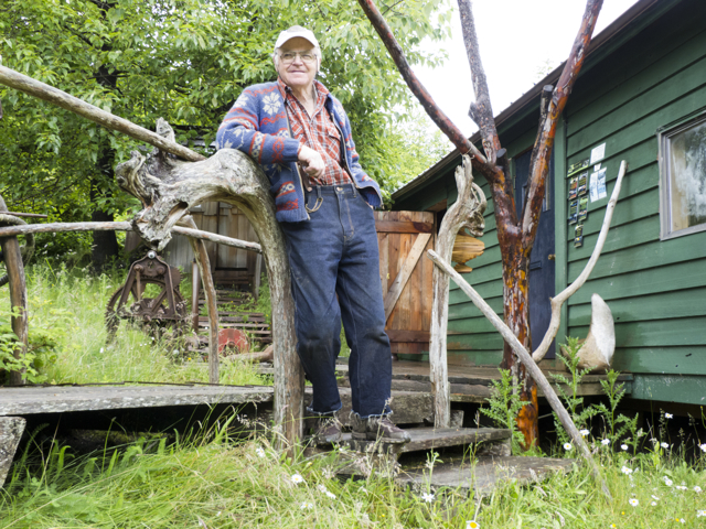
Louis lived in one, with his cat, but his dream of running a marina, and offering rustic cabins for rent, was fading.  Still, he worked hard to keep things up.  He’d planted a garden with flowers and vegetables, and two cabins were furnished and starkly hospitable.

Butedale Louis at home

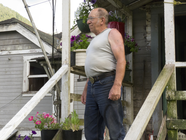
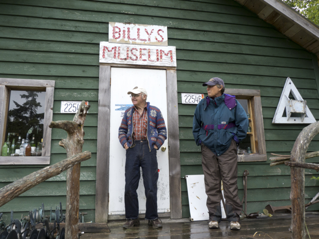
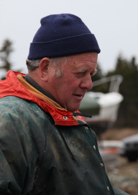
Butedale Louis on his porch

cat in Butedale

Butedale Louis’ cat

Butedale flowerpots

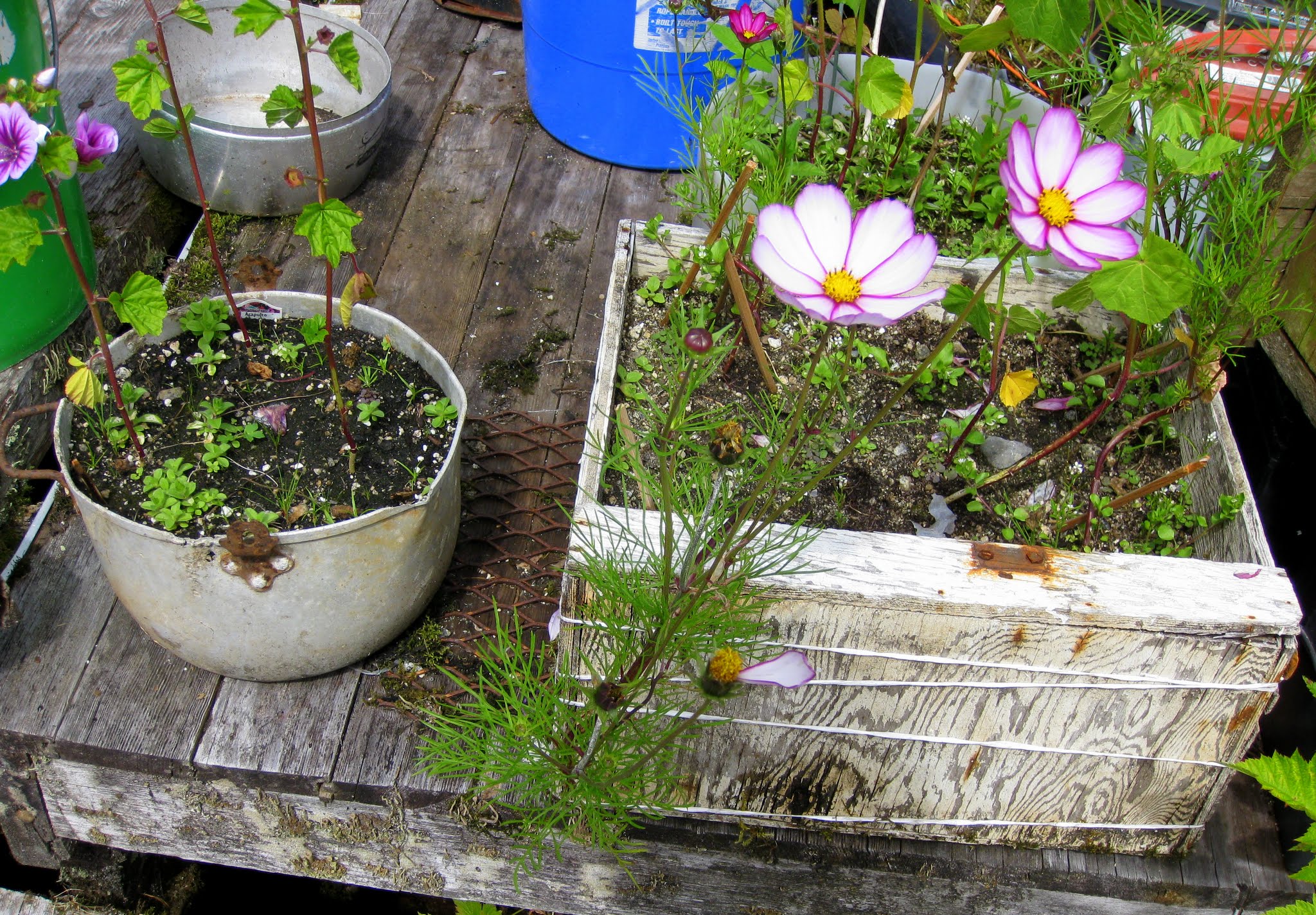
Butedale Louis’ flowers

He kept some trails cleared and mowed paths between the various buildings.

P1090336 Butedale

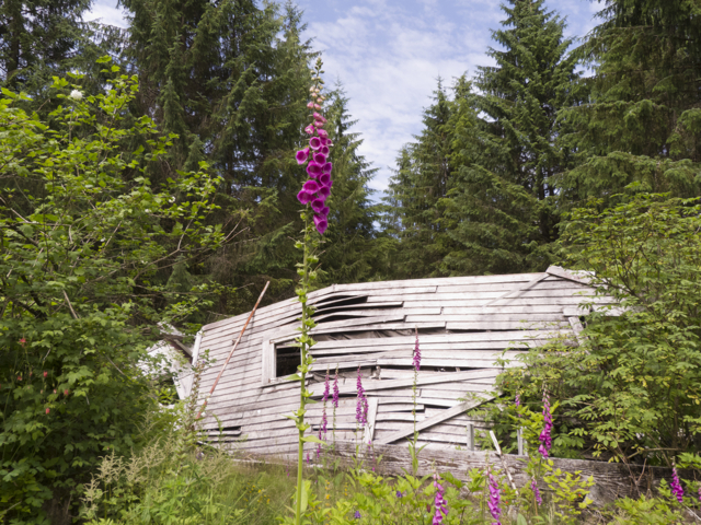
Foxgloves and crumbling wall

P1090391 Butedale

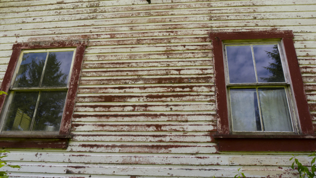
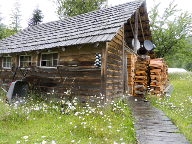
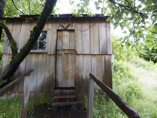
House for rent, Butedale

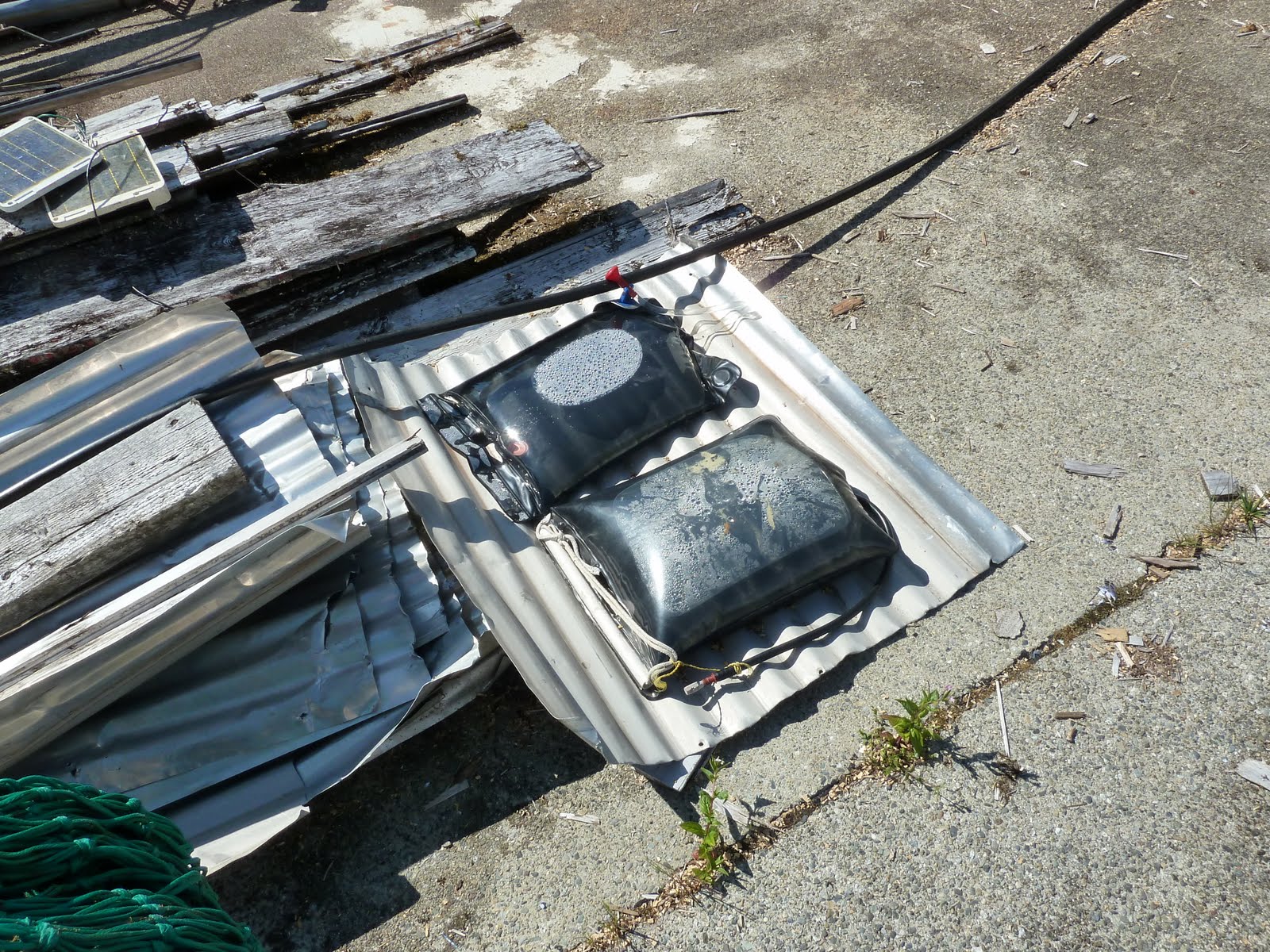
Louis also collected old movies and videos, and watched for Kermode bears—he’d made a video of one playing with a bucket on the beach.  And he kept the power supply going in the old power house over Butedale Creek, just above the falls.  The old wheel still turned, but the generator was now hooked up to a 12 volt alternator that powered Louis’ house and fridge and two outdoor lights, which he never turned off.

P1090337 Butedale

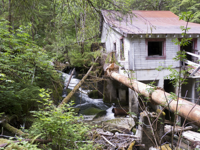
Power station, Butedale

cupboard, power station Butedale

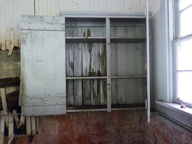
Empty cupboard in the power station

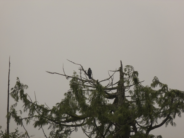
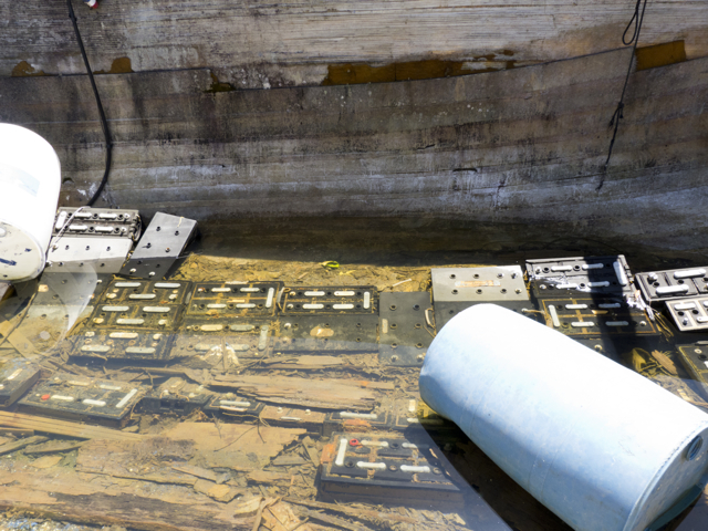
Once a little railway had connected the factory’s buildings, transporting workers and goods to their designated stations.  Apparently Butedale had been a segregated site; workers had lived in  separated “villages,” according to the racial designations of the day: “Japanese,” “White,” or “Indian.” The forest was already reclaiming “Japanese” and “Indian” housing zones.  Now birds called wildly in the trees, and we watched for bears in the berry bushes along the paths.  The ghosts of bustle rang from so much derelict machinery, but the people were almost all gone.

P1090373 Butedale

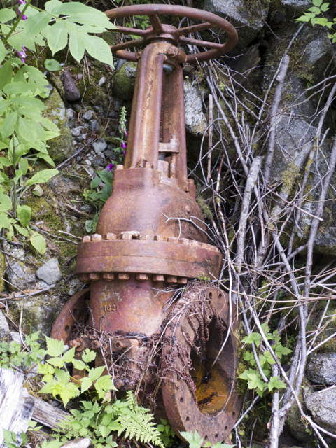
Abandoned machinery, Butedale

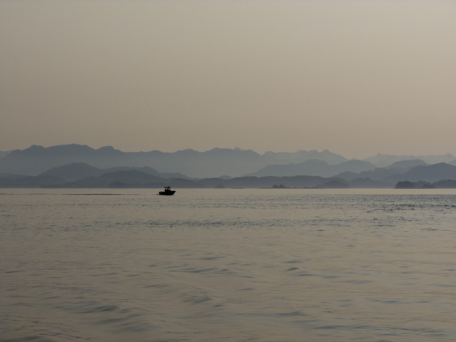
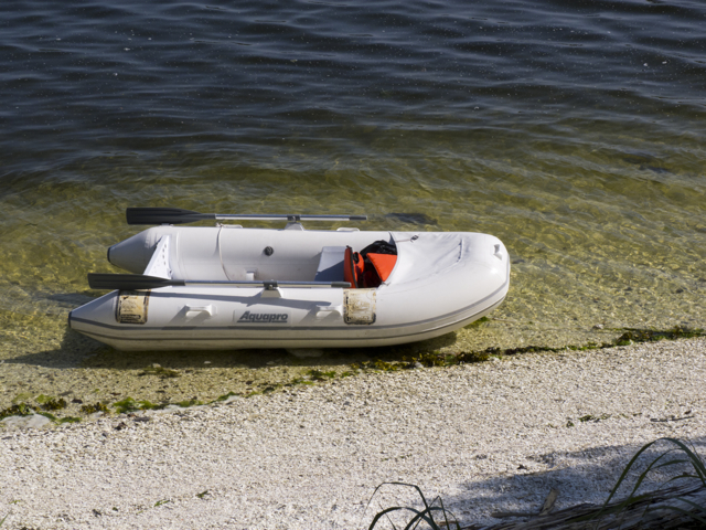
Once it was possible to catch, clean, and freeze the fish on a boat, and rush it back to the city for sale, no one needed an island outpost in the middle of the fishing grounds, so far from roads and markets and demand. Butedale was a relic, and even water and ice cream and wilderness experience seduced few visitors. It seemed most important these days as a stopping place for kayakers or boaters like us, and as a safe mooring for fishermen in small boats racing back to Bella Bella from the Skeena River. It offered a night off of watch,  a respite from vigilance or bad weather.

at dock in Butedale

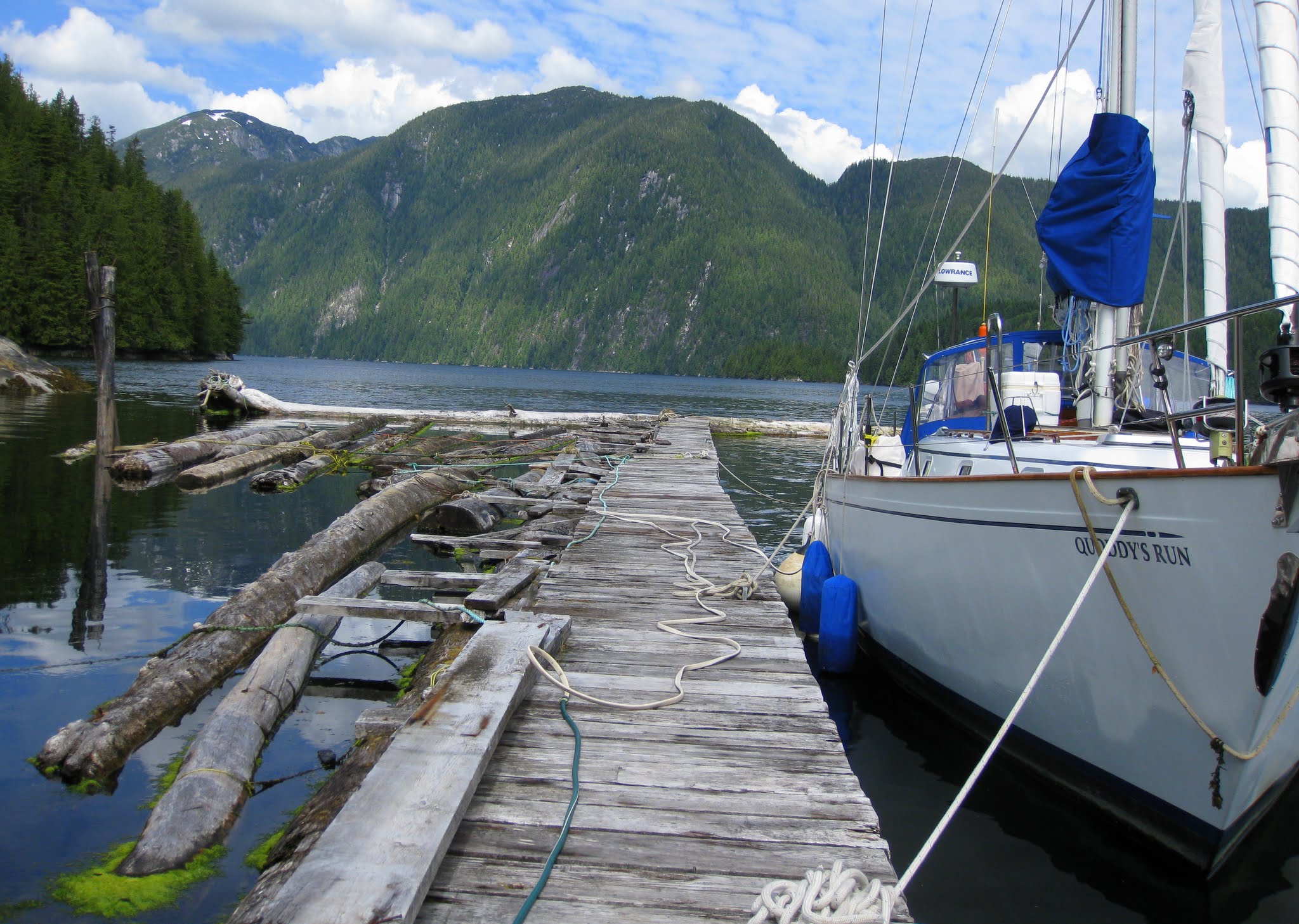
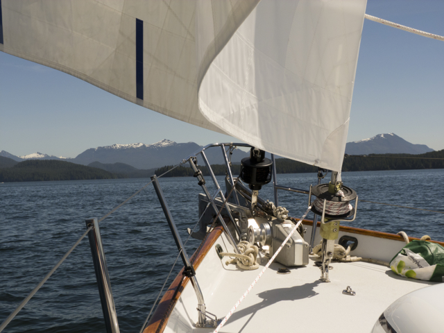
Quoddy’s Run at dock, Butedale

Louis, it turns out, was Quebecois, originally from La Beauce.  He wouldn’t say why he had left home, whether love or work or a sense of adventure had taken him west. According to Louis, Butedale’s owner is a grumpy, elderly Californian man who doesn’t want to sell, but also isn’t prepared to try to preserve the place.  He had let Louis come every summer from Kitimat, to try to run a marina in Butedale.  But now that the government was demanding that the cannery wreckage be cleared from the water and shore–no small task or expense–the owner seemed to want to collect some dues from Louis, or at least oblige him to do some remedial work.

Louis in his launch

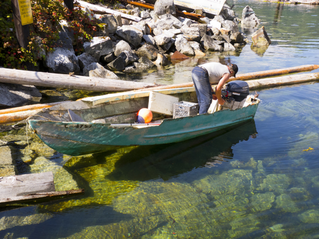
Louis at work in his launch

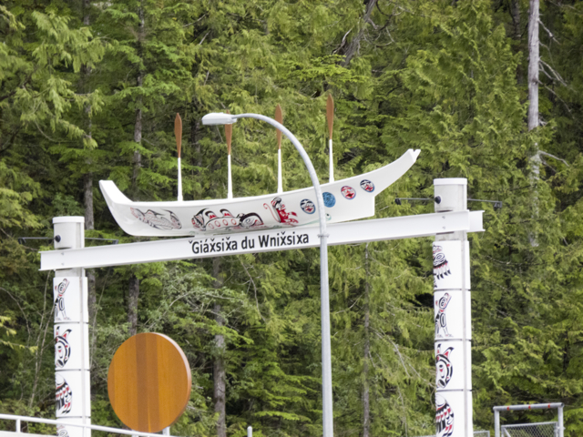
We should have recorded Louis; many of his stories were hilarious and full of voices—he imitated all of his interlocutors.  The stories were almost all about how le petit gars de la Beauce (the little guy from La Beauce) outwitted some stupid bigwig.  Or put him in his place.  Or else about fighting with local Haisla people—Butedale is at the southern edge of traditional Haisla territory.  In fact, the Haisla name for Butedale is C’idexs, which means “runny diarrhea,” thought by some to refer to the many berry bushes in the area, or what happens if you gorge on too much fruit.
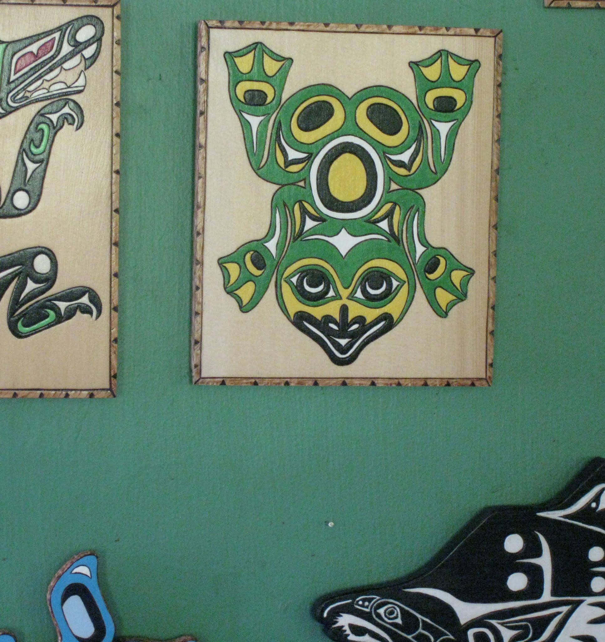
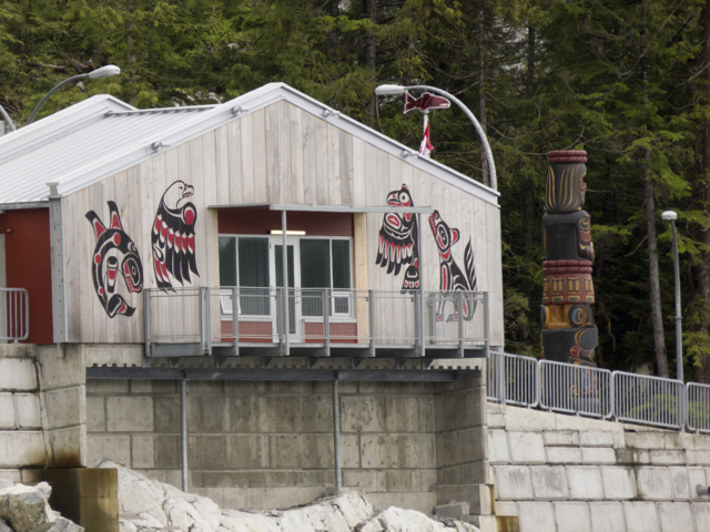
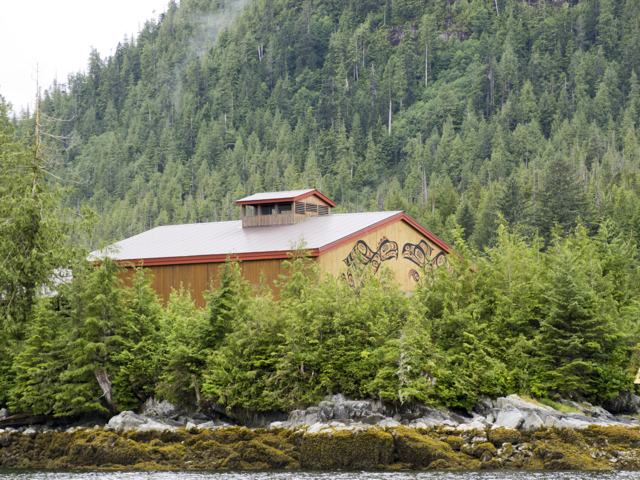
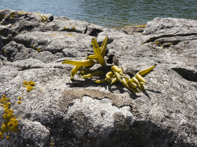
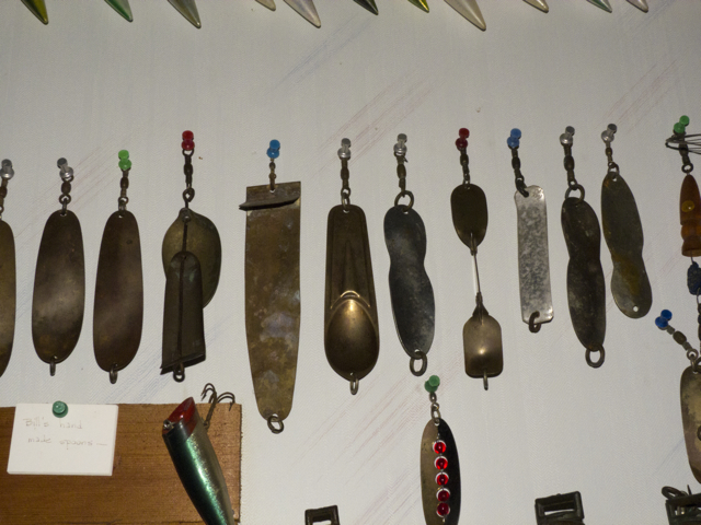
Butedale Louis art

Some of Louis’ art

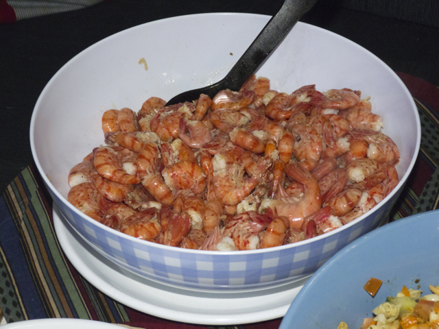
Louis was clearly depressed from his solitary life in Butedale; he tried to keep himself busy by burn-etching copies of First Nations artwork on slabs of board, then painting and selling them to passersby.  Such imitations did not stop him from telling stories about how he “cussed up the Indians” every chance he got.   Still, did not want to move back to Kitimat; he seemed to like his status as the keeper of Butedale; he even relished his title, “Butedale Louis.”  And he particularly liked female visitors, so we were treated quite well. We even begged some rhubarb from his garden to make rhubarb crisp, which we shared with him and the sailors in the yellow boat docked in front of us, who were enroute from Alaska to retire in Oregon.  The world is full of such intrepid adventurers.

letter to Butedale Louis

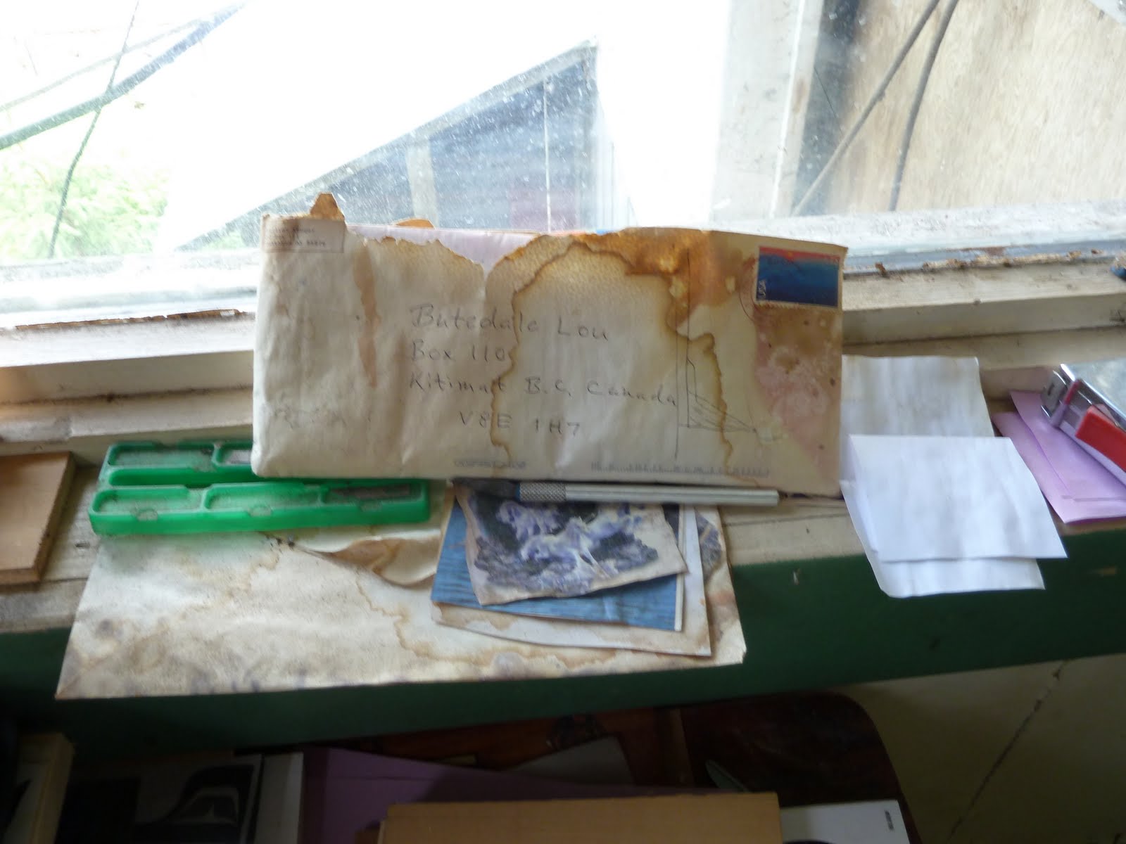
Butedale Louis–an address

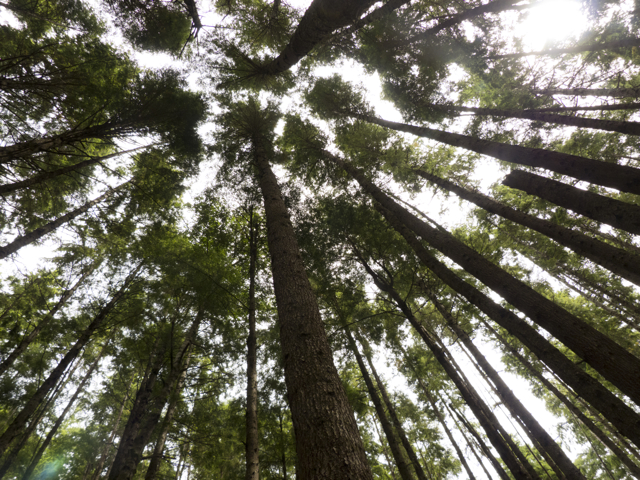
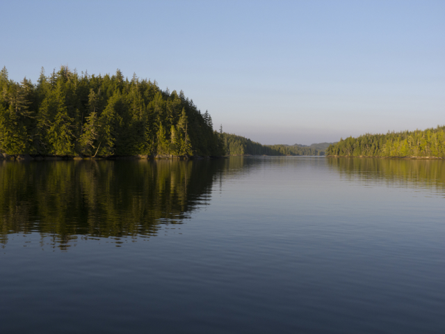
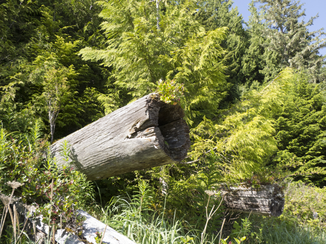
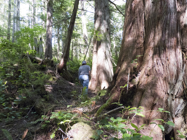
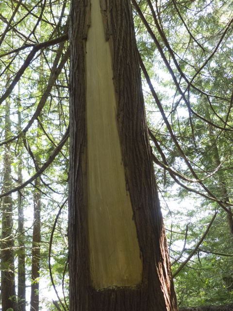
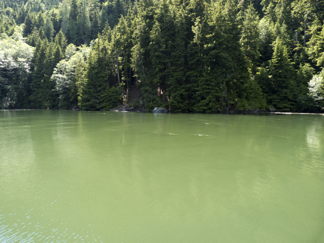
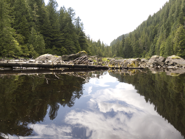
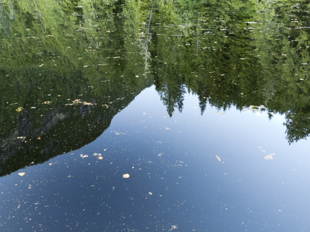
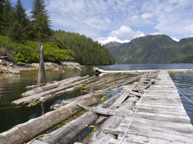
After visiting the power house and shooting many photos, we hiked up a path through the rainforest.  The trail wound past huge trees and the remains of a large logging operation to a mountain meadow and then stopped at the lake, where we scrambled over fallen logs and by silver snags to the open water.  The day was hot and we’d hoped to swim, but the lake was so clogged with logs and bark and debris that we gave that project up.

P1090379 Butedale forestry

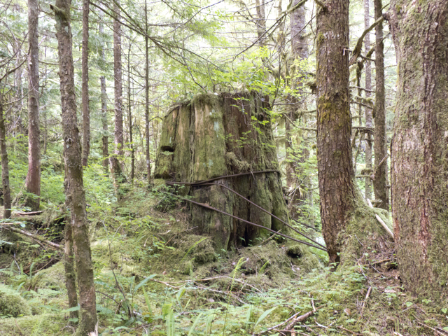
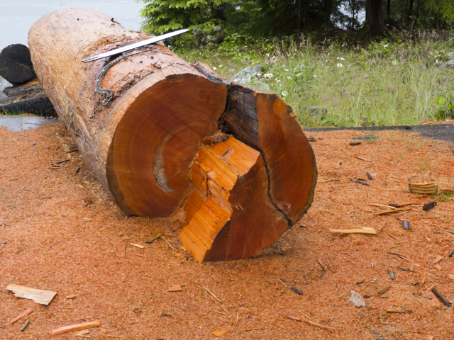
Remnants of logging operation, Butedale

P1090439 Butedale lake silver snags

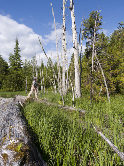
Marike walks on logs beneath silver snags

Louis asked for $50 a night for his ramshackle dockage but could be bargained down to $25.  At night, under the moon and a clear sky, the abandoned factory rattled with ghosts and wracking losses. A fascinating, but hard place to stay.

Butedale lake

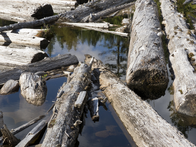
Butedale Lake choked with logs

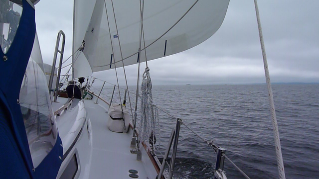
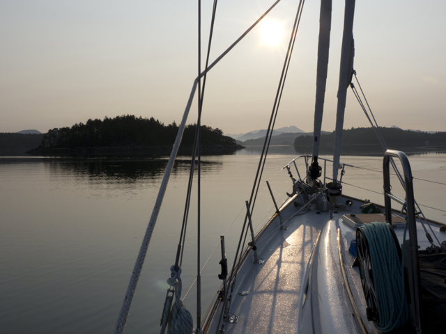
Our tanks full of fresh water, early in the morning  we were ready to sail on to Bishop’s Bay for a bath in the hot springs.

power line Butedale

Power supply in Butedale

And yes, the sign was honest advertising.   Louis’ Butedale Marina still does offer ice-cream and hot showers.  At your own risk.

Butedale showers

Butedale showers

Notes

Statement about the significance of the Butedale Cannery as a heritage site in the Regional District of Kitimat-Stikine  http://www.rdks.bc.ca/content/regional-district-community-heritage-registry?q=node/58

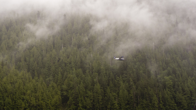
On Kermode bears (Ursus kermodei), also known as “Spirit Bears” http://ngm.nationalgeographic.com/2011/08/kermode-bear/barcott-text

and http://www.vws.org/project/spiritbear/about_bear/index.html

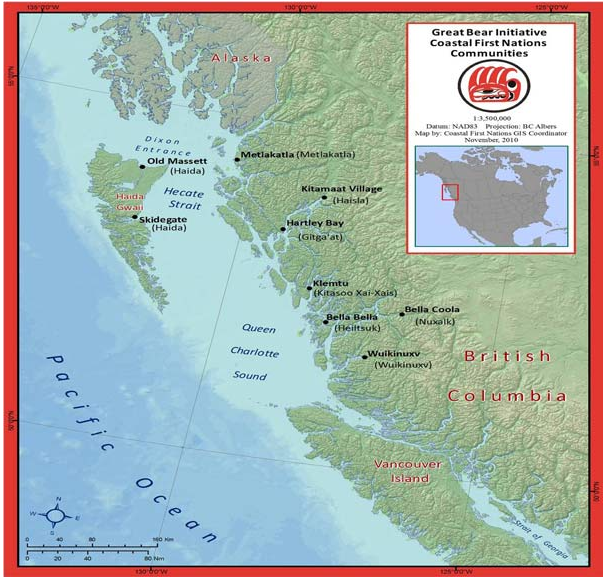
For information on the Haisla Nation, see http://haisla.ca/

Posted in 2012 | Tagged , , , , , , , , , , , , , | 7 Comments

Mysterious Music (Khutze Inlet)

After Klemtu

Quoddy’s Run heads up Finlayson Channel

21 July 2012 Klemtu to Khutze Inlet

A pattering of rain all night, but come morning, there were glimmers of sun.  The fog lifted, the wind rose; we could see and count the mountaintops. And then they disappeared: fog and rain closed over Klemtu and Tolmie Channel as we passed the village and ran on out and up the far reaches of Finlayson Channel to Heikish Narrows.

Ocean Harvest in Klemtu

Ocean Harvest building, Klemtu

We had intended to stop at Klemtu village to see the town and take on water, but could not sort out where we could dock.  Several sailing vessels were pulled in to a dock near shore, but there didn’t seem to be room for another boat; a little further along we saw a large wharf and buildings that belonged to Ocean Harvest, a Norwegian open pen salmon feedlot operation. It looked like fish were offloaded here from nearby pens and processed for shipping out on the ferry.

Ferry dock, Klemtu

BC Ferry Dock, Klemtu

A grand new BC ferry dock towered over us just outside of town and power transmission lines ran over the mountain from a hydroelectric dam.  Wifi—messages thumped into the telephone’s inbox as we passed by Klemtu.

Swindle Island, Klemtu

Road to the Ferry Dock, Swindle Island, Klemtu

The village is home to around 500 people who are descended from the Kitasoo tribe of Tsimshians, originally from Kitasu Bay, and the Xai’xais of Kynoc Inlet, who are Heiltsuk.   Residents of Klemtu live together as the Kitasoo/Xai’xais Nation, which is a member of the Oweekeno-Kitasoo-Nuxalk Tribal Council. Apparently, Klemtu gets its name from “klemdoo-oolk,” a word which means “impassable” in the Coast Tsimshian language, though whether this refers to the steepness of the terrain, the narrowness of Klemtu Passage, which runs between Swindle Island, where the village is located, and Cone Island, or the sometimes dense fog we saw there, we couldn’t say.

Tools of the trade

Tools of the trade–chart, guidebooks, binoculars, gloves

Most of the fjords and waterways of the Inside Passage in British Columbia are extremely deep, with few hidden reefs.  But one rock in Finlayson Channel interested us, perhaps because of its name. As Quoddy’s Run pinched around Ohio Rock, Karin, who was born and raised far from the sea in the US state of Ohio, read aloud from our cruising guide.  Here, in 1909, the Alaska Steamship Company Ship, the SS Ohio, struck an uncharted rock. To avoid sinking in the deep water, the captain ran the vessel across the channel to Carter Bay, where he managed to ground her in time to save the lives of all but four of his 214 passengers and crew.  We read that the same captain foundered a second time in Haida Gwaii.  Then on the way back to Vancouver as a passenger on another ship, he committed suicide by jumping overboard.  It was not hard to identify with that man, we thought. Despite the support of GPS, radar, accurate mapping and all sorts of navigational aids, as well as pretty accurate weather forecasts, we still had to be on our toes in these waters.  Anything could happen, and sometimes did.

cascade

One of hundreds of cascades

As we motored up Finlayson Channel, overcast skies gradually thinned; although the weather forecast spoke of rain offshore, we were headed inland, into the mountains.  We found that changing currents took a long time to catch up with a change in tide.  We were slowed down by the current pushing against us for a long while, but finally, happily, screamed through Heikish Narrows with a boost of 3 knots.  We got quite a ride; strong eddies swirled all around us. Apparently a few years ago, so our guidebook said, a NOAA research vessel underestimated the power of the currents and was washed up against the rock wall on one side of the narrows.  We saw that vegetation was still scraped away where the boat had struck. Here, too, we saw many logs and deadheads–ours to avoid, while the gulls gleefully rodeoed them through the eddies.

BC FERRY

We cross paths with Northern Expedition

As Quoddy’s Run shot out into Graham Channel, the clouds lifted, the sun came out, and we were surrounded by glistening snow-capped mountains and steep cascades. Meltwater. BC Ferry, Northern Expedition, passed us, enroute from Port Hardy, Bella Bella, and Klemtu to Prince Rupert. We hailed them to learn their schedule.  We would see them again and again in these waters, on their speedy trips back and forth.

Meltwater cascades

Meltwater cascades

We were watching for the place where the Canoona River, flowing down from Canoona Lake, turns into the low, broad, terraced Canoona Falls, which are quite distinct from the hundreds of other falls along the way. Debris littered the sides of the river and the falls, the remains of forestry and canning operations, and once much denser human habitation.

Canoona River, Canoona Falls

Canoona Falls

The air was hot and drowse-inducing as we crossed the channel to enter Khutze Inlet.  We’d been instructed by other sailors who had already been here to hunt for a  shallow spot, a spit fingering out into the fjord.  We found it on the chart, and then beneath our hull and anchored, as if in the middle of the inlet.

Khutze Inlet

Entering Khutze Inlet

All around us, snowy peaks glittered in the sun.  We watched for bears, but only spotted seals chasing leaping salmon; we saw and heard eagles, gulls and ravens.  Everywhere, the sound of running water.  Cascades poured down the mountains from snowy patches or lakes at high elevations.  Whirlpools twisted around the boat, but the current held us in place.

Khutze whirlpool

Looking down into a Khutze whirlpool

A few trawlers motored into Khutze, but passed us and went all the way to the base of the inlet. Two or three days later, a passenger on a luxurious yacht would tell us that grizzlies come out to forage there at dawn and dusk.  A small white cruise ship, golden in the evening light, throbbed north up Graham Channel towards Alaska. Loudspeakers aboard blared a message; we were glad to be on our slower, quieter boat.

sunset Khutze

Sunset peak in Khutze

At sunset, light tumbled from the clouds and over the peaks, illuminating first one, then another, then winking out. And then another ray fingered out, tossing a rosy wash over snow and rocks and trees. Water and valleys dropped gradually into darkness; at 9:45 pm, just the heights were aglow.  Tide and current went slack. Soon, we thought, the light would fade and we would turn. Night.

Khutze rosy peak

Rosy peak, Khutze

But we did not turn.  The gulls gathered at dusk and then as the current picked up again, around 10:30 or 11 pm, they began to ride those streams out of the harbour. It gave us the sensation of racing by them, but we were fixed, and they were moving. Light played over the peaks until after 11. None of us wanted to miss a second of all of that glory; we peered out at the light until the last peak flared and darkened and no more photographs were possible.

Khutze sunset

Khutze borrowed glory

Then as we were lying in bed, just drifting into sleep, came a sound, a sort of fluting, ethereal music of one or two notes, in the water.  A little slapping and movement of the hull.  Who’s singing we wondered?  Could that be a whale?

The singing grew fainter, and then stopped as the rocking of the hull ceased.  We heard it again at 2:30—Karin went out onto the deck to take a look.  Nothing there, just stars in a night sky and the mountains towering over us.  Hard to know if we are imagining things, hearing “music of the spheres,” or our own music of the waters.

Posted in 2012 | Tagged , , , , , , , , , , , | Leave a comment

In Klemtu Anchorage

fog near Klemtu

Near Klemtu in the fog

19-20 July 2012, Klemtu Anchorage (Clothes Bay)

Marike Muses

Anchored in Klemtu Anchorage, a mile south of the public wharves.
It rained all afternoon.

Quoddy's Run

Quoddy’s Run heads north

At 13h00 Zulu, we left No Name.  That was morning where we were.
Zulu time so we know when to sign on to the radio. When to communicate.
Zulu time: we count as Greenwich does. Oh England, even here.

Troup Passage.  We take the outside route
and find ourselves in slop.
We need more wind to sail.  That little schooner out there is just treading water.
We won’t go outside through Milbanke Sound. Instead
we’ll cut through Mathieson.  Lots of options in these waters.

Ivory Island Light

Ivory Island Light at junction of Seaforth Channel and Milbanke Sound

Suddenly a blow, a brief reach on, then more slop.
She starts the engine with a pang.  I am cheating. I really am cheating here.

Quoddys Run sailing

Wind in the sails

Up Mathieson Channel.  Where would it lead if we followed it? To Fiordland?  Or some other Inlet?  All of these Inlets and never any Outlets.  No wonder there are serial killers in B.C.

Should we cut across the Jackson Passage?  No too shallow.  This guide we’re using was written by a damn stink-potter, draft 3 feet.  Our keel: 7 feet.   Should not risk it.  We might on the way back though.

Instead, we choose–she keeps wanting to say “Goat,” but it’s “Oscar”–Passage
from Mathieson Channel to Finlayson.  Finlayson is wide.  The swell swells in from the Sound.

We look close when the broad sea surges; the hull rises.  A moment of vertigo, leap in the gut, like when an elevator shoots up too quickly, then suddenly stops.  How many floors did the World Trade Center have?  Who remembers? No way to answer that question now. 

But if you want to know what that black-hooded gull there is,  my mate will tell you:  “It’s a Bonaparte gull: a small, agile gull, likened to a tern.”  She has the guides to prove it.  As we ghost along, she reads about its migration patterns, when it mates, what it eats.

Now we really are socked in. Rain and fog.
Elisabeth, our deaf admiral, who often tunes out, surprises us by noticing.  “What’s that off to starboard?”  A shiny smooth back.  Rolls.  Then tail flukes.  She sounds.  Bye.  A small humpback.  So close we could hear her breathe.

Klemtu Passaage

Inside Klemtu Passage

Time to douse the main.  Wouldn’t you know it.  Now we have a sailing wind.  20 knots.
I stand at the mast on deck.  Trying to train the cardboard thick Dacron of our new main. Obedience school for sails.

“Nose to wind!”  “Nose to wind!”
But the helmswoman cannot nail it and the leech bunches up in the lazy jacks.
Now I’ll have to grow to eight feet tall to flatten the monster so it can be stowed!

I start to swear. I am more and more soaked in the rain.  Suddenly
“Whoooshhh”  and off to starboard, arm’s length from the hull, the humpback rolls to show her eye.  Then there’s her entire body, the knobby top of her head.  What are those knobs about anyway? Finally the goodbye flukes.
That humpback came to mock my bad humour. What after all, is a little water?

Float plane Klemtu Passage

Buzzed by a float plane in Klemtu Passage

 
Klemtu means “a place to tie up.”
Inside Klemtu Passage we are buzzed by a landing float plane.
Dangerous place in the fog.
The tug called “Western Titan” doesn’t follow us there, but into Tolmie Channel.  As it turns, the tug posts a securité.”  How wonderful these quiet waters where captains believe they must still pay heed.

Klemtu Big House

Klemtu First Nations Cultural Center

At anchor in Klemtu Anchorage, we eat the rest of our Dungeness crab.  A farewell from our shepherds.  We earned our independence today.  Fear.    Insomnia.  Determination.  Relief.

The rain lets up.  The fog remains.

Eagle on a silver snag

Eagle on a silver snag in Klemtu Anchorage

We drop crab shells into the bay, but they sink too fast for Raven or Eagle to snatch, though both are waiting on their silver snags.  They let us know their discontent.
“Squeeeek  squeeek”   complains Eagle, wailing like a rusty clothesline.
“Crawww crawww”  mocks Raven.
“KCracck KKracckk” interrupts Heron.

I try jigging for what chases smolts into the air.  One jig brings up an empty line.
“My hoochie fell off!”   I did not tie it right.
Now Eagle puts her head under her wing: “This could take a long time.”
I give up too.  Stow the rod on the stern.

Raven

Raven in Klemtu Anchorage

Mate addresses Raven squawking in the tree:
“I know the bits of crab we tossed had no flesh on them.  You wouldn’t have left more yourself.”
Raven settles.
Then Mate speaks to Eagle:
“I am sorry about the fishing.  We’re bad at it.”

We think we know this Eagle is she because she’s big.  The big ones are the girls.  Or so we’ve been told.

Posted in 2012 | Tagged , , , , , , , , , , , , , , | Leave a comment

Why We Like Outposts

map of Central and North Coast First Nations in BC

BC Central and North Coast waters and First Nations

17-19 July 2012  Codville Lagoon Marine Park, King Island, Fisher Channel/ Shearwater, Denny Island & Bella Bella (Waglisla), Campbell Island/ Unnamed cove on Cunningham Island, off of Troup Passage

We would have liked to stay in Codville Lagoon and hike again to Sagar Lake for a swim, but getting our raw water pump fixed was becoming urgent: saltwater was flowing into the bilge and the bilge pump was coming on more and more frequently, which was a drain on the batteries. (One trouble forever leads to another on a boat; if you don’t fix the first thing, other things will soon require repair.) Our friends George and Susan on Top Brass were headed to Shearwater for supplies and wireless service; they volunteered to shepherd us in.

We hauled anchor then and set off. Wind!

Volendam

Holland America Lines Volendam passes in front of Quoddy’s Run

We set the sails and reached across Fisher Channel, where we passed off the stern of the Holland America Line’s cruise ship Volendam.  They would not deviate for us, although we were sailing and they motoring, and the rules of the sea dictate that they should change course, if necessary for us.  Here, instead, as in so much of the world today, size and corporate might ruled: the little one must step aside for and accommodate the bigger one, no matter the situation.

When the Volendam passed, we noticed that it was not flying an ensign.  Marike called them on the radio to ask why—wasn’t that, too, a rule of the sea? The mate on watch stumbled about, at a loss for words, and finally said, “well, we were supposed to have high winds,” as if wind and flags might never mix. We imagined this must be another cost cutting measure—“no need to replace any tattered flags this year because we didn’t fly any”—or else a way to avoid confusing North American customers aboard for an Alaska cruise: “if we’re in North America, why are we flying a Dutch flag?” But perhaps it was sheer laziness. Who knows? Definitely not shipshape naval order! Perhaps cruise ships have now completely traded naval customs for hospitality services.

Llama Passage

In Llama Passage

Suddenly we were in the narrower Llama Passage, but still sailing. Northern Expedition, one of the largest of the BC ferries, passed us, its wake and its echoes knocking back and forth from shore to shore and rocking us violently, though not so violently as the man paddling by near shore in a canoe.  He turned himself into the waves and rode them out; if he hadn’t, he would have been swamped.

Northern Expedition

BC Ferry Northern Expedition in Llama Passage

Soon the clouds lifted and we were passing Bella Bella (Waglisla), home to the Heiltsuk First Nation. Suddenly messages started pouring into the inbox of our telephone—wireless service!  Waglisla might be difficult to get to, but its citizens are profoundly connected to the outside world.

near Waglisla

Quoddy’s Run approaching Bella Bella

A turn to starboard and then again; we threaded a narrow passage and motored to a dock at Shearwater.  Shearwater, once a WWII Air Force Base, is now the marine service center for the Central Coast. Fishing boats, ferries and other essential craft are looked after here; so too are leisure craft such as ours, as well dozens of big sports fishing craft and cruisers bound to and from Alaska.  We had been told that a repair in Shearwater would be pricey and require a long wait.

Shearwater

Shearwater Harbour Dock

Indeed, when Marike first went to the order desk, she was told that we might have to wait some days to see a mechanic, and that the fees for work could exceed $100 an hour.  But when she introduced herself as a sailor from Nova Scotia, and said that we really could not afford to stay at a dock for more than one night, the office manager shifted her approach.  Clearly, what we needed wasn’t the “yacht from afar” treatment (although we were, truly, a yacht from afar); we required, instead, access to the local inside track, the sort of service that residents might get when they needed it, on local time and at local rates.  Marike was sent out to see the manager in the yard and explained to him that we had a spare pump, but were unable to get the awkwardly placed old one off with its bracket, which had to be placed on the new pump. “Ah you need a monkey,” the foreman said, walking over to one of his workers.  “Here’s your fellow, Kevin.”

Wasco at Dock in Shearwater

Vessel in Shearwater enroute to Haida Gwaii

Kevin came immediately down the dock to the boat.  He wasn’t sure he could change the pump before the yard closed for the day, but he liked the smell of the soup Karin was cooking.  We promised him some soup and homemade bread if he managed to pull off the repair that day.  And of course he managed.  He even tapped in a new hole for the set screw on the pulley, so that we could be sure that the pulley would not fly off.  He changed the belts; he said that the belt on the pump pulley was too tight, which pulled the pump out of alignment and caused it to fail sooner.  In the end, we paid for two and a half hours of labour at $95 an hour, with a side of minestrone and bread and butter, had a completed repair, learned a few things, and made a new friend.

Be Bear Aware

Be Bear Aware! Slightly altered sign at the grocery store

We realize that we like outposts—after all, we’ve chosen to live in one on the East Coast, although it is admittedly far less remote than Shearwater–because people who live in such a place do recognize fellow outliers, fellow travellers, and they have, at once, respect for and capacity to assist those who, like them, don’t center their lives in the economies and expectations of large urban centers.

Night in Shearwater

Night view in Shearwater

Shearwater was bustling in July; the docks were crammed with vessels.  The wharfinger, it turned out, had a boat of his own in Guaymas, Mexico—we reminisced with him about the way the mountains and desert run to the sea there—and came back to Shearwater in the summers to manage the docks. We met others working in the Service Center office or the chandlery who had arrived, as we had, by chance on a passage and stayed, seduced by the wilderness and camaraderie of living on the periphery. We felt as if we’d stumbled into a community of long lost friends. They were eager to hear about Nova Scotia, and promised to sail or fly or drive by for a visit one of these days.

Laundry table

Laundry Table, Shearwater, BC

We used our hours at the dock to haul away our recycling and trash, to do laundry and reprovision at the impressive and well-supplied grocery store. Figs! Frozen chicken! Fresh vegetables! Ginger! More flour! (We hadn’t known we’d regularly be baking bread when we set out from Nanaimo.) The BC ferry and regular flights to Bella Bella brought in all sorts of luxuries.  We were even treated to a brass concert the evening we were at dock. Our favourite thing, however, was the grand table in the laundromat, a huge, thick, planed and sanded piece of lumber.

Against the Northern Gate Pipeline

Heiltsuk First Nation Opposes Enbridge

Among our aims for this voyage, in addition to investigating the effects of open pen salmon farms on the coast, had been to see for ourselves, first hand, just where the controversial Northern Gateway Pipeline would go, to investigate some of the waters where the tankers would sail, and to listen to what area residents citizens felt about this project to pipe Alberta crude to Kitmat, and then load it on tankers bound for processing in Asia.   We saw a number of signs of Heiltsuk opposition to the pipeline project at Shearwater.  It was clear that many members of the nine North and Central Coast First Nations did not want the pipeline on their lands, nor the risk of a tanker accident fouling their coastal waters.  We would sail some of the waters the tankers would travel if the pipeline were approved once we left the Shearwater/Bella Bella region, and headed further north.

Queen of Chilliwack

Queen of Chilliwack arrives at 10:30 pm

Two ferries serve the major communities between Port Hardy and Prince Rupert: the Northern Expedition, a grand passenger ferry that serves the entire Central and North Coasts, and the Queen of Chilliwack, a smaller, slower vessel that brings cargo and hardier passengers on cheaper fares from Port Hardy to Shearwater and other small communities.  That vessel arrived after 10 pm, when we were out walking at the water’s edge in the long light of a northern summer evening.

Old boats in Shearwater

Abandoned vessels in Shearwater

We hoped the next day to cross to Bella Bella in our boat, fill up with water, and reconnoitre, but when we arrived there were no places to be had at the wharf.   So we moved on, to a charted but unnamed bay on Cunningham Island, where Kalagan and Top Brass expected us for a goodbye dinner before we set off for places further north and they returned south.

mosquito net

Mosquito netting in Horsefly Bay

It was swelteringly hot in that no name bay, if gorgeous.  We listened to a water fall near shore, and watched a grassy area for bears. But, alas, the place was plagued by squadrons of vicious horseflies—in fact, we now call the spot Horsefly Bay.  It was too hot to stay closed up in the boat; besides, it seemed crazy to remain below decks on such a bright day. In desperation, we got out the mosquito net that we’d used in Mexico, a regular queen-sized bednet, and pulled it over the cockpit covers.  That afternoon, when we finally braved the biting onslaught to jump in the water, it was as warm as a bath.  We swam for an hour before dressing for dinner.

crab feast

Elisabeth chooses a crab

That dinner was a feast. Rick and George had spent two days scouting out the best spots and fishing their crab and prawn traps morning noon and night. Dawn and Susan had produced all sorts of other goodies too—salads and brownies—while we baked cornbread and prepared a fruit salad. As the sun dropped, the flies went away. We all sat on Kalagan’s deck, swapping stories, until after dark.  We would head out early the next morning through the Seaforth Channel, then up Finlayson Channel to Klemtu.

prawn feast

Big bowl of prawns

Notes

Codville Lagoon Marine Provincial Park http://www.env.gov.bc.ca/bcparks/explore/parkpgs/codville_lagoon/

Memories of Mexico (Guaymas & San Carlos) http://visiblepoetry.blogspot.ca/2011/03/february-in-mexico.html and http://visiblepoetry.blogspot.ca/2010/02/snapshots.html

On the Heiltsuk of Bella Bella (Waglisla) see http://www.hcec.ca/main.html

For a historical note, see http://www.hcec.ca/heiltsuk.html

Coastal First Nations Great Bear Initiative http://www.coastalfirstnations.ca/

The Coastal First Nations is an alliance of First Nations on British Columbia’s North and Central Coast and Haida Gwaii. The Coastal First Nations include Wuikinuxv Nation, Heiltsuk, Kitasoo/Xaixais, Nuxalk Nation, Gitga’at, Metlakatla, Old Massett, Skidegate, and Council of the Haida Nation.  For their stance on Enbridge Oil’s Northern Gateway Project see http://www.coastalfirstnations.ca/programs/anti-oil-tanker-campaign

See too http://www.firstnations.de/fisheries/heiltsuk.htm for information on stances towards fish farming

BC Ferries Inside Passage  schedules  http://www.bcferries.com/schedules/inside/

Posted in 2012 | Tagged , , , , , , , | 1 Comment

Learning to Read the Weather

Fury Cove beach picnic

Marike and Elisabeth picnic on Fury Cove beach

13-17 July 2012

Little Frypan, Penrose Island/ Codville Lagoon, King Island

When you arrive on a new coast and listen to the weather forecast, the first challenge is to figure out where the weather reporting stations in your general region are.  Then you must sort out which stations you need to listen to and track for your proposed voyage.  And of course, you need to learn to read the signs of approaching weather.

mast & clouds

Look to the heavens: what do you see?

The quickly shifting weather patterns in Nova Scotia have generated all sorts of humorous adages: “If you don’t like the weather, wait 15 minutes and it will change.”  Or, for those who want to live like cats, “If you don’t like the weather outside your front door try your back door.”  Despite the obvious instabilities of coastal weather on the Eastern Shore of Nova Scotia, we have become quite good at determining what the weather will be.  If you hear a rumble over the east beach, you can expect a Nor’easter–bad weather for sure. If the rumble is over the west beach, you can expect a Sou’wester. This may or may not bring precipitation or stormy conditions. If the barometer sinks quickly, then you are in for a howling Nor’easter.  It the sky clouds up with fast-moving dark clouds, you’re certainly in for some snotty weather.

P1080911

Purple crab in a tidepool–does it know the weather?

But as we sailed the coast of BC, our weather reading instincts failed us. We had to take into account, not only the force of systems moving in from the open Pacific to the west, but, as well, the fast-moving tidal currents in many passes, and the effects of winds racing downhill out of mountain passes and through the many narrow inlets that run deep into the interior of the mainland. Just listening to the weather radio wasn’t as simple as it tends to be on the east coast either. Tuning into just one radio station will not do across a large distance in BC; we found you have to change weather stations often because the mountains interfere with reception—and dramatically affect weather patterns.  Why the rather abrupt shift in weather patterns north and south of Nanaimo? We wondered, starting out, why these were even separate forecast areas. But if you look at the topography of Vancouver Island, you’ll see that between the way the land curves, and the narrowing of the Georgia Strait, you might expect to see some shift in weather patterns around Nanaimo. Further north, we knew to expect afternoon blows from the west in Johnstone Strait, and not to try to go against the chop that ensued; or when planning to head to the Central Coast, we needed to listen to the wave and wind readings at Egg Island for a sense of the prevailing weather. Too often, what we thought we read in the clouds in BC was not what the weather delivered.

Little Frypan sunset

Strange clouds over Penrose Island–What do they say?

As we basked in the sun in our newly found tropical paradise of Fury Cove, far north of Nanaimo, Johnstone Strait and even Egg Island, weather reports were ominous, calling for 45 knot winds out of the north for the Central Coast, Queen Charlotte Sound, and the infamous Hecate Straits.  Attentive weather radio listeners, we decided we had better find a less exposed anchorage.

light winds

Sailing to Little Frypan

So we weighed anchor in mild winds and glorious sun, and sailed slowly, just a gentle breeze pushing the sail, around Penrose Island into the “Little Frypan,” a fully surrounded, sheltered hurricane hole where half a dozen other boats were also anchored.  It was a place that seemed “bomb-proof,” to use a term favoured by many of the male sailors we’d met in BC; steep cliffs towered over us, and the spot, when we arrived was windless.

Penrose Island

Little Frypan on the right, Fury Cove on the lower left

There we sat in the sunny, clear heat for a few days, watching horsetail clouds whip over the tops of the cliff edges and listening to the same scary weather report: 40 and 45 knots for the Central Coast, Queen Charlotte Sound, Hecate Strait.  We saw barely a piffle of wind, and the clouds dissipated. We began to feel foolish and restless holed up there: maybe there wouldn’t be strong winds or seas in Fitzhugh Sound, but how could we know?  The weather report continued to say there would be. Was staying put a reasonable precaution or not? How could we know? We pored over guidebooks and charts, looking for clues.

QR in Little Frypan

Quoddy’s Run with other shelter seekers, Little Frypan

We dinghied around the islands, wrote, did a number of repairs, and visited with other boaters who were also sweltering and scratching their heads in the Frying Pan.

Dinghy picnic

Bladderwrack on a rock

We had a steady leak from our raw water pump—the bilge pumps were running every 20 minutes or so—and we wanted to get to Shearwater/Bella Bella before we pulled the raw water pump out to look at it, in case we needed special equipment, a replacement, and a proper mechanic, but this ongoing, extraordinary and anomalous weather forecast—and our own inexperience with Central Coast weather—kept us at anchor.

Near Little Frypan

We find an old wreck filled with drowned batteries

Fine view near Penrose Island

And stupendous views

Finally, however, claustrophobia and our annoyance at the salmon fishing madness infecting nearby powerboats (go get get get all the fish you can!) got to us, and we decided  to chance it.

Finally!

We depart at dawn

At 6 am we nudged out into the wider world, with two other boats, Kalagan and Top Brass, shepherding us in case our raw water pump failed and we found ourselves in need of a tow. All was calm.

Shpeherd Kalagan

Kalagan keeps us in sight

We put up a triple reefed mainsail and edged back into Fitzhugh Sound.  No wind to speak of. We passed the weather reporting station, Addenbrooke Island, beneath clear skies, on rippled seas.  And there, to the right, humpbacks, blowing, rolling, sounding—hurrah.

Calm seas

Nary a ripple

Rippled seas Fitzhugh Sound

Okay, a few ripples

Finally, as we passed the Kwakshwa Channel and the Hakai and Nalau Passages, which open towards the Pacific, we caught a little breeze coming out of the west; we raced, all too briefly, across the chop.

Top Brass sailing in Fitzhugh Sound

Top Brass sails ahead

Then just as quickly, the ride was over, and we drifted north, dead downwind in a light southerly. This mystified us at first.  If we listened to the weather report, it was supposed to be blowing like crazy out of the north. But a high hovered over Fitzhugh Sound, and with the tide running in around Calvert Island from the south, so, too, ran the wind. Our “stormy weather” was further offshore. Not here.  Our first lesson about the vagaries of the weather on the Central Coast.

QR Fitzhugh Channel

Quoddy’s Run runs dead downwind

Finally we exited the top of Fitzhugh Sound and entered the narrower confines of Fisher Channel. We dropped our sails and motored into Codville Lagoon where, again, it was hot and still.  There, we greeted fellow cruisers, including the three couples we had met at Fury Cove, who had, wisely, not remained holed up.  They were fishing for shrimp.  As soon as we anchored, we hopped overboard for a swim in the 23C (77 F) water.  Ahhh.  Then we dinghied ashore and hiked up a trail to a marvelously large, warm freshwater lake–Sagar Lake–fringed by alders and cedars, and tucked into the mountains. We crossed an amber coloured sandy beach, walked along reddish coarse sand full of deer prints and then into clear silky water.  The water was red or yellow in the shallows, deepening to green and blue; cascading ripples of yellow light rushed across the sand when we stepped into the water.  We had brought shampoo and soap and so we lathered and rinsed up, our first baths in more than a month.  But then vicious horse flies drove us quickly back through the woods; we waved and swatted alder branches to keep them at bay.

Weather patterns may differ from coast to coast to coast in Canada, but biting horse flies can be relied upon in the summer, no matter where you are.

We finished the evening by grilling chicken fajitas and drinking sun-downers in the glorious still warm air.  If we had gone on simply listening to the weather forecast, we might still be holed up in the Little Frypan.  No question about it; we still have much more to learn about how to judge weather patterns along the BC coast.

sourdough

Freshly baked sourdough bread–the gift that keeps giving

Posted in 2012 | Tagged , , , , , , , , , , | Leave a comment

Rounding Cape Caution to Fury Cove and the Central Coast (Paradise!)

Tall trees Mound Island

Canopy on Mound Island

8-12 July 2012 Mound Island/Port McNeill/Blunden Harbour/Cape Caution/Fury Cove

We met up again with our friends Rick and Dawn on Kalagan  at Mound Island, and crossed Blackfish Sound to Port McNeill, near the top edge of Vancouver Island.  There, to the background music of roaring chainsaws—Port McNeill was hosting an annual celebration of logger’s sports–we spent a day furiously running about the docks and town: ten blog posts up, several loads of laundry done, our new staysail delivered and picked up. (Yes! It fits! Thank you Stuart at UK Sails!) We also insulated the refrigerator with styrofoam, re-provisioned (food, toilet paper, cleaning supplies, alcohol), and topped up with water and fuel. This was our last resupply stop before we headed north, to the remoter zones of the Central Coast of BC.

To Port McNeill at dawn

Heading out to cross Blackfish Sound

From here, one recommended course was to make Blunden Harbour, then wait for a weather window to round Cape Caution, so named because not only is the mainland cape exposed to the swells of the open Pacific as they roll in north of Vancouver island, but the sea floor shallows steeply there, which means you get significant waves and currents in any kind of a blow.  Our friend Rick—until this point our knowledgeable informant and sometimes guide–had never rounded the Cape and was a bit nervous about doing so.

Crossing QCS

Morning near Port McNeill

We left Port McNeill before 7 am, hauling up an anchor full of kelp (bits of kelp trailing in the chain, drying on the deck, snagged in the windlass). It was a misty grey morning, a falling tide, and the nearby still water was full of slowly moving logs and bits of debris.  Hundreds of rhinoceros auklets gathered on the surface of the water and then dove frantically as we approached.  We passed the lighthouse and outbuildings on Pultaney Point, Malcolm Island, slipped through a channel between kelp beds, and then we were in Queen Charlotte Strait.  Two cruise ships tracked out of the Strait, blurred blue objects moving through fog. Two or three fishing boats and then nothing, just us, the sound of the motor droning on, the silver water parting.  We spotted a dolphin, two loons, a murre.

gulls

Young gulls on a log

Then gradually, out of the fog and rising above it, the mainland shore. Then stony islands, a certain glow behind the clouds that promised sun, the scent of fresh (cold!) sea air from the west, and suddenly, many little rocky islets. Almost there. 11 am. 25 miles logged. A few more minutes to wind through narrow channels into the harbour. Anchor down: 11:15 am.

Blunden Harbour entrance

Approaching Blunden Harbour

Blunden Harbour opens up into a large protected bowl once you jog through two narrow rocky doglegs. Half a dozen boats were anchored there when we arrived, and the sun was just coming out. A long glittering shell midden stretched in front of us; behind it, onshore, a building or two hidden in the trees.  There is also a lagoon in Blunden Harbour—a long narrow arm leads up to it, then across several shallow bars and a rocky entrance, into a wide pool.

P1080838

Blunden Harbour at sunset

Blunden Harbour was named, unsurprisingly, by white captain and surveyor, Daniel Pender, for one of his officers,  Edward Raynor Blunden, in 1863. But it was also known as Ba’as or Pahas by the Nakwaxda’xw people who lived there.  They were Kwak’wala speakers who belonged to the Kwakwa’ka’wakw First Nations.  In 1964, members of the village relocated to Port Hardy, after the Department of Indian and Northern Affairs threatened to cut off support for housing, education and other services if villagers remained in their remote settlement. But as a recent sign announced, we were still on Nakwaxda’xw territory, and it was clear that some descendents of the villagers who had lived here still visited regularly.

Nakwaxda'xw Territory

Respect Nakwaxda’xw Territory!

When went ashore we walked across the shell midden and could see, right away, at the top and bottom edges of the beach, a layered history of settlement: a longhouse beam, bits of porcelain and the remnants of engine blocks. A cabin that is still obviously used was tucked back in the trees; it was served by water piped in from a stream and neat stacks of firewood. The cabin contained a couple of bedsteads, a sleeping bag and a little stove; nearby were an outhouse and a fire circle.  The cabin smelled fresh, deliciously of cedar.

P1080831

Dinghy on the shell midden beach

P1080829

Longhouse beam

P1080797

Cabin in the woods

We followed a path through enormous cedars—the largest we’d seen since coming to the Broughton—and noticed some evidence of people working on them, chopping shingles and longboard strips from the trees the old way, cutting out a chunk but letting the tree stand and continue to grow.  Thimbleberries and salal ripened all along the beach, but were not ready yet to eat.

P1080813

Enormous trees

sustainable harvest

Board stripped from tree

Then, beneath an enormous cedar, behind a narrow wooden shelf containing bits of broken glass and crockery and barnacled engine parts, we saw a sign, erected in 2010, in memory of a dog named Schooner who had been killed on the spot by a mountain lion (cougar).  “She gave her life to spare ours,” the sign said. Suddenly we were nervous, and although we continued to explore, we made sure we didn’t wander or lose sight of each other.

dog killed by cougar

“Schooner…gave her life to save ours”

We spent the next day doing a few essential repairs to the boat’s plumbing in the aft head (enough said about that, ugh) and checking weather.  Should we stay or should we go?  It seemed as if there were a narrow window to depart if we went early the next morning.  We were up at 4:30 am, checking the weather.  The long term forecast called for a week of high winds, so it was then or never if we wanted to round the Cape. We made the leap and set out. Dolphins came to greet us, right away, as soon as we left the harbour—a good augury we thought.

Kalagan on Cape Caution run

Kalagan motors nearby

Out there, in Queen Charlotte Strait, the winds were calm, but we were in thick fog.  Radar on and double watch on each side of the boat eyes, peeled for dead heads.  The swell strengthened around the shallows and as we approached the open sea.  Both Kalagan and Quoddy’s Run handled the seas well, although setting out with a triple reefed main would have been advisable.  Still our new staysail steadied the roll.

keep your eye on the radar

Watching the chart and the radar

The route to Cape Caution through Richards Channel was a tricky passage, above all in dense fog; there were many reefs and rocks to avoid and steer around. We peeled through one paper chart after another as we charged ahead, keeping a constant watch on the radar and dead ahead for logs. Deadheads were everywhere, booming up suddenly out of the mist; to starboard, we tracked a tug towing two enormous barges full of equipment—they had looked for a time like a series of small rocky islets carrying a few stunted trees. Near a buoy off to the portside, we sighted the faint outline of a sailboat; someone making the same passage we were, a tiny grey speck bobbing in the heaving mass of the sea. Things were particularly tricky near the entrance to Seymour and Belize Inlets, where the fastest rapids on the coast, the Nakwakto Rapids may be found.  We approached the mouth of the inlet in an ebb tide, and it was disgorging a massive stream of flotsam and drift logs. Next time, we thought, we’ll head further out into the Strait, or time our passage better!

Queasy Karin

Navigator temporarily down after staring at charts too long

Everywhere there were birds. Rhinoceros auklets and eagles and then, as we got out to sea, pigeon guillemots, murres, pink-footed shearwaters, storm petrels. They rose and fell in the air over the waves, then settled on the water and rode up and down over the crests, diving, then flying off again. Once, on the lookout for deadheads—we’d just missed a huge log—we saw what seemed to be an absolutely enormous log on starboard. And the it rolled and there was the fin…It was a fin whale feeding.

The fog began to lift a bit as we approached Cape Caution, thickened as we passed, and then began to rise again as we headed toward Egg Island.

Fog Cape Caution

Fog around Cape Caution

The wind came up and we threw up the Yankee.  The sea was suddenly blue on one side and grey on the other; bits of blue began to appear in the sky, and then, as we approached Calvert Island, the world opened up. Islands, Smith Inlet, Rivers Inlet: behind them snow-capped mountains heaped up, higher and higher, the sun glittering on the snow.

Egg Island in the fog

Fog rises over Egg Island

The seas settled once we were in the shelter of Calvert Island. There were rumours over the radio of orcas near Fury Cove—and indeed, we did see whales at sundown, after we were anchored, cavorting in Fitzhugh Channel, visible through the narrow passes that flood at high tide into Fury Cove.

Beaches near Fury Cove

Near Fury Cove

Suddenly, as we approached Penrose Island, it was hot and sunny.  White shell midden beaches line Fury Cove and little islets protect it, but also offer a view out to Fitzhugh Sound and Calvert Island. We wound through narrow passages into the anchorage, and found ourselves, suddenly, in a tropical paradise.

Fury Cove

Beach at Fury Cove

After lunch, we dinghied over to explore the beach.

big trunk Fury Cove

Fury Cove flotsam

Three couples were already on the beach, and welcomed us heartily.  We traded sea tales, and when we admitted we were from Nova Scotia, and just arriving on the Central Coast for the first time, they made all sorts of suggestions for remarkable places to go. They invited us for coffee the next morning and we agreed to a swap—we’d trade some lingcod steaks for some probiotic sourdough starter and some bread recipes.  Each party thought it got the best deal.  We got an easy, no-water-to-wash doughy-messes-needed way to mix bread in a ziplock bag, and they got some delicious fish. That sourdough has accompanied us everywhere; we’ve shared it with friends and brought it home to Nova Scotia in the fall, and we’ll return to BC with its descendent in the spring.  Never again will we be on a boat without sourdough!

Fury Cove view

View out to Fitzhugh Sound from Fury Cove

Our new friends also marked our charts, pointing both to dangers and not to be missed sights.  We all picnicked and sun-bathed on the beach the next afternoon.  We climbed the rocks, identified plants, watched the whales and watched whitecaps in Fitzhugh Sound, and reveled in the first few days of our tropical vacation at 51˚29’north latitude.  We felt as if we’d somehow found and slipped through a back door to paradise.

Marike on the beach

Marike enjoys Paradise at 51 degrees north latitude!

Notes on Blunden Harbour/ Ba’as

Filmmaker Robert Gardner comments: “In the middle of the twentieth century, Blunden Harbour was a small village on the coast of Vancouver Island in British Colombia inhabited by a handful of impoverished Kwakiutl Indians who gained their meagre livelihood from fishing and gathering…[This film] is a beginner’s attempt to impart the rhythm and atmosphere of a place and a people.” See a short excerpt from the film made by Robert Gardner in 1951, when he was a graduate student of anthropology at the U. Washingon. Robert Gardner, with William Heick: http://youtu.be/yhz3EEGD3TI

Hilamas (also known as Willie Seaweed or Smoky Top) was a famous carver from the Nak’waxda ‘xw nation in Blunden Harbour. See the gikiwe’ or “chief’s headdress” depicting a killer whale and two ravens that he made for himself,   now held by the Smithsonian in the US at http://nmai.si.edu/exhibitions/infinityofnations/northwest-coast/238252.html

In 1930, Emily Carr made a painting entitled Blunden Harbour, now in the National Gallery in Ottawa, from a 1901 photograph of Blunden Harbour totems taken by W.A. Newcombe.  For images and additional information (see especially “more photographs” at the bottom of the page) see http://www.emilycarr.org/totems/exhibit/kwak/baintro.htm

Fury Cove holiday

Fury Cove in hot sun

Posted in 2012 | Tagged , , , , , , , , , , | 2 Comments

Circumnavigating Gilford Island (Indulging a Longing for Inlets)

P1010252

Shore reflections Viner Sound

6 July 2012 Viner Sound/Tribune Channel/Bond Inlet and the Ahta River/Sargeaunt Passage/Knight Inlet/Tsakonu Cove

After days of rain and fog, summer suddenly arrived in the Broughton, hot and bright. We stayed moored to the Forest Service buoy in Viner Sound for a couple of days, rowing, exploring, fishing, and visiting with our friends Rick and Dawn who were nearby on their boat, Kalagan.  We wrote, cleaned and aired the boat, and watched for bears. We didn’t see any.  Zephyr, at the Salmon Coast Field Station in Echo Bay, had told us they would be shy because American trophy hunters had been permitted to take four bears in the area and one had been shot from a boat in Viner Sound; the bears, she said, were probably no longer going to feel safe around boats. We didn’t really blame them. It seems unsporting to shoot at a bear on shore from a boat, especially when they have become accustomed to boats, and don’t consider them dangerous. If you want a bear pelt you ought to have to struggle through the steep, overgrown terrain—get your feet wet, scramble over fallen trees and boulders, risk getting lost, put your own life on the line—not fire through a scope at bears casing the beach for clams.

Gilford Island sign

Gilford Island

Dawn suggested we circumnavigate Gilford Island.  We looked at the charts—that would take us into the Tribune Channel by a spectacular falls, up into Bond Inlet, where the Ahta Valley watershed that Billy Proctor fought to preserve from logging is found, then back into the Tribune Channel towards Knight Inlet, a deep fjord that runs way up into the mountains of the BC mainland and drains the Kinaklini River. It seemed like a grand idea.

Elisabeth Tribune Channel

Elisabeth photographs sights in Tribune Channel

We were up early the next day and already it was bright and sunny, even hot. We weighed anchor, zipped open the cockpit coverings–our dodger and bimini–and turned up into the Tribune Channel—named we discovered, after yet another 19th century British gunship.  Clearcuts scarred the mountainsides, but still the beautiful world sparkled: snow clung to the mountaintops, dolphins leapt through our bow wake; now and then we crossed paths with other boats.

near Lacy Falls

Quoddy’s Run approaches Lacy Falls

At Lacy Falls, which is indeed spectacularly patterned and frilled, we nudged in towards the cliff as closely as possible for a photo shoot.  The cliff wall is steep and smooth, allowing the water to glide down its surface in cascading loops and drops.

Lacy Falls, BC

Lacy Falls Tribune Channel

And right next to the falls, a fish farm. The water around it was green, perhaps indicative of an algae bloom.

Fish Farm, Tribune Channel

Fish Farm next to Lacy Falls, Tribune Channel

We continued along up the Tribune Channel and into Bond Sound, where we aimed for the Ahta River Valley at its head.  In Heart of the Raincoast, we read that one day Billy Proctor came dashing into a gathering in Echo Bay shouting that the lumber companies were going to clearcut the Ahta River Valley and Bond Sound, the last old growth forest in the Broughton and a crucial wild salmon spawning grounds.    Thanks to a fierce fight, for now at least, the Ahta Valley is safe.  Because this was the southernmost unlogged river valley on the coast, we wanted to see it. What did old growth forest look like anyway?

Into Bond Inlet

In Bond Inlet–grey gash of a slide to the right

Bond Inlet was covered in trees but they did not seem huge.  In fact, much of the inlet had been logged. Striping the green slopes were steep gashes of bare rock—mudslides in the wake of cutting, or naturally occurring events? We didn’t know.

Bond Inlet 2

Into Bond Inlet

The sky was blue, the water bluer, the mountainsides green, the mountaintops still snowy, waterfalls everywhere, range upon range of mountains receding in the distance. You felt you could go forever in such a landscape on such a day, and never tire of the clouds and water, the colours and heights.

Ahta River at head of Bond Inlet

Ahta River estuary

The Ahta River estuary is at the head of Bond Sound– a sandy, flat, green marshy area, inhabited by many waterfowl.  Karin identified a red-throated loon taking flight; we also saw guillemots, gulls, eagles, rhinoceros auklets, and tiny marbled murrelets.  The shore shelved too steeply for us to anchor comfortably there, but the morning was so still and the place so bucolic, that we just cut the engine and drifted quietly before the shore.    We would have liked to spend the night there, and dinghy up the river at high tide towards the snow-covered mountains looming above.  Another time perhaps.

Lunch adrift: Karin feels the heat

Lunch adrift: Karin feels the heat

After a lunch adrift, we left Bond Inlet and continued through Tribune Channel in the heat, dodging logs and other flotsam—it’s rather a trip to sunbathe underway, while surrounded by snow-covered mountains, but you do have to keep a sharp lookout, so as not to run into logs spinning by in the current.

Sargeaunt Passage seal

Seals near Sargeaunt Passage

By afternoon, we’d arrived at the edge of narrow, shallow Sargeaunt Passage .  We turned into it, past several young seals who had hauled out of the water and were sunning themselves on a floating log. They looked up at us lazily but did not move.  We continued threading through the passage, past a hurly-burly camp built of half-wrecked, jerry-rigged old boats, and then an enormous fish farm (stink of manure and thick green algae in the water).

Algae in Sargeaunt Passage

Algae bloom in Sargeaunt Passage

We crossed Knight Inlet—gazing longingly up into its splendid heights—and turned into Tsakonu Cove for the night.

Knight Inlet

Crossing Knight Inlet

Tsakonu Cove is recovering from a huge forestry operation. Small deciduous trees run along the shore, and the water in the cove is full of logging buoys, logs and other debris.  The base of the cove was very shallow, drying out at low tide.  We launched the dingy and rowed along the shore at high tide, going up a small stream into the cool, fresh, damp woods.

We found that water beneath the hull of the boat looked and behaved strangely; it was unlike anything we’d ever seen before.  Two or three feet below the surface was a layer of algae seven or eight feet deep—it looked, in fact,  as if we were anchored in impossibly shallow water.  We tried to stir the algae with a paddle, but it didn’t move. The paddle didn’t even dent it, nor could we brush it aside or peer through it.  Was this the remainder of the forestry operation, or—as it seemed it might be—the gathering in this corner of algae from a bloom caused by the high sulphide levels around the nearby fish pens?  We now knew that for every cycle of 500,000 open pen farmed salmon grown out, more than ten jumbo jet loads of fish waste falls to the sea floor rendering it anoxic and unable to support marine life.  The average farm is over a million fish now, and in the Broughton there are 22 open pen salmon farms.  That is quite a number of jumbo jets of fish waste year upon year in the coves where there are fish farms.

Marike in Tsakonu Cove

Marike peers into the strange water

The days are very long in early July north of 50 degrees north latitude.  The sun beat down on us with a ferociousness more like you’d expect in the tropics than rainforest BC.  We were all alone in our cove, so we stripped down on the stern for a sun shower, then began to barbecue some lingcod.  Overhead, a woodpecker rattled away. As we nursed our sundowners, a black bear lumbered out of the woods, stepped carefully across a fallen log, and dropped  onto the beach.  The bear crawled below the tide-line and began flinging huge rocks aside, digging beneath them for crabs and clams and other tasty sea creatures for supper, sometimes almost disappearing into the hole where a rock had been.  Finally, we’d seen our first bear.  –In fact, we have hesitated to mention it, worried that it will become a target for another coward’s trophy hunt.

Bear on the beach

Bear walks along the beach

When the tide changed, another strange thing happened: we spun around and around, four times, and all of the logs and debris in the cove gathered and rafted together with us. Then, as the current shifted, the logjam broke apart, the logs all spun away, and we stayed just where we were, in the middle of the cove.

Logs float around Quoddy's Run

Logs and debris float in Tsakonu Cove

The next morning as we weighed anchor and turned away from Knight Inlet and towards Mound Island, then Port McNeil, we joked that we could not take another inlet just now. The previous day had been crammed with wonder, beauty and peculiar spots of devastation. Glory and sorrow wrapped up in one big spectacular package. We ached to see more.

Elisabeth heads into an inlet

Elisabeth–and a longing for inlets

We promised ourselves we’d come back to Knight Inlet—the place known as dzawali in the Kwak’wala language–and brave its remoter reaches sometime.  Boaters headed up the Inlet are advised to travel with a companion because once one winds up into the mountains, there are no communications, no real services, big winds, big tidal changes, strong currents and lots of grizzly bears. And if you’re stuck or in trouble, it is a very long way back—125 kilometers, in fact. But someday we’ll brave that–what a promising adventure it seems!

Rhinoceros Auklets

Rhinoceros Auklets

Notes
Billy Proctor, writing from the perspective of the Ahta River: “My estuary is located at the head of Bond Sound. Bond Sound is a little known inlet and a very beautiful place into which I have been flowing unchanged for over 10,000 years. I have watched trees grow and mature and die and fall down and rot to help feed the new growth. I love all the trees and plants that grow in my valley as they also help to keep me from flooding when it rains really hard. The alders grow close to me, lean over me and help keep me cool in the hot summer days. And it is cool water that the salmon need. The roots of the alders hold the soil firmly and keep my banks from eroding.” http://www.wavelengthmagazine.com/2000/as00auto.html
Online guide to Kwak’wala place names: http://www.firstvoices.com/en/Kwakwala/word-category/1f2fd0f8542dbe9f/–Nature–Environment—place-names
Posted in 2012 | Tagged , , , , , , , , , , , | 6 Comments

Fishing Lessons II (In which we kill a lingcod and learn to fillet it)

Viner Sound, BC

Near the forestry buoys, Viner Sound, BC

4 July 2012 Viner Sound, BC

We were moored to a Forestry Service buoy in Viner Sound and our provisions were running low.  A fresh fish would be lovely, we thought.

Our friend Rick, who had persuaded us to come here, invited us to take our dinghy and accompany him out to the entrance to the Sound.  “Sure,” we said, “we’ll come along soon.  But first we have some writing to do.”

Viner Sound

Falls, Viner Sound

Writing, however, does not feed you, so when Rick returned—“Hey, I thought you said you were coming along! The wall out there is lined with lingcod”—and held up an enormous fish, we too were hooked.  We jumped into our dinghy and rushed off.

Rick and lingcod

Rick with his lingcod

Marike dropped our line in the water and it was struck again and again on the way down by rockfish of various kinds; one or two of them might have been large enough to keep if we had wanted them, but we hooked not a single lingcod.

Marike, Viner Sound

Marike rowing in Viner Sound

Rick returned then, and showed us “the place;” for of course, we were fishing in front of the wrong steep cliff.   We watched as he hooked a heavy fish and took his time to reel it in. As he brought it to the surface, he invited us to dinghy over and net it, which we did.  We tried then to load the fish into his boat—it was huge!—but he wouldn’t let us.

“No; it’s yours now. You netted it; you kill it.”

Yikes.  Practice; not theory.

We looked down at the enormous head and mouth of this unhappy large lingcod, and took up our shot hammer, which we’d brought for the most unlikely occasion of needing to brain a fish.

Karin wielded the hammer and banged the cod on the head just enough to make it thrash more. Not good.  Marike then seized the hammer and whacked the poor thing right between the eyes several times.  That did it.  A death throe and then the fish was still.

We removed the hook from the toothy mouth, lifted the fish from the net and settled it, headfirst, into our bucket.  It was 3 feet long! And slippery.

Lingcod and rockfish

Marike holds our lingcod and a rockfish

We headed back to the anchorage with Rick and pulled our dinghies up a grassy incline.  He taught Karin how to fillet the fish—laying it out on a flat spot on the grass, slipping the sharpened narrow blade along the flesh just above the spine, pulling the meat away from the bone, gently, slice by slice with the knife, cutting around the tail, being careful not to pierce the gut and intestines or your own finger as it slipped in the fish blood. We remembered what a delicacy the cheeks of Atlantic cod were, and, though lingcod are another species, this memory induced us to slice out these large (and delicious) cheeks too. (After peering into the fish’s mouth for awhile, we decided to leave the tongue; it probably wouldn’t be, we thought, anything like Atlantic cod tongue.)

Eagle lingcod Viner Sound

Eagle guards lingcod carcass

We ferried the carcass to another rock where we left it for the eagles and ravens and bears.

lingcod filets

Barbecued lingcod filets

Thus, for the 4th of July this year, thanks to our generous friend and marvelous teacher, Rick Burkmar, we had fresh barbecued lingcod fillets.  We were finally hungry enough for them.

Marike drinks and barbecues

Skipper Marike celebrates and barbecues

An afterthought which cannot ever really be an afterthought: Rick and his wife Dawn are adamant that fish must only ever be seasoned with “the holy trinity”–salt, pepper, garlic. And always buttered, no oil. We followed their instructions and were, indeed, pitched by palate into zones transcendental.

evening sky Viner sound

Evening in Viner Sound

Night, Viner Sound

Nightfall, Viner Sound

Posted in 2012 | Tagged , , , , , , , , | Leave a comment

The Sound of Something Vanishing (Billy Procter)

Billy Proctor Echo Bay

Billy Proctor outside of his bookshop

2 July 2012 Echo Bay, Gilford Island, BC

We were eager to meet Billy Proctor, a lifelong resident of Echo Bay, now in his 70s.  Billy had worked as a fisherman, a hand logger, a beachcomber, a salvager, and an activist; he was now also an author, a curator and a bookshop owner. We had read about Echo Bay, Billy and his life in the book he had co-authored with Alexandra Morton, Heart of the Raincoast: A Life Story.  There, perhaps for the first time, with Billy as our experienced observer and guide, we began to understand how forests and fish were related, how poor logging practices destroy salmon habitat, and why watershed management and conservation matter. The salmon need the forests that line and shade the rivers in which they spawn, but the forests also need the salmon, which feed bears and eagles and people and wolves and many other creatures, and then, as decaying corpses and waste matter, fertilize those forests full of enormous trees. No forests, no salmon; and no salmon, no more gigantic trees.

Ocean Dawn in Echo Bay

Billy’s boat, the Ocean Dawn, at his dock

We first saw Billy Proctor’s place from the water as we approached the dock at Alexandra Morton’s place, now the Salmon Coast Field Station.  There was his boat, the Ocean Dawn, tied to his dock, and on the steep rise of land behind it, a boathouse and several other buildings: his house, his museum, some outbuildings, a store, and houses belonging to family members and friends.

Proctor building, Echo Bay

One of several structures on Billy Proctor’s land

We’d started out on our muddy drizzling walk with M.J. from the Salmon Coast Field Station in order to get to Billy’s place–the stop at the school had been a bonus, a diversion–if such an abandoned space can be called a diversion. The distance from Alexandra’s to Billy’s was less than two minutes by rowboat, but more than an hour–perhaps two–by foot, and in the end, considerably wetter for us.

Proctor Boathouse, Echo Bay

Billy’s boathouse

Our first stop on Billy’s terrain was his boat house, a huge hangar of a building he had designed and engaged the entire community to raise. The cedar that had been used to construct the place was perfumed and fresh in the damp air. Inside were junks of old rope, old boats, collections of tools. The marine railway leading up to the building was idle.  Beside the building were huge split logs of red cedar; some had been turned into firewood, but Billy was splitting choice pieces by hand into shingles.

Making red cedar shingles

Red cedar log being split into shingles

Billy's Museum Echo Bay

Billy Proctor and Marike at Billy’s Museum

We met Billy at his museum.  Many boaters stop here every year to see a history of West Coast material culture gathered and preserved by Billy.  He had discovered most of the items in his museum along the shores and beaches of the Broughton Archipelago, or acquired them during the course of making his living as a self-sufficient fisherman, hunter and logger.  There were arrowheads, bottles, pieces of maritime bronze, trading beads from the times of Cook and Vancouver, and fishing and logging gear from a span of decades; all were ranged in Billy’s museum.

salmon trolling spoons in Billy's Museum

Spoons for salmon trolling

salmon spoon mould, Echo Bay

Mould and hammer for making salmon spoons

Spoon metal, Billy's Museum

Spoon making materials

Vancouver and Cooke's trading beads

Trading beads, Billy’s Museum

Books, Billy's Museum

Wold and Coyote Trapping, Billy’s Museum

Milk of Magnesia blue

Blue bottles–Billy’s Museum contains hundreds of items of glass flotsam and jetsam

Beside the museum is a small logger’s cabin constructed by Billy from a single tree, a five-foot diameter cedar log he had salvaged.  The process of hewing the wood and shingles with hand tools and building the cabin over the course of a couple of weeks had been recorded by a sound anthropologist interested in preserving the sounds of disappearing cultures. Door, studs, planks, shingles, a bunk, a chair and a table had all been fashioned by hand from the log, into a model of what hand-loggers once might have confectioned for themselves as they began to log a promising tract of land. Inside, the paraphernalia of a logger’s trade: thick-soled caulk boots, a rifle, saws, a shovel, snowshoes, an oil lamp…

Logger's Cabin, Echo Bay

Logger’s cabin at Billy Proctor’s

Proctor Logger's Cabin interior 1

Interior, logger’s cabin

Proctor's Logger's Cabin interior 2

Interior, logger’s cabin, Echo Bay

Caulk boots

Caulk boots, mud, rust and all

We reflected, as we explored Billy’s museum and grounds, that we have Billy Proctors on the Eastern Shore of Nova Scotia as well.  Our fisherman friend, Ramey Monroe, was a highliner fisherman and carpenter; he could build a boat from a set of numbers and turn a shape around in his head to fashion anything you might need.  They are a dying breed these jacks of  all trades who survived the premature deaths of their fathers and the challenges of building a life in remote rural communities.  There are none who follow them who know what they know.

Ramey Munroe, Sober Island, NS

Ramey Munroe, in from lobster fishing on Sober Island, NS

Heart of the Raincoast recounts what is basically a conversion story.  As the book tells it, after spending many years working hard, making what he could by exploiting sea and land, Billy sat down one day on the stump of a big tree he had felled and thought about the state of the world.  The fish stocks were dwindling; all of the shore leases were being granted to large lumber companies rather than individuals, and fish farms were taking over many bays in the Broughton.  Something had to change, or his lifelong home wouldn’t be a fit place to live. So Billy Proctor joined forces with Alexandra Morton and became an activist.  Just as our very own friend, Bill Williams, on the Eastern Shore does, Billy drew on his love and knowledge of the fauna and flora of his coastal waters to try to persuade the politicians and bureaucrats to see the catastrophic consequences of their support for unabated resource exploitation.

Bill Williams in Shoal Bay, NS

Bill Williams on the water in Shoal Bay, NS

Billy told us that after the fish farms had established themselves in nearby bays, huge quantities of trash began piling up all around–literally tons of it. Used to hauling huge logs of grand tonnage, Billy gathered up  the flotsam and jetsam from the fish farms and called on the fish farming companies and the DFO (Department of Fisheries and Oceans) to clean up their mess.   He used his vast local knowledge and years spent keeping careful logs tracking the patterns of salmon spawning and migration to help demonstrate that both open pen salmon farms and the erosion of stream beds caused by clear cutting were destroying the wild salmon runs.  He wrote to politicians.  He demonstrated and protested and finally  managed to preserve the Ahta Valley watershed from clearcutting; it is now the southern-most uncut watershed on the west coast. But still the salmon runs are declining. As Alexandra Morton writes in Heart of the Raincaost, “I am witness to an extinction.” Sometimes the best you can do is tell that story, so that it, at least, is not entirely forgotten.

Bill Williams, Sheet Harbour, NS

Bill Williams with Alex Morton and Marike in Sheet Harbour, NS

We had come to share our experiences of the open pen salmon farms in Nova Scotia with Billy, to compare notes and seek advice.  He was devastated to hear that an NDP (New Democratic Party) government was foisting this scourge on us, since he had hoped that the typically more left-leaning NDP in BC would finally deliver him and his neighbours from the Norwegian salmon feedlots in the Broughton. Politics, we all agreed was a rogues’ business, depressing,  a sadly necessary evil. You have to keep a constant eye on politicians it seems, lean on them, or they’ll be up to no good no matter what their stripe.

Billy's log dogs

Log dogs and line used in beachcombing logs

It was a cold and rainy day, so Billy invited us into his home for a cup of tea and biscuits.  The house was warm and lovely: a fire crackled in the stove and we warmed our hands and dried our socks as we continued to talk about how things are made or how to fix the world–the two key topics of the day.  Like everything else in his place, Billy had built his house from materials close to hand, and deployed each to its best effect–strong knees for the ceiling beams, flat shiny polished yew for the counters, hand-hewn round logs for the banister, a stone floor. The place was like a library or museum of different woods: red and yellow cedar, yew, spruce, the whole powered by a generator and a vast battery bank, for everyone who lives at Echo Bay lives off-grid, on their own resources.

Billy's boat

Cabin window, Ocean Dawn

Billy’s wife and mother are now deceased so he lives alone.  But he likes to give young women a chance to earn a living from the land.  When Alex Morton found herself a destitute widow with a child, he took her on as crew on his fishing vessel.  Now he works with Scott, a former Salmon Field Station manager, to salvage the logs that will help her pay for the purchase and renovation a house in Echo Bay.  They beach-combed together all winter and were speculating about exactly when the salmon would start running that summer.

Billy's Boathouse, Echo Bay

Beams in Billy’s boathouse

We parted reluctantly, leaving Billy a copy of our book, Casting a Legend, about the Lunenburg Foundry, as a thank you and a sharing of history and artifacts from one coast to another.  There are so many things we have in common.

Once Billy got started writing with Alexandra, he never stopped.  In fact, he loved books so much that he opened a bookstore on his homestead to sell books about coastal BC. Neither our Ramey nor our Bill have done that.  Yet.

Book in Billy's Museum

Trails to Successful Trapping–book in Billy’s Museum

We bought a copy of Billy’s guidebook to the Broughton Archipelago, Full Moon, Flood Tide: Bill Proctor’s Raincoast, to accompany us on the next leg of our trip.

materials from Billy's Museum, Echo Bay

Log scale handbook, Billy’s museum

NOTES
For more information on the ecology of what is increasingly called the “salmon forest” see:
http://www.wildsalmonfirst.org/threats/logging/47-no-forests-no-salmon
http://web.uvic.ca/~reimlab/salmonforest.html
http://www.cbc.ca/player/Shows/Shows/The+Nature+of+Things/Darwin%27s+Brave+New+World/ID/1296281941/ Click on “Interconnected Life in the Salmon Forest”
See too Mary F. Willson, Scott M. Gende, and Brian H. Marston, “Fishes and the Forest: Expanding Perspectives on Fish-Wildlife Interactions,” Bioscience vol. 48, no. 6 (June 1998): “We think these fish [salmon] provide a resource base that supports much of the coastal ecosystem.”
Posted in 2012 | Tagged , , , , , , , , , , , | 3 Comments

Echo Bay

Salmon sign Simoon Sound

Salmon Coast Field Station sign, Echo Bay

When we first began sailing in British Columbia in 2011, we met many people who talked about how damaging and contentious salmon farming was in the province.  They talked about how dangerous salmon farms are to the wild salmon fishery—one of the mainstays of the BC economy.  They told us how salmon farms concentrate and then spread sea lice and disease to the wild salmon that migrate by the open pen feedlots, and how escapes threaten the genetic health of indigenous species. We hadn’t known, for example, that salmon farms grow Atlantic salmon to great size in Pacific waters, and that when they escape the open pen nets, as they regularly do, these fish compete with the various varieties of Pacific salmon, not only for food and space, but quite literally, for the future.

One sailor who came aboard to suggest places to visit made a mark on our charts by Echo Bay in the Broughton Archipelago.  “That is where Alexandra Morton lives,” he told us as if we should know who she was.  We didn’t, so he explained:  “She began working up here as a whale researcher, but for the last twenty years, she’s been leading the fight for wild salmon and against the multinational companies who have stocked bays up and down the coast with farmed Atlantic salmon.” He mentioned several of her books to us, and went on to explain that when Alexandra and her neighbours were asked to show the salmon farming companies where existing salmon migration routes and breeding grounds were, rather than avoiding those sites, the companies took advantage of that knowledge to put farms in those spaces, believing they must be good places for salmon.

“They believed salmon farms might be good for their communities in the beginning, but now they know better,” our friend said. “They were betrayed. We’ve all been betrayed on this issue. Now that the wild salmon populations are so obviously disappearing more people seem willing to listen to Alexandra Morton, but we’re afraid it might already be too late.”  We listened to such comments with interest, concern, and, we must admit, incomprehension.  And when we returned home to Nova Scotia, we continued to eat smoked farmed salmon regularly and with gusto, as if the two weren’t connected.

Echo Bay Salmon

Salmon Stencils, Echo Bay

Then in February of 2012, our world turned upside down.  A small article in the provincial newspaper announced that there would be a public hearing in nearby Sheet Harbour about an application for three 18-hectare salmon farm leases in three neighbouring bays. Snow Island Salmon, Inc., the applicant, was said to be a subsidiary of Scottish multinational company, Loch Duart. Hundreds of citizens showed up to ask questions.  Many were furious to discover that this meeting would be the only moment in the licensing process where community members were welcomed. A number of people wondered why there wasn’t opportunity for more citizen input; already many people stood up to tell representatives of Snow Island, Loch Duart, and the federal and provincial government bureaucrats there that they did not trust the process; they did not like their tax dollars being used to subsidize fish farming, and they did not want this polluting industry in their coastal waters.

Following that meeting, hundreds of concerned community members got on their computers and began reading scientific papers, government studies and finding out about open pen salmon feedlots.  We learned from fisher-people in other communities in the province—St. Mary’s Bay, Shelburne, Jordan Bay, Port Mouton–that no matter what we did, the licenses would be granted. Not one had ever been refused, no matter how damning the environmental studies or likely the damage to existing jobs and industries. Undeterred we formed an organization called the Association for the Preservation of the Eastern Shore (APES) and began to organization scientific and economic information sessions, letter writing and petition campaigns, film screenings, and meetings with politicians.  We also began to interface with other communities across the province, the region and the nation facing similar threats.  Alexandra Morton responded immediately when we wrote to her with questions.  We studied and made extensive use of her blog, her scientific papers, and her connections.  We remain astonished by and enormously grateful to her for her unending generosity and helpfulness as we have tried to defend our coasts from the social, cultural and environmental damage wrought by open pen feedlots.

_MG_6455

Testing farmed salmon for disease in NS

One of our aims for the summer of 2012 was to visit the area where the mainland tilts in closely towards the northern end of Vancouver Island—the Broughton Archipelago—host to huge Norwegian fish farms for twenty or so years now.  We wanted  to meet with Alex Morton to discuss what was happening in BC, to learn some strategies for self-defence, and to visit alternative fish rearing projects being piloted in a couple of communities, both in-water and on-land closed containment sites.  By late June, we were finally in the Broughton, and headed for Alexandra Morton’s home base, Echo Bay.

Canada Day colours

Canada Day colours

On July 1st, Canada Day, we set out from Goat Island for Echo Bay with our regalia flying from the rigging and a large wind-ripped Canadian flag on which we had written “take back our country” hung at eye level on a shroud.  We followed the instructions for making our way there carefully: head through Spring Passage, up Retreat Passage–beware of Brown Rock, head close to the point and turn, staying close to Isle Point before entering Cramer Passage– to Echo Bay.  Many motor yachts passed us, heading to Echo Bay for the Canada Day BBQ at Pierre’s Marina and Lodge, famous for its pig and prime rib roasts.  We were glad to see so much activity for a local business, but decided to head towards Shoal Bay and look up Alexandra Morton at her research station there.

Alex Morton's place

Salmon Coast Field Station (Alexandra Morton’s place) Echo Bay

Where to anchor?  We circled around and around trying to raise Alex without success.   Nor did Billy Proctor, her friend, a nearby fisherman and woodsman, reply to our radio calls.  Finally we were hailed by an entity called the Salmon Coast Field Station.  “Alex doesn’t live here any longer,” the voice said.  She is in Sointula.” We introduced ourselves on the VHF: “We are from Nova Scotia, and engaged in the struggle against open pen salmon feedlots on that coast.  We’ve had enormous help via the internet from Alex, and were hoping to meet her and see her work at the station.”  We were invited to tie up at the dock and come to see the Salmon Coast Field Station.

wet lab, dock, nets, boat

Quoddy’s Run at Alex’s dock

We tied up at a very substantial dock with a boat house that contains a wet lab; this, we learned, was the starting point for many salmon research trips.  Zephyr Polk, a station coordinator, came down to greet us.  She lives at the station with a handful of researchers,  Coady Webb, co-station co-ordinator, and their daughter, Salix.  Coady and Salix were away when we arrived, on vacation on Read Island, Zephyr’s home port.

Within ten minutes of landing, we learned that there was a Maritime connection to this field station in Simoon Sound.  Zephyr and Coady had met at St. Francis Xavier University.  Coady hailed from Nova Scotia—indeed, he was named after Father Moses Coady, educator and founder of the co-operative movement in Antigonish, Nova Scotia in the 1920s and ‘30s.  We had even met Coady’s father, Tom Webb,  a professor who taught about cooperative movements at the Sobey School of Business at St. Mary’s University in Halifax.  Zephyr, Salix and Coady had joined Alex in May of 2010 on Alex’s Get Out Migration, a 500 kilometre walk down the length of Vancouver Island to the legislature in Victoria.  The walk was joined by thousands in protest against the damage fish farms do to wild salmon, the environment and human culture; walkers came from many walks of life and included First Nations and settler communities that have relied for years on wild salmon as nourishment, inspiration and livelihood. After the march, Zephyr, Salix and Coady visited the Salmon Coast Field Station and applied to serve as the coordinators of the enterprise. They had everything necessary to do well–experience living on an island, nearby family, commitment to wild salmon, a degree in biology and aquatic resources, and great enthusiasm – that combination of qualifications doesn’t show up every day.

Entrance to the dry lab, Salmon Coast Field Station

Entrance to the dry lab, Salmon Coast Field Station

Zephyr invited us to climb the steps up to the main building of the field station.  There we saw the dry lab, and met two more young scientists working on projects.  Along one wall, Lauren, a self-described lab rat, was counting sea lice on wild salmon smolts, part of a collaborative project called the Broughton Archipelago Monitoring Plan and designed to bring together industry professionals, independent scientists and government officials.  M.J., a Quebecoise transplant, was hunched over another microscope, quantifying phytoplankton density in water samples, in an effort to understand the nutritional carrying capacity of various salmon habitats and migration routes. Then Scott, a former coordinator of the Station, whizzed in on a speed boat with a load of salmon carcasses from a nearby fishing and hunting lodge.  She got to work taking samples from the gills, brain, liver, and other organs and cooling them in vials for later testing for a variety of salmon viruses. It was Sunday, Canada Day, and these young women were still hard at work.

finding sea lice on smolts

Lauren looks at sea lice on smolts

It is very isolated in Echo Bay.  Whatever residents cannot make, grow, catch or hunt they must somehow acquire—usually by traveling some hours by small launch across Blackfish Sound to Port McNeil for provisions and supplies.  We decided that since we would soon head to Port McNeil ourselves in our larger boat, we had more resources to share than the Salmon Field Station probably did.  We volunteered to make them dinner, but agreed to carry it up the steps to eat at the larger table on land in their digs.  A rapid camaraderie develops when two groups of people from opposite sides of the continent meet to try to stop a destructive action by government and big business; together we dreamed of a national anti open pen aquaculture movement, and brainstormed about how to build it.

smolt in petri dish

Weighing a smolt

We also learned something about the history of the Salmon Coast Field Station. Decades ago, Alexandra Morton had traveled to Echo Bay to research whale language.  While there, she met a filmmaker, fell in love, got married and had a child.  Then tragedy struck – while she hovered above in a launch with her son, her husband filmed orcas below the water—and then failed to return to the surface.  A re-breather had malfunctioned.  Alex dove down to find him unresponsive.

She could not, in her grief, bring herself to leave the Broughton Archipelago, which had become her home.  She remained on, working as crew for fisherman Billy Proctor, building a house, and continuing whale research until the Norwegians set up salmon farms in her archipelago.  At first she thought it might be a good thing for the community economically.  Soon everyone realized that this was not the case.  The noise and lights used to drive predators away also drove the whales Alex was studying away.  The detritus from the pens washed up on every shore.  The company hired workers from away who lodged on the farms and not in town.  The wild salmon ceased to return to the streams and rivers where they had always spawned.  Whale-watching tourism and sports fishing dwindled.  Echo Bay, a float-home town of a hundred with a school diminished to eight residents, and the school is now closed.

nets and mountains

Salmon nets on Alex’s dock, Echo Bay

Alex has devoted the past two decades to scientific research demonstrating the links between the depletion of the wild salmon returns and the 22 open net salmon farms in the Broughton, which are positioned along the migration routes of the wild salmon.  She has, in effect,  been forced to become a political activist since neither government nor industry will listen to citizens’ observations and experiences or to independent scientific research.  Her home became a casual research lab; it was later refurbished and upgraded into the Salmon Coast Field Station with the generous help of benefactor and environmental activist, Sarah Haney.

Sea louse

Sea louse–the first of many we see

Now the Salmon Coast Field Station hosts a number of researchers who come to study various aspects of wild salmon health and population dynamics in the Broughton Archipelago.  Propose a project with funding and the station will house and feed you.  Right now, the station is hosting 10 ongoing studies, from assessments of salmon health to marine mammal studies, investigations of wild and farmed salmon interactions, salmon counts, sea lice studies, and zooplankton dynamics.

bear stripped trees

Trees stripped of bark by bears!

The morning after our dinner,  M.J. volunteered to guide us over the hill and through the woods to Billy Proctor’s establishment.  It was pouring rain; every surface was cedar coloured, damp and slippery.  Huge curtains of moss were beaded with water; rain dripped on our heads and down our necks.  M.J. carried a bear-banger because the woods were rife with bear and cougar.  As we walked, she told us about an evening run on a nearby logging road when she’d been stalked by a cougar. Very terrifying.

rain moss

Water beads on moss

We climbed up a steep path over large roots, around enormous red trunks, over rocks and fallen trees; we balanced across a log over a deep hole, jumped from tree trunk to tree trunk; we slipped, slid, slouched through mud, hung onto trees, shook off the water, studied bear and cougar scat, examined long strips where bears had torn bark from the trees in search of insects and sap; then slid greasy red step by muddy step, down into the little cove of Echo Bay, rain streaming from our coats and hoods, water pooling in our boots, Elisabeth gamely keeping pace with us.

Wet Elisabeth in wet gear

Elisabeth is glad to have her wet gear!

We crossed a bridge and walked through an overgrown field where the school and playground lie sorrowfully empty.  An abandoned playground and the dozen parked bikes with no more children to ride them have to be among the saddest examples of rural depopulation that we have ever witnessed.

bicycles in a shed

Bicycles in a school shed where there are no more children

abandoned play house

Who plays here now?

Is this the fault of fish farms, or of the ever greater urbanization of our age?

abandoned school

A school without pupils

We are used to that rather silly childhood question, that trick of perspective that asks, if a tree falls in the forest and there is no one to hear it does it still make a sound?  (Yes, of course it does; sound does not depend on our ears to rumble through the air-waves!) But what of the problem of the disappearance of those natural supports to rural communities, the commons of air and water and trees and fish and game? When witnesses to the ways that these resources are privatized and sold off to multinational corporations to pillage and profiteer disappear, will anyone remember or care or even protest that other ways are possible, imaginable, feasible? Will anyone remember where these places are, or were, and the liveliness they once contained? How will you teach your children and grandchildren to fish or show them the wonder of a breathing, sounding, singing whale if these things aren’t there anymore to be seen or experienced? If species crash all around us and no one notices, the world is indeed a lesser place, and we, we will have lost our grounds for hope, for invention and reinvention, for life.

Yours,

Karin and Marike

abandoned tricycle

Toys but no one to play with them

NOTES
For more on the Salmon Coast Field Station see http://salmoncoast.org/home
For Alexandra Morton’s blog see http://alexandramorton.typepad.com/
For more on our East Coast struggle against open pen salmon feedlots see http://nsapes.ca/
We also encourage you to watch the 70-minute film, Salmon Confidential, which follows Morton’s efforts to understand what is happening to BC wild salmon and why they are declining: http://salmonconfidential.ca/
For more information about the school closing and depopulation of Echo Bay, see http://www.canada.com/story.html?id=7f986efb-0255-4f5e-8638-e2681ef571d9
Posted in 2012 | Tagged , , , , , , , , , , | 5 Comments