
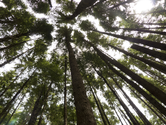
Canopy on Mound Island
8-12 July 2012 Mound Island/Port McNeill/Blunden Harbour/Cape Caution/Fury Cove
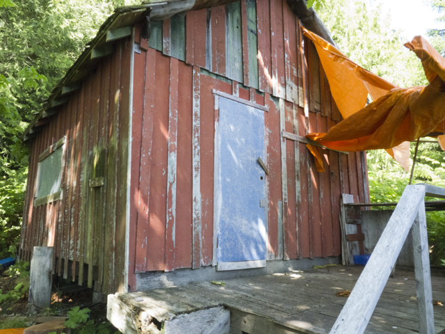
We met up again with our friends Rick and Dawn on Kalagan at Mound Island, and crossed Blackfish Sound to Port McNeill, near the top edge of Vancouver Island. There, to the background music of roaring chainsaws—Port McNeill was hosting an annual celebration of logger’s sports–we spent a day furiously running about the docks and town: ten blog posts up, several loads of laundry done, our new staysail delivered and picked up. (Yes! It fits! Thank you Stuart at UK Sails!) We also insulated the refrigerator with styrofoam, re-provisioned (food, toilet paper, cleaning supplies, alcohol), and topped up with water and fuel. This was our last resupply stop before we headed north, to the remoter zones of the Central Coast of BC.
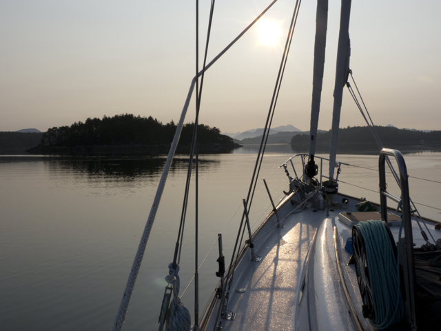
Heading out to cross Blackfish Sound
From here, one recommended course was to make Blunden Harbour, then wait for a weather window to round Cape Caution, so named because not only is the mainland cape exposed to the swells of the open Pacific as they roll in north of Vancouver island, but the sea floor shallows steeply there, which means you get significant waves and currents in any kind of a blow. Our friend Rick—until this point our knowledgeable informant and sometimes guide–had never rounded the Cape and was a bit nervous about doing so.
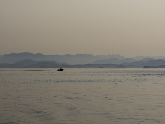
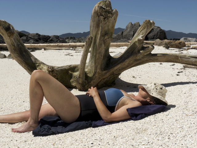
Morning near Port McNeill
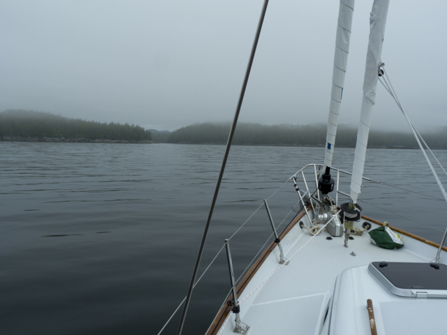
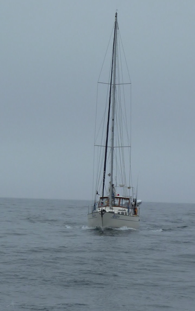
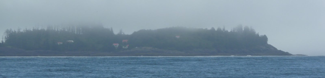
We left Port McNeill before 7 am, hauling up an anchor full of kelp (bits of kelp trailing in the chain, drying on the deck, snagged in the windlass). It was a misty grey morning, a falling tide, and the nearby still water was full of slowly moving logs and bits of debris. Hundreds of rhinoceros auklets gathered on the surface of the water and then dove frantically as we approached. We passed the lighthouse and outbuildings on Pultaney Point, Malcolm Island, slipped through a channel between kelp beds, and then we were in Queen Charlotte Strait. Two cruise ships tracked out of the Strait, blurred blue objects moving through fog. Two or three fishing boats and then nothing, just us, the sound of the motor droning on, the silver water parting. We spotted a dolphin, two loons, a murre.
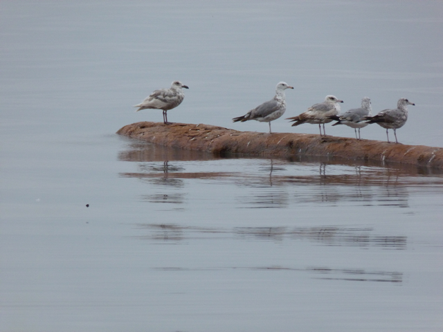
Young gulls on a log
Then gradually, out of the fog and rising above it, the mainland shore. Then stony islands, a certain glow behind the clouds that promised sun, the scent of fresh (cold!) sea air from the west, and suddenly, many little rocky islets. Almost there. 11 am. 25 miles logged. A few more minutes to wind through narrow channels into the harbour. Anchor down: 11:15 am.
Approaching Blunden Harbour
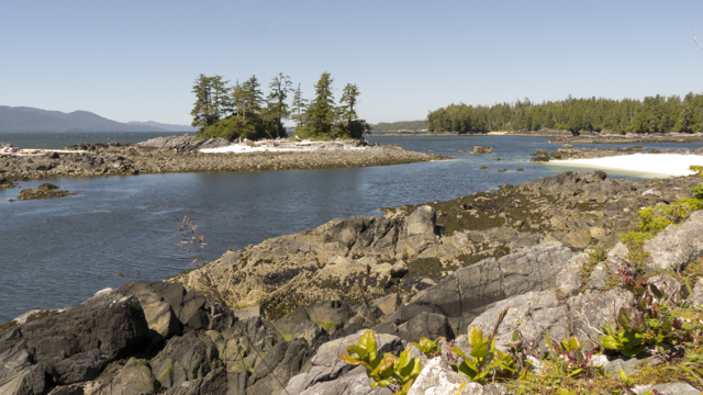
Blunden Harbour opens up into a large protected bowl once you jog through two narrow rocky doglegs. Half a dozen boats were anchored there when we arrived, and the sun was just coming out. A long glittering shell midden stretched in front of us; behind it, onshore, a building or two hidden in the trees. There is also a lagoon in Blunden Harbour—a long narrow arm leads up to it, then across several shallow bars and a rocky entrance, into a wide pool.
Blunden Harbour at sunset
Blunden Harbour was named, unsurprisingly, by white captain and surveyor, Daniel Pender, for one of his officers, Edward Raynor Blunden, in 1863. But it was also known as Ba’as or Pahas by the Nakwaxda’xw people who lived there. They were Kwak’wala speakers who belonged to the Kwakwa’ka’wakw First Nations. In 1964, members of the village relocated to Port Hardy, after the Department of Indian and Northern Affairs threatened to cut off support for housing, education and other services if villagers remained in their remote settlement. But as a recent sign announced, we were still on Nakwaxda’xw territory, and it was clear that some descendents of the villagers who had lived here still visited regularly.

Respect Nakwaxda’xw Territory!
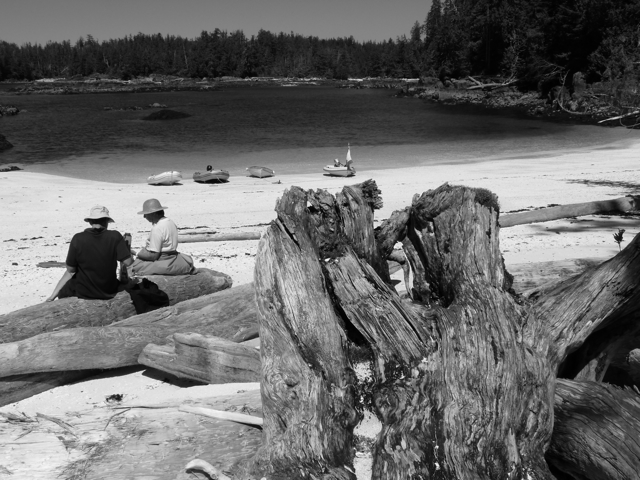
When went ashore we walked across the shell midden and could see, right away, at the top and bottom edges of the beach, a layered history of settlement: a longhouse beam, bits of porcelain and the remnants of engine blocks. A cabin that is still obviously used was tucked back in the trees; it was served by water piped in from a stream and neat stacks of firewood. The cabin contained a couple of bedsteads, a sleeping bag and a little stove; nearby were an outhouse and a fire circle. The cabin smelled fresh, deliciously of cedar.
Dinghy on the shell midden beach
Longhouse beam
Cabin in the woods
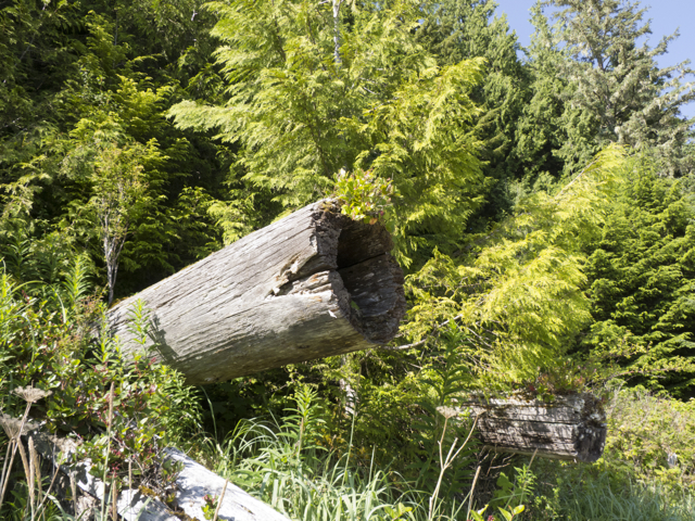
We followed a path through enormous cedars—the largest we’d seen since coming to the Broughton—and noticed some evidence of people working on them, chopping shingles and longboard strips from the trees the old way, cutting out a chunk but letting the tree stand and continue to grow. Thimbleberries and salal ripened all along the beach, but were not ready yet to eat.
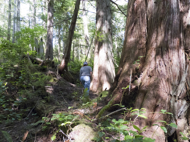
Enormous trees
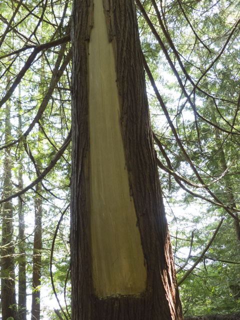
Board stripped from tree
Then, beneath an enormous cedar, behind a narrow wooden shelf containing bits of broken glass and crockery and barnacled engine parts, we saw a sign, erected in 2010, in memory of a dog named Schooner who had been killed on the spot by a mountain lion (cougar). “She gave her life to spare ours,” the sign said. Suddenly we were nervous, and although we continued to explore, we made sure we didn’t wander or lose sight of each other.
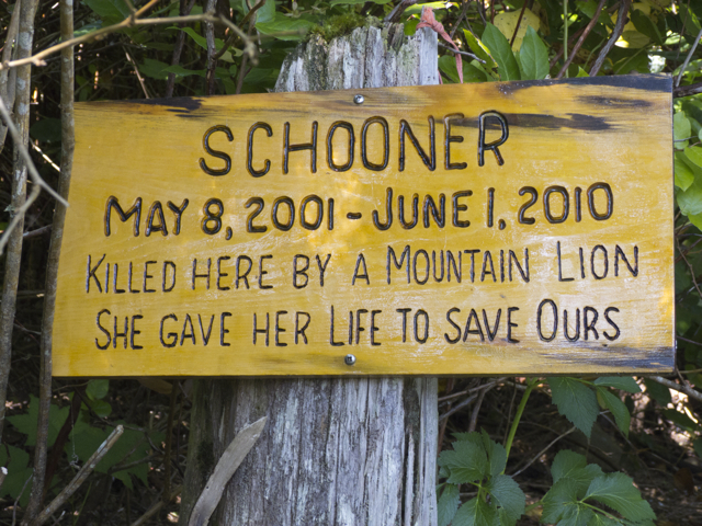
“Schooner…gave her life to save ours”
We spent the next day doing a few essential repairs to the boat’s plumbing in the aft head (enough said about that, ugh) and checking weather. Should we stay or should we go? It seemed as if there were a narrow window to depart if we went early the next morning. We were up at 4:30 am, checking the weather. The long term forecast called for a week of high winds, so it was then or never if we wanted to round the Cape. We made the leap and set out. Dolphins came to greet us, right away, as soon as we left the harbour—a good augury we thought.
Kalagan motors nearby
Out there, in Queen Charlotte Strait, the winds were calm, but we were in thick fog. Radar on and double watch on each side of the boat eyes, peeled for dead heads. The swell strengthened around the shallows and as we approached the open sea. Both Kalagan and Quoddy’s Run handled the seas well, although setting out with a triple reefed main would have been advisable. Still our new staysail steadied the roll.
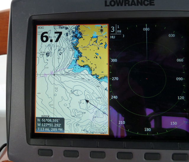
Watching the chart and the radar
The route to Cape Caution through Richards Channel was a tricky passage, above all in dense fog; there were many reefs and rocks to avoid and steer around. We peeled through one paper chart after another as we charged ahead, keeping a constant watch on the radar and dead ahead for logs. Deadheads were everywhere, booming up suddenly out of the mist; to starboard, we tracked a tug towing two enormous barges full of equipment—they had looked for a time like a series of small rocky islets carrying a few stunted trees. Near a buoy off to the portside, we sighted the faint outline of a sailboat; someone making the same passage we were, a tiny grey speck bobbing in the heaving mass of the sea. Things were particularly tricky near the entrance to Seymour and Belize Inlets, where the fastest rapids on the coast, the Nakwakto Rapids may be found. We approached the mouth of the inlet in an ebb tide, and it was disgorging a massive stream of flotsam and drift logs. Next time, we thought, we’ll head further out into the Strait, or time our passage better!
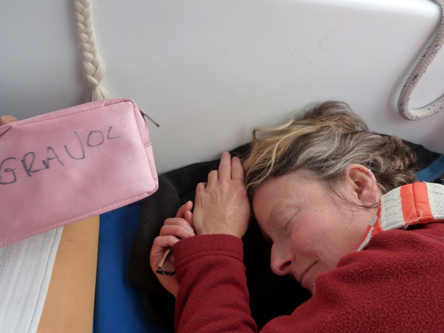
Navigator temporarily down after staring at charts too long
Everywhere there were birds. Rhinoceros auklets and eagles and then, as we got out to sea, pigeon guillemots, murres, pink-footed shearwaters, storm petrels. They rose and fell in the air over the waves, then settled on the water and rode up and down over the crests, diving, then flying off again. Once, on the lookout for deadheads—we’d just missed a huge log—we saw what seemed to be an absolutely enormous log on starboard. And the it rolled and there was the fin…It was a fin whale feeding.
The fog began to lift a bit as we approached Cape Caution, thickened as we passed, and then began to rise again as we headed toward Egg Island.
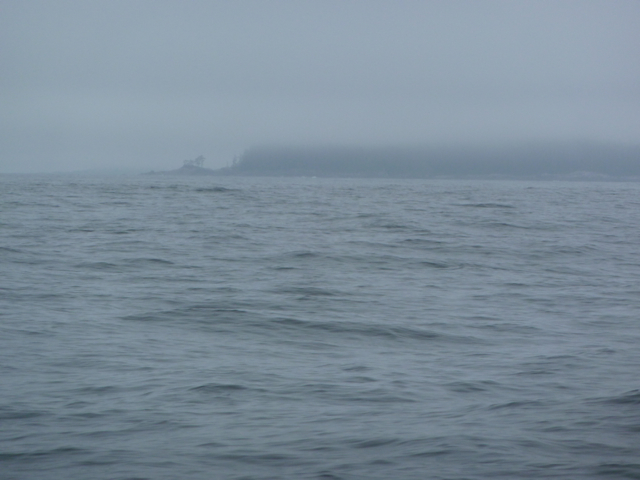
Fog around Cape Caution
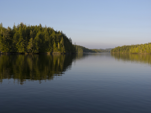
The wind came up and we threw up the Yankee. The sea was suddenly blue on one side and grey on the other; bits of blue began to appear in the sky, and then, as we approached Calvert Island, the world opened up. Islands, Smith Inlet, Rivers Inlet: behind them snow-capped mountains heaped up, higher and higher, the sun glittering on the snow.
Fog rises over Egg Island
The seas settled once we were in the shelter of Calvert Island. There were rumours over the radio of orcas near Fury Cove—and indeed, we did see whales at sundown, after we were anchored, cavorting in Fitzhugh Channel, visible through the narrow passes that flood at high tide into Fury Cove.
Near Fury Cove
Suddenly, as we approached Penrose Island, it was hot and sunny. White shell midden beaches line Fury Cove and little islets protect it, but also offer a view out to Fitzhugh Sound and Calvert Island. We wound through narrow passages into the anchorage, and found ourselves, suddenly, in a tropical paradise.
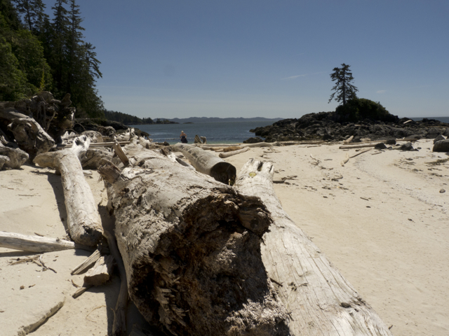
Beach at Fury Cove
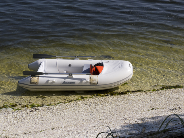
After lunch, we dinghied over to explore the beach.

Fury Cove flotsam
Three couples were already on the beach, and welcomed us heartily. We traded sea tales, and when we admitted we were from Nova Scotia, and just arriving on the Central Coast for the first time, they made all sorts of suggestions for remarkable places to go. They invited us for coffee the next morning and we agreed to a swap—we’d trade some lingcod steaks for some probiotic sourdough starter and some bread recipes. Each party thought it got the best deal. We got an easy, no-water-to-wash doughy-messes-needed way to mix bread in a ziplock bag, and they got some delicious fish. That sourdough has accompanied us everywhere; we’ve shared it with friends and brought it home to Nova Scotia in the fall, and we’ll return to BC with its descendent in the spring. Never again will we be on a boat without sourdough!
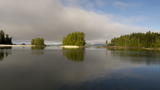
View out to Fitzhugh Sound from Fury Cove
Our new friends also marked our charts, pointing both to dangers and not to be missed sights. We all picnicked and sun-bathed on the beach the next afternoon. We climbed the rocks, identified plants, watched the whales and watched whitecaps in Fitzhugh Sound, and reveled in the first few days of our tropical vacation at 51˚29’north latitude. We felt as if we’d somehow found and slipped through a back door to paradise.
Marike enjoys Paradise at 51 degrees north latitude!
Notes on Blunden Harbour/ Ba’as
Filmmaker Robert Gardner comments: “In the middle of the twentieth century, Blunden Harbour was a small village on the coast of Vancouver Island in British Colombia inhabited by a handful of impoverished Kwakiutl Indians who gained their meagre livelihood from fishing and gathering…[This film] is a beginner’s attempt to impart the rhythm and atmosphere of a place and a people.” See a short excerpt from the film made by Robert Gardner in 1951, when he was a graduate student of anthropology at the U. Washingon. Robert Gardner, with William Heick: http://youtu.be/yhz3EEGD3TI
Hilamas (also known as Willie Seaweed or Smoky Top) was a famous carver from the Nak’waxda ‘xw nation in Blunden Harbour. See the gikiwe’ or “chief’s headdress” depicting a killer whale and two ravens that he made for himself, now held by the Smithsonian in the US at http://nmai.si.edu/exhibitions/infinityofnations/northwest-coast/238252.html
In 1930, Emily Carr made a painting entitled Blunden Harbour, now in the National Gallery in Ottawa, from a 1901 photograph of Blunden Harbour totems taken by W.A. Newcombe. For images and additional information (see especially “more photographs” at the bottom of the page) see http://www.emilycarr.org/totems/exhibit/kwak/baintro.htm
Fury Cove in hot sun

Thanks so much for your vivid account — I sailed as far as Malcolm Island back in the late 1980s in my 29′ Alberg and was able to visit Mamalikula before it became a special site. Your travels bring back wonderful memories!!! I’ve followed you through Janet Maybee, friend of my partner Jean Wilson. Jean and I live near Sidney, BC. Cheers, Jane Hastings
Thank you Jane! We’ll be back soon, and near Sidney. Let’s meet up in May if you and Jean will be around. K & M